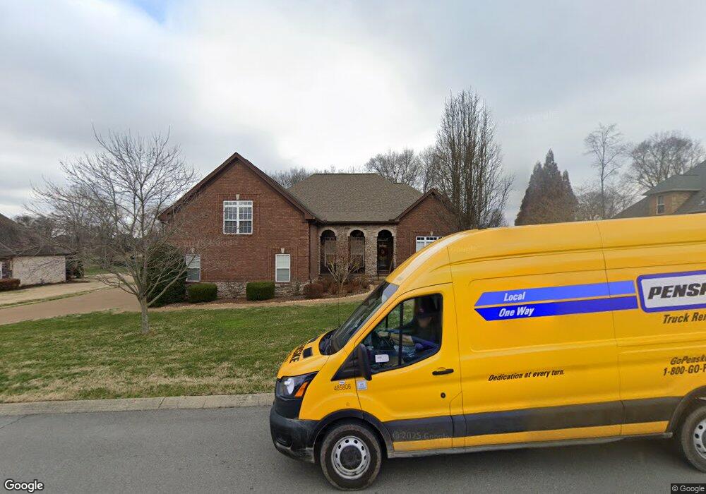
1808 Toliver Trace Mount Juliet, TN 37122
Estimated Value: $854,976 - $1,015,000
--
Bed
3
Baths
3,462
Sq Ft
$271/Sq Ft
Est. Value
About This Home
This home is located at 1808 Toliver Trace, Mount Juliet, TN 37122 and is currently estimated at $936,494, approximately $270 per square foot. 1808 Toliver Trace is a home located in Wilson County with nearby schools including Rutland Elementary School, Gladeville Middle School, and Wilson Central High School.
Ownership History
Date
Name
Owned For
Owner Type
Purchase Details
Closed on
Dec 18, 2008
Sold by
Wright Farms Llc
Bought by
Inzeo James M
Current Estimated Value
Home Financials for this Owner
Home Financials are based on the most recent Mortgage that was taken out on this home.
Original Mortgage
$300,000
Outstanding Balance
$203,094
Interest Rate
5.96%
Estimated Equity
$733,400
Purchase Details
Closed on
May 30, 2008
Sold by
Wright Farms Llc
Bought by
Morton Kwabene
Purchase Details
Closed on
Dec 29, 2003
Bought by
Wright Farms Llc
Create a Home Valuation Report for This Property
The Home Valuation Report is an in-depth analysis detailing your home's value as well as a comparison with similar homes in the area
Home Values in the Area
Average Home Value in this Area
Purchase History
| Date | Buyer | Sale Price | Title Company |
|---|---|---|---|
| Inzeo James M | $419,900 | -- | |
| Morton Kwabene | $367,450 | -- | |
| Wright Farms Llc | $1,919,800 | -- |
Source: Public Records
Mortgage History
| Date | Status | Borrower | Loan Amount |
|---|---|---|---|
| Open | Wright Farms Llc | $300,000 |
Source: Public Records
Tax History Compared to Growth
Tax History
| Year | Tax Paid | Tax Assessment Tax Assessment Total Assessment is a certain percentage of the fair market value that is determined by local assessors to be the total taxable value of land and additions on the property. | Land | Improvement |
|---|---|---|---|---|
| 2024 | $2,891 | $151,425 | $25,000 | $126,425 |
| 2022 | $2,891 | $151,425 | $25,000 | $126,425 |
| 2021 | $2,891 | $151,425 | $25,000 | $126,425 |
| 2020 | $2,964 | $151,425 | $25,000 | $126,425 |
| 2019 | $2,955 | $117,375 | $22,500 | $94,875 |
| 2018 | $2,955 | $117,325 | $22,500 | $94,825 |
| 2017 | $2,955 | $117,325 | $22,500 | $94,825 |
| 2016 | $2,955 | $117,325 | $22,500 | $94,825 |
| 2015 | $3,016 | $117,325 | $22,500 | $94,825 |
| 2014 | $2,440 | $94,935 | $0 | $0 |
Source: Public Records
Map
Nearby Homes
- 894 Harrisburg Ln
- 805 Harrisburg Ln
- 862 Harrisburg Ln
- 413 Stockbridge Way
- 15 Beechwood Ct
- 580 Windy Rd
- 1013 Station Cir
- 223 Rosemary Way
- 103 Wynfield Blvd
- 228 Rosemary Way
- 312 Union Pier Dr Unit 312
- 208 Campbell Cir
- 321 Union Pier Dr
- 656 Burnett Rd
- 658 Burnett Rd
- 770 S Rutland Rd
- 603 Sophia Ct
- 501 Doxford Dr
- 601 Maple Brook Ln
- 213 Caroline Way
- 1810 Toliver Trace
- 1806 Toliver Trace
- 1807 Toliver Trace
- 1805 Toliver Trace
- 1812 Toliver Trace
- 1809 Toliver Trace
- 1804 Toliver Trace
- 1803 Toliver Trace
- 1605 Danbury Ln
- 1811 Toliver Trace
- 1407 Abernathy Point
- 1408 Abernathy Point
- 1802 Toliver Trace
- 1801 Toliver Trace
- 1603 Danbury Ln
- 1814 Toliver Trace
- 1813 Toliver Trace
- 2606 Oxford Place
- 2608 Oxford Place
- 1815 Toliver Trace