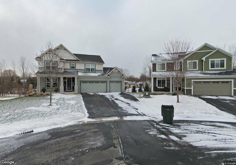
18089 Duncan Ct Farmington, MN 55024
Estimated Value: $499,000 - $552,000
4
Beds
4
Baths
2,021
Sq Ft
$263/Sq Ft
Est. Value
About This Home
This home is located at 18089 Duncan Ct, Farmington, MN 55024 and is currently estimated at $531,042, approximately $262 per square foot. 18089 Duncan Ct is a home with nearby schools including Akin Road Elementary School, Levi P. Dodge Middle School, and Farmington High School.
Ownership History
Date
Name
Owned For
Owner Type
Purchase Details
Closed on
Jan 31, 2014
Sold by
Mattamy Partnership
Bought by
Abel Andrew M and Abel Michelle C
Current Estimated Value
Home Financials for this Owner
Home Financials are based on the most recent Mortgage that was taken out on this home.
Original Mortgage
$225,500
Outstanding Balance
$171,456
Interest Rate
4.5%
Mortgage Type
New Conventional
Estimated Equity
$359,586
Create a Home Valuation Report for This Property
The Home Valuation Report is an in-depth analysis detailing your home's value as well as a comparison with similar homes in the area
Home Values in the Area
Average Home Value in this Area
Purchase History
| Date | Buyer | Sale Price | Title Company |
|---|---|---|---|
| Abel Andrew M | $281,930 | Dca Title |
Source: Public Records
Mortgage History
| Date | Status | Borrower | Loan Amount |
|---|---|---|---|
| Open | Abel Andrew M | $225,500 |
Source: Public Records
Tax History Compared to Growth
Tax History
| Year | Tax Paid | Tax Assessment Tax Assessment Total Assessment is a certain percentage of the fair market value that is determined by local assessors to be the total taxable value of land and additions on the property. | Land | Improvement |
|---|---|---|---|---|
| 2024 | $5,932 | $466,300 | $119,500 | $346,800 |
| 2023 | $5,932 | $487,100 | $119,800 | $367,300 |
| 2022 | $5,648 | $463,000 | $119,500 | $343,500 |
| 2021 | $5,348 | $397,000 | $103,900 | $293,100 |
| 2020 | $5,588 | $374,600 | $98,900 | $275,700 |
| 2019 | $5,298 | $375,600 | $94,200 | $281,400 |
| 2018 | $5,117 | $351,000 | $81,100 | $269,900 |
| 2017 | $4,299 | $330,000 | $77,200 | $252,800 |
| 2016 | $4,352 | $274,500 | $73,500 | $201,000 |
| 2015 | $2,875 | $257,169 | $67,601 | $189,568 |
| 2014 | -- | $178,471 | $59,701 | $118,770 |
| 2013 | -- | $17,400 | $17,400 | $0 |
Source: Public Records
Map
Nearby Homes
- 17895 Eclipse Ave
- 18231 Elkwood Ave
- 17798 Eclipse Ave
- 17811 Ellsworth Dr
- 18220 Empire Trail
- 17795 Ellsworth Dr
- 17836 Ellsworth Dr
- 18325 Embers Ave
- 17812 Ellsworth Dr
- 17763 Ellsworth Dr
- 17747 Ellsworth Dr
- Sierra Plan at Pheasant Run - Villas
- Clifton Plan at Pheasant Run - Villas
- 17772 Ellsworth Dr
- 17759 Embers Ave
- 17740 Ellsworth Dr
- 17787 Ellsworth Dr
- 5266 177th St W
- 17589 Dunkirk Way
- 5252 177th St W