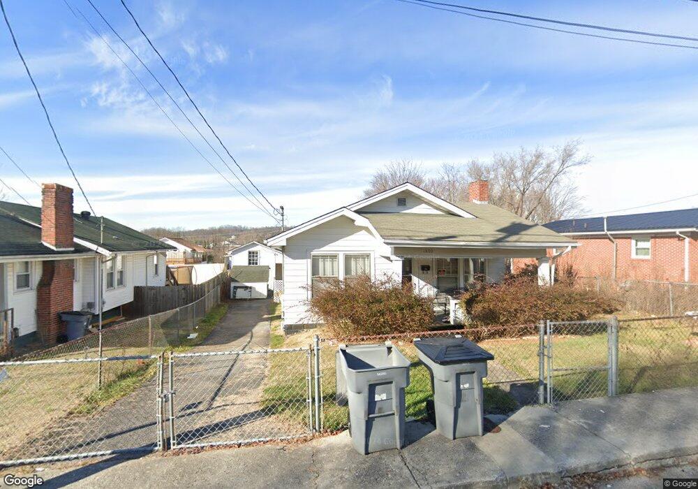
1809 Anderson St Bristol, TN 37620
Estimated Value: $36,000 - $61,000
--
Bed
1
Bath
1,088
Sq Ft
$42/Sq Ft
Est. Value
About This Home
This home is located at 1809 Anderson St, Bristol, TN 37620 and is currently estimated at $46,069, approximately $42 per square foot. 1809 Anderson St is a home located in Sullivan County with nearby schools including Anderson Elementary School, Vance Middle School, and Tennessee High School.
Ownership History
Date
Name
Owned For
Owner Type
Purchase Details
Closed on
Mar 24, 2025
Sold by
Sluder Alma Diane
Bought by
Smith Shannon and Smith Derek
Current Estimated Value
Purchase Details
Closed on
Jan 4, 2013
Sold by
Dingus Willie Mae
Bought by
Sluder Alma Diane
Purchase Details
Closed on
Nov 23, 2009
Sold by
Dingus Willie Mae
Bought by
Dingus Willie Mae
Purchase Details
Closed on
Jun 23, 1989
Purchase Details
Closed on
Sep 13, 1986
Create a Home Valuation Report for This Property
The Home Valuation Report is an in-depth analysis detailing your home's value as well as a comparison with similar homes in the area
Home Values in the Area
Average Home Value in this Area
Purchase History
| Date | Buyer | Sale Price | Title Company |
|---|---|---|---|
| Smith Shannon | $35,000 | Malcolm Title | |
| Smith Shannon | $35,000 | Malcolm Title | |
| Sluder Alma Diane | -- | -- | |
| Dingus Willie Mae | -- | -- | |
| -- | $36,000 | -- | |
| -- | $25,000 | -- |
Source: Public Records
Tax History Compared to Growth
Tax History
| Year | Tax Paid | Tax Assessment Tax Assessment Total Assessment is a certain percentage of the fair market value that is determined by local assessors to be the total taxable value of land and additions on the property. | Land | Improvement |
|---|---|---|---|---|
| 2024 | -- | $5,325 | $2,025 | $3,300 |
| 2023 | $828 | $18,850 | $2,025 | $16,825 |
| 2022 | $828 | $18,850 | $2,025 | $16,825 |
| 2021 | $828 | $18,850 | $2,025 | $16,825 |
| 2020 | $858 | $18,850 | $2,025 | $16,825 |
| 2019 | $858 | $18,125 | $2,025 | $16,100 |
| 2018 | $854 | $18,125 | $2,025 | $16,100 |
| 2017 | $854 | $18,125 | $2,025 | $16,100 |
| 2016 | $766 | $15,875 | $2,025 | $13,850 |
| 2014 | $722 | $15,853 | $0 | $0 |
Source: Public Records
Map
Nearby Homes
- 1614 Broad St
- 1443 Windsor Ave
- 2000 Euclid Ave
- 60 Peters St
- 1224 Shelby St
- 1227 Shelby St
- 000 Hemlock Dr
- 311 12th St
- 1057 Moorland Ave
- 1216 Norway St
- 1724 & 1728 Euclid Ave
- 420 Douglas St
- 2121 2123 Randolph St
- 2177 Randolph St
- 461 Douglas St
- 728 Randolph St
- 1020 Hill St
- 2412,14,16 Bradley St
- 2241 Bradley St
- 460 Vance St
- 1807 Anderson St
- 1811 Anderson St
- 1805 Anderson St
- 1831 Anderson St
- 1824 Broad St
- 1826 Broad St
- 1822 Broad St
- 1828 Broad St
- 1820 Broad St
- 1810 Anderson St
- 1806 Anderson St
- 1801 Anderson St
- 1834 Broad St
- 1833 Anderson St
- 1804 Anderson St
- 1814 Anderson St
- 1816 Broad St
- 1722 Anderson St
- 1814 Broad St
- 1835 Anderson St