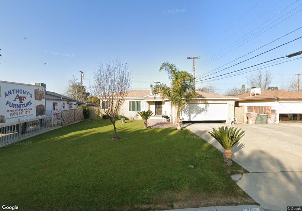
1809 Marshall St Bakersfield, CA 93304
Benton Park NeighborhoodEstimated Value: $268,000 - $300,000
3
Beds
2
Baths
1,334
Sq Ft
$216/Sq Ft
Est. Value
About This Home
This home is located at 1809 Marshall St, Bakersfield, CA 93304 and is currently estimated at $288,762, approximately $216 per square foot. 1809 Marshall St is a home located in Kern County with nearby schools including Frank West Elementary School, Curran Middle School, and South High School.
Ownership History
Date
Name
Owned For
Owner Type
Purchase Details
Closed on
Dec 5, 1999
Sold by
Frederick Liv Tr and Charles Michael
Bought by
Munoz Steve and Munoz Guillermina Z
Current Estimated Value
Home Financials for this Owner
Home Financials are based on the most recent Mortgage that was taken out on this home.
Original Mortgage
$78,374
Interest Rate
7.84%
Mortgage Type
FHA
Purchase Details
Closed on
May 29, 1996
Sold by
Frederick Wesley P
Bought by
Frederick Wesley Peyton and Frederick Living Trust
Create a Home Valuation Report for This Property
The Home Valuation Report is an in-depth analysis detailing your home's value as well as a comparison with similar homes in the area
Home Values in the Area
Average Home Value in this Area
Purchase History
| Date | Buyer | Sale Price | Title Company |
|---|---|---|---|
| Munoz Steve | $78,500 | Chicago Title Co | |
| Frederick Wesley Peyton | -- | -- |
Source: Public Records
Mortgage History
| Date | Status | Borrower | Loan Amount |
|---|---|---|---|
| Previous Owner | Munoz Steve | $78,374 |
Source: Public Records
Tax History
| Year | Tax Paid | Tax Assessment Tax Assessment Total Assessment is a certain percentage of the fair market value that is determined by local assessors to be the total taxable value of land and additions on the property. | Land | Improvement |
|---|---|---|---|---|
| 2025 | $2,099 | $120,628 | $30,727 | $89,901 |
| 2024 | $2,099 | $118,264 | $30,125 | $88,139 |
| 2023 | $2,051 | $115,946 | $29,535 | $86,411 |
| 2022 | $1,996 | $113,673 | $28,956 | $84,717 |
| 2021 | $1,892 | $111,445 | $28,389 | $83,056 |
| 2020 | $1,856 | $110,303 | $28,098 | $82,205 |
| 2019 | $1,820 | $110,303 | $28,098 | $82,205 |
| 2018 | $1,780 | $106,022 | $27,008 | $79,014 |
| 2017 | $1,769 | $103,944 | $26,479 | $77,465 |
| 2016 | $1,635 | $101,907 | $25,960 | $75,947 |
| 2015 | $1,623 | $100,378 | $25,571 | $74,807 |
| 2014 | $1,571 | $98,413 | $25,071 | $73,342 |
Source: Public Records
Map
Nearby Homes
- 1920 Doolittle Ave
- 1804 Hodges Ave
- 1913 Ming Ave
- 1709 Hodges Ave
- 2309 Bradley Ave
- 443 Myrtle St
- 1807 June Ave
- 1814 June Ave
- 1916 Wilson Rd
- 1512 Southgate Dr
- 1917 S J St
- 1501 Edna St
- 1811 Radiance Dr
- 1410 Southgate Dr
- 2323 S J St
- 1212 S F St
- 1313 Kelly St
- 2510 Wilson Rd
- 1900 La France Dr
- 1405 S Chester Ave
- 2000 Bradley Ave
- 1805 Marshall St
- 2008 Bradley Ave
- 1801 Marshall St
- 1724 Anita Ln
- 1820 Marshall St
- 2012 Bradley Ave
- 1802 Marshall St
- 1717 Marshall St
- 1720 Anita Ln
- 2005 Bradley Ave
- 2001 Bradley Ave
- 2101 Mark Ct
- 1920 Bradley Ave
- 2100 Bradley Ave
- 1929 Bradley Ave
- 1921 Hodges Ave
- 2009 Bradley Ave
- 1713 Marshall St
- 1716 Anita Ln
Your Personal Tour Guide
Ask me questions while you tour the home.