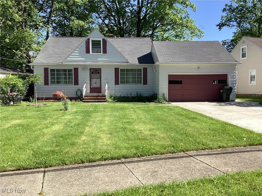


1809 Pontiac Dr Euclid, OH 44117
Estimated payment $1,116/month
Highlights
- No HOA
- Bungalow
- Ceiling Fan
- 2 Car Attached Garage
- Forced Air Heating and Cooling System
About This Home
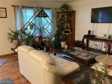
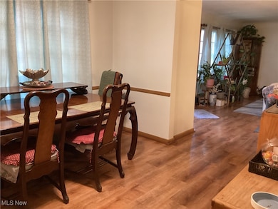
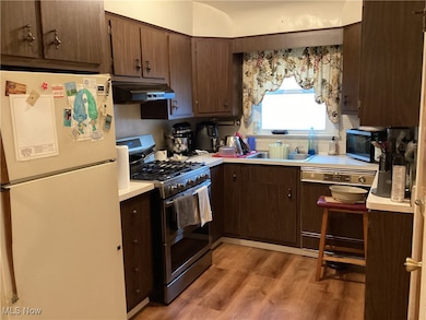
Welcome to this delightful 3-bedroom, 2 full bathroom bungalow that perfectly blends comfort and convenience! Step inside to find a warm and inviting layout featuring a cozy living area, a dedicated dining room for special gatherings, with eat-in kitchen — perfect for casual meals or entertaining. Two bedrooms and a full bath are conveniently located on the main floor, while the entire second floor is dedicated to a private owner’s suite complete with its own full bathroom, offering a peaceful retreat.
Enjoy outdoor living in the partially fenced backyard and benefit from the convenience of an attached garage. Appliances are included, making this home truly move-in ready.
Don’t miss this wonderful opportunity to own a home with character, space, and thoughtful features throughout!
Listing Agent
Keller Williams Living Brokerage Email: jborders@kw.com 216-543-1232 License #2019001455 Listed on: 05/16/2025

Home Details
Home Type
- Single Family
Est. Annual Taxes
- $2,357
Year Built
- Built in 1957
Parking
- 2 Car Attached Garage
Home Design
- Bungalow
- Fiberglass Roof
- Asphalt Roof
- Aluminum Siding
Interior Spaces
- 2-Story Property
- Ceiling Fan
- Range
- Partially Finished Basement
Bedrooms and Bathrooms
- 3 Bedrooms | 2 Main Level Bedrooms
- 2 Full Bathrooms
Additional Features
- 6,669 Sq Ft Lot
- Forced Air Heating and Cooling System
Community Details
- No Home Owners Association
- Glenridge Subdivision
Listing and Financial Details
- Home warranty included in the sale of the property
- Assessor Parcel Number 649-11-046
Map
Home Values in the Area
Average Home Value in this Area
Tax History
| Year | Tax Paid | Tax Assessment Tax Assessment Total Assessment is a certain percentage of the fair market value that is determined by local assessors to be the total taxable value of land and additions on the property. | Land | Improvement |
|---|---|---|---|---|
| 2024 | $2,251 | $41,580 | $8,715 | $32,865 |
| 2023 | $2,357 | $35,950 | $7,630 | $28,320 |
| 2022 | $2,338 | $35,950 | $7,630 | $28,320 |
| 2021 | $3,442 | $35,950 | $7,630 | $28,320 |
| 2020 | $3,264 | $30,980 | $6,580 | $24,400 |
| 2019 | $2,942 | $88,500 | $18,800 | $69,700 |
| 2018 | $2,940 | $30,980 | $6,580 | $24,400 |
| 2017 | $3,151 | $27,440 | $4,760 | $22,680 |
| 2016 | $3,158 | $27,440 | $4,760 | $22,680 |
| 2015 | $2,878 | $27,440 | $4,760 | $22,680 |
| 2014 | $2,878 | $27,440 | $4,760 | $22,680 |
Property History
| Date | Event | Price | List to Sale | Price per Sq Ft |
|---|---|---|---|---|
| 06/09/2025 06/09/25 | For Sale | $175,000 | 0.0% | -- |
| 05/26/2025 05/26/25 | Pending | -- | -- | -- |
| 05/21/2025 05/21/25 | Price Changed | $175,000 | -12.5% | -- |
| 05/16/2025 05/16/25 | For Sale | $200,000 | -- | -- |
Purchase History
| Date | Type | Sale Price | Title Company |
|---|---|---|---|
| Warranty Deed | $169,000 | None Listed On Document | |
| Deed | $78,000 | -- | |
| Deed | -- | -- | |
| Deed | -- | -- |
Mortgage History
| Date | Status | Loan Amount | Loan Type |
|---|---|---|---|
| Open | $160,550 | New Conventional | |
| Previous Owner | $74,100 | New Conventional |
Source: MLS Now
MLS Number: 5123482
APN: 649-11-046
Disclaimer: Certain information contained herein is derived from information provided by parties other than Homes.com. All information provided is deemed reliable, but is not guaranteed to be accurate and should be independently verified.
![]() IDX information is provided exclusively for personal, non-commercial use, and may not be used for any purpose other than to identify prospective properties consumers may be interested in purchasing. Information is deemed reliable but not guaranteed.
IDX information is provided exclusively for personal, non-commercial use, and may not be used for any purpose other than to identify prospective properties consumers may be interested in purchasing. Information is deemed reliable but not guaranteed.
- 1721 Grand Blvd
- 1930 Seneca Rd
- 1860 Glenridge Rd
- 2150 Glenridge Rd
- 19201 Shawnee Rd
- 24 Washington Square
- 19151 Genesee Rd
- 2017 Natona Rd
- 1477 E 195th St
- 1556 Dille Rd
- 209 Greenbriar Ct
- 237 Greenbriar Ct Unit F237
- 2110 Miami Rd
- 1777 Catalpa Rd
- 22151 Hadden Rd
- 18132 Weston Rd
- 2545 Hilltop Rd
- 1707 Catalpa Rd
- 1563 Clermont Rd
- 2337 Greenvale Rd
- 19710 Euclid Ave
- 1541 E 191st St
- 1939 Green Rd
- 1524 E 204th St Unit 2-up
- 1487 E 193rd St
- 1464 E 195th St
- 2031 N Green Rd
- 1686 Avalon Rd
- 2071-2091 Belvoir Blvd
- 1443 Larchmont Rd
- 19121 Nottingham Rd
- 1665 Cliffview Rd
- 18402 Melville Rd Unit UP
- 22550 Euclid Ave
- 4129 Greenvale Rd
- 719 E 162nd St Unit 2
- 1271 E 169th St Unit 1
- 3759 Northampton Rd
- 1087 E 177th St Unit UP
- 1125-E174 E 174th St Unit efficentcy