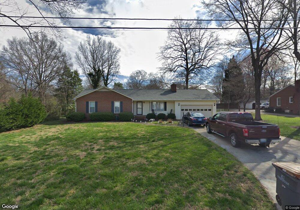
1809 S Ridge Ave Kannapolis, NC 28083
Estimated Value: $298,000 - $354,000
3
Beds
2
Baths
1,438
Sq Ft
$232/Sq Ft
Est. Value
About This Home
This home is located at 1809 S Ridge Ave, Kannapolis, NC 28083 and is currently estimated at $334,335, approximately $232 per square foot. 1809 S Ridge Ave is a home located in Cabarrus County with nearby schools including Forest Park Elementary School, Kannapolis Middle, and A.L. Brown High School.
Ownership History
Date
Name
Owned For
Owner Type
Purchase Details
Closed on
Mar 8, 2012
Sold by
Sorrow Sandra Y
Bought by
Burnette Lanny M and Pair Louise W
Current Estimated Value
Home Financials for this Owner
Home Financials are based on the most recent Mortgage that was taken out on this home.
Original Mortgage
$100,261
Interest Rate
3.37%
Mortgage Type
FHA
Purchase Details
Closed on
Jun 1, 1985
Bought by
Sorrow Sandra Y
Create a Home Valuation Report for This Property
The Home Valuation Report is an in-depth analysis detailing your home's value as well as a comparison with similar homes in the area
Home Values in the Area
Average Home Value in this Area
Purchase History
| Date | Buyer | Sale Price | Title Company |
|---|---|---|---|
| Burnette Lanny M | $115,000 | None Available | |
| Sorrow Sandra Y | $63,000 | -- |
Source: Public Records
Mortgage History
| Date | Status | Borrower | Loan Amount |
|---|---|---|---|
| Previous Owner | Burnette Lanny M | $100,261 |
Source: Public Records
Tax History Compared to Growth
Tax History
| Year | Tax Paid | Tax Assessment Tax Assessment Total Assessment is a certain percentage of the fair market value that is determined by local assessors to be the total taxable value of land and additions on the property. | Land | Improvement |
|---|---|---|---|---|
| 2025 | $3,894 | $342,900 | $70,000 | $272,900 |
| 2024 | $3,894 | $342,900 | $70,000 | $272,900 |
| 2023 | $2,156 | $157,370 | $39,000 | $118,370 |
| 2022 | $2,156 | $157,370 | $39,000 | $118,370 |
| 2021 | $2,156 | $157,370 | $39,000 | $118,370 |
| 2020 | $2,156 | $157,370 | $39,000 | $118,370 |
| 2019 | $1,699 | $124,050 | $25,000 | $99,050 |
| 2018 | $1,675 | $124,050 | $25,000 | $99,050 |
| 2017 | $1,650 | $124,050 | $25,000 | $99,050 |
| 2016 | $1,650 | $125,890 | $40,000 | $85,890 |
| 2015 | $1,586 | $125,890 | $40,000 | $85,890 |
| 2014 | $1,586 | $125,890 | $40,000 | $85,890 |
Source: Public Records
Map
Nearby Homes
- 103 Crescent St
- 303 Odell St
- 302 Suburban Ave
- 709 Carson Ct
- 503 Eddleman Rd
- 111 Landmark Dr
- 210 Brook St
- 2116 S Main St
- 1500 S Ridge Ave
- 103 Carriage House Dr
- 614 Breckenridge Rd Unit 17
- 1589 Matthew Allen Cir
- 617 Peace Haven Rd
- 2301 S Ridge Ave
- 105 Ashmont Dr Unit 1
- 210 Cliffside Dr
- 505 Rogers Lake Rd E
- 251 Briarcliff Dr
- 128 Greenview Dr
- 301 Briarcliff Dr
- 120 Suburban Ave
- 1811 S Ridge Ave
- 118 Brookshire Ave
- 1806 S Ridge Ave
- 120 Brookshire Ave
- 122 Suburban Ave
- 118 Suburban Ave
- 1804 S Ridge Ave
- 1813 S Ridge Ave
- 122 Brookshire Ave
- 116 Suburban Ave
- 117 Suburban Ave
- 119 Brookshire Ave
- 117 Brookshire Ave
- 114 Brookshire Ave
- 121 Brookshire Ave
- 1816 S Ridge Ave
- 114 Suburban Ave
- 105 Crescent St
- 115 Suburban Ave