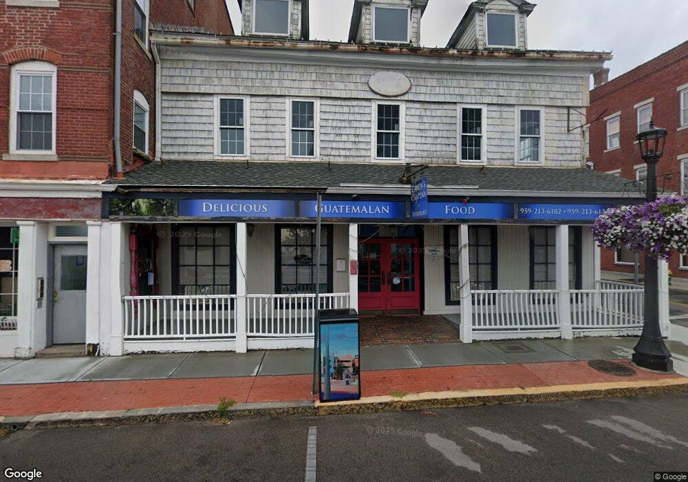
181 Bank St New London, CT 06320
Downtown New London Neighborhood
--
Bed
--
Bath
4,840
Sq Ft
3,920
Sq Ft Lot
About This Home
This home is located at 181 Bank St, New London, CT 06320. 181 Bank St is a home located in New London County with nearby schools including Harbor Elementary School, Bennie Dover Jackson Middle School, and New London High School.
Ownership History
Date
Name
Owned For
Owner Type
Purchase Details
Closed on
Jul 30, 2024
Sold by
181 205 Bank Street Llc
Bought by
Oceanfront Apt 181 Llc
Purchase Details
Closed on
Apr 26, 2021
Sold by
Hinners Richard C and Hinners Annette M
Bought by
181-205 Bank Street Llc
Home Financials for this Owner
Home Financials are based on the most recent Mortgage that was taken out on this home.
Original Mortgage
$752,000
Interest Rate
3.1%
Mortgage Type
Purchase Money Mortgage
Purchase Details
Closed on
Feb 6, 2021
Sold by
Hinners Ret and Hinnerrs
Bought by
Hinners Richard C and Hinners Annette M
Purchase Details
Closed on
Nov 7, 2005
Sold by
Hinners Annette
Bought by
Hinners Richard C and Hinners Annette M
Create a Home Valuation Report for This Property
The Home Valuation Report is an in-depth analysis detailing your home's value as well as a comparison with similar homes in the area
Home Values in the Area
Average Home Value in this Area
Purchase History
| Date | Buyer | Sale Price | Title Company |
|---|---|---|---|
| Oceanfront Apt 181 Llc | $190,000 | None Available | |
| Oceanfront Apt 181 Llc | $190,000 | None Available | |
| Oceanfront Apt 181 Llc | $190,000 | None Available | |
| 181-205 Bank Street Llc | $755,000 | None Available | |
| 181-205 Bank Street Llc | $755,000 | None Available | |
| 181-205 Bank Street Llc | $755,000 | None Available | |
| Hinners Richard C | -- | None Available | |
| Hinners Richard C | -- | None Available | |
| Hinners Richard C | -- | None Available | |
| Hinners Richard C | $2,000 | -- | |
| Hinners Richard C | $2,000 | -- |
Source: Public Records
Mortgage History
| Date | Status | Borrower | Loan Amount |
|---|---|---|---|
| Previous Owner | 181-205 Bank Street Llc | $752,000 | |
| Previous Owner | Hinners Richard C | $275,000 |
Source: Public Records
Tax History Compared to Growth
Tax History
| Year | Tax Paid | Tax Assessment Tax Assessment Total Assessment is a certain percentage of the fair market value that is determined by local assessors to be the total taxable value of land and additions on the property. | Land | Improvement |
|---|---|---|---|---|
| 2025 | $8,169 | $289,800 | $78,300 | $211,500 |
| 2024 | $8,259 | $289,800 | $78,300 | $211,500 |
| 2023 | $11,107 | $289,030 | $68,040 | $220,990 |
| 2022 | $11,116 | $289,030 | $68,040 | $220,990 |
| 2021 | $11,315 | $289,010 | $68,020 | $220,990 |
| 2020 | $11,385 | $289,030 | $68,040 | $220,990 |
| 2019 | $11,879 | $289,030 | $68,040 | $220,990 |
| 2018 | $12,800 | $283,570 | $72,520 | $211,050 |
| 2017 | $12,551 | $283,570 | $72,520 | $211,050 |
| 2016 | $11,862 | $283,570 | $72,520 | $211,050 |
| 2015 | $11,198 | $283,570 | $72,520 | $211,050 |
| 2014 | $9,718 | $283,570 | $72,520 | $211,050 |
Source: Public Records
Map
Nearby Homes
- 40 Pearl St
- 9 Brewer St Unit 3
- 9 Brewer St Unit 1
- 9 Brewer St Unit 2
- 9 Brewer St
- 400 Bank St Unit 105
- 2 Coit St Unit 1
- 38 Mountain Ave
- 49 Belden St
- 55 Connecticut Ave
- 59 Connecticut Ave
- 32 Moore Ave
- 26 Jefferson Ave
- 835 Bank St
- 142 Montauk Ave
- 22 Willetts Ave
- 72 Willetts Ave
- 77 Colman St
- 59 School St
- 132 Thames St Unit R
- 191 Bank St
- 187 Bank St Unit 402
- 187 Bank St
- 169 Bank St
- 169 Bank St
- 195 Bank St Unit 201
- 10 Pearl St
- 165 Bank St
- 205 Bank St
- 209 Bank St Unit 201
- 209 Bank St Unit 302
- 209 Bank St Unit 202
- 209 Bank St Unit 301
- 209 Bank St Unit 204
- 209 Bank St
- 157 Bank St Unit 301
- 157 Bank St
- 153 Bank St Unit 303
- 153 Bank St Unit 203
- 153 Bank St Unit 301