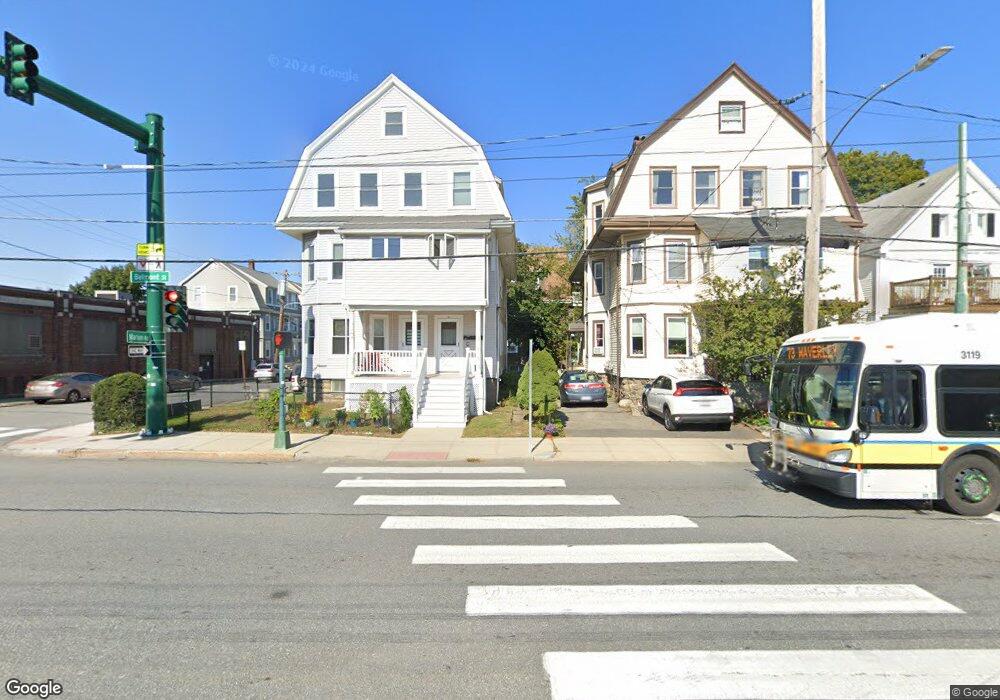
181 Belmont St Unit 183 Belmont, MA 02478
Cushing Square NeighborhoodEstimated Value: $1,342,000 - $1,633,000
7
Beds
3
Baths
3,718
Sq Ft
$394/Sq Ft
Est. Value
About This Home
This home is located at 181 Belmont St Unit 183, Belmont, MA 02478 and is currently estimated at $1,466,234, approximately $394 per square foot. 181 Belmont St Unit 183 is a home located in Middlesex County with nearby schools including Roger Wellington Elementary School, Winthrop L Chenery Middle School, and Belmont High School.
Ownership History
Date
Name
Owned For
Owner Type
Purchase Details
Closed on
Jan 21, 2009
Sold by
Barrell Jane M and Barrell Joseph P
Bought by
Jane M Barrell Ret and Barrell Jane M
Current Estimated Value
Purchase Details
Closed on
Aug 18, 1997
Sold by
Murphy James B and Murphy Eleanor A
Bought by
Barrell Joseph P and Barrell Jane M
Home Financials for this Owner
Home Financials are based on the most recent Mortgage that was taken out on this home.
Original Mortgage
$232,750
Interest Rate
7.56%
Mortgage Type
Purchase Money Mortgage
Create a Home Valuation Report for This Property
The Home Valuation Report is an in-depth analysis detailing your home's value as well as a comparison with similar homes in the area
Home Values in the Area
Average Home Value in this Area
Purchase History
| Date | Buyer | Sale Price | Title Company |
|---|---|---|---|
| Jane M Barrell Ret | -- | -- | |
| Barrell Joseph P | $332,500 | -- |
Source: Public Records
Mortgage History
| Date | Status | Borrower | Loan Amount |
|---|---|---|---|
| Previous Owner | Barrell Joseph P | $231,700 | |
| Previous Owner | Barrell Joseph P | $232,750 | |
| Previous Owner | Barrell Joseph P | $88,000 | |
| Previous Owner | Barrell Joseph P | $94,000 |
Source: Public Records
Tax History Compared to Growth
Tax History
| Year | Tax Paid | Tax Assessment Tax Assessment Total Assessment is a certain percentage of the fair market value that is determined by local assessors to be the total taxable value of land and additions on the property. | Land | Improvement |
|---|---|---|---|---|
| 2025 | $14,067 | $1,235,000 | $600,000 | $635,000 |
| 2024 | $13,411 | $1,270,000 | $823,000 | $447,000 |
| 2023 | $13,241 | $1,178,000 | $776,000 | $402,000 |
| 2022 | $11,367 | $1,087,000 | $710,000 | $377,000 |
| 2021 | $11,367 | $985,000 | $703,000 | $282,000 |
| 2020 | $10,230 | $930,000 | $567,000 | $363,000 |
| 2019 | $9,698 | $831,000 | $460,000 | $371,000 |
| 2018 | $9,343 | $769,000 | $398,000 | $371,000 |
| 2017 | $9,771 | $770,000 | $329,000 | $441,000 |
| 2016 | $9,634 | $767,000 | $329,000 | $438,000 |
| 2015 | $8,256 | $640,000 | $293,000 | $347,000 |
Source: Public Records
Map
Nearby Homes
- 10 Marlboro St Unit 1
- 163 Belmont St
- 30 Unity Ave Unit 30
- 87 Templeton Pkwy Unit 3
- 16 Ericsson St
- 56-58 Edgecliff Rd
- 133 Hillside Rd
- 147 Langdon Ave Unit 149
- 73 Foster Rd Unit 2
- 276 Belmont St Unit 1
- 25 Francis St Unit 2
- 25 Francis St Unit 1
- 43 Irma Ave Unit 43
- 1 Clayton St
- 81 Winsor Ave
- 95 Cushing St
- 161 Cushing St
- 66 Holworthy St
- 87 Holworthy St Unit 2
- 87 Holworthy St Unit 3
- 179 Belmont St Unit 3
- 179 Belmont St Unit 2
- 179 Belmont St Unit 1
- 3 Marion Rd Unit 2
- 177 Belmont St
- 7 Marion Rd Unit 2
- 57 Marion Rd
- 5 Marion Rd
- 5 Marion Rd Unit 1
- 5-7 Marion Rd
- 4 Marion Rd
- 11 Marion Rd Unit 3
- 11 Marion Rd
- 11 Marion Rd Unit 1
- 11 Marion Rd Unit 2
- 10 Marlboro St Unit 3
- 10 Marlboro St Unit 2
- 10 Marlboro St Unit B
- 10 Marlboro St Unit A
- 10 Marlboro St Unit C