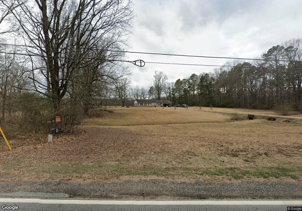
181 Highway 53 N Gurdon, AR 71743
Estimated Value: $107,000 - $194,000
23
Beds
2
Baths
1,976
Sq Ft
$83/Sq Ft
Est. Value
About This Home
This home is located at 181 Highway 53 N, Gurdon, AR 71743 and is currently estimated at $164,096, approximately $83 per square foot. 181 Highway 53 N is a home located in Clark County with nearby schools including Gurdon Primary School, Cabe Middle School, and Gurdon High School.
Ownership History
Date
Name
Owned For
Owner Type
Purchase Details
Closed on
Jul 1, 2014
Sold by
Bank Of New York Trust Company Na
Bought by
King Mark and King Kim
Current Estimated Value
Purchase Details
Closed on
Jul 22, 2005
Bought by
Duncan Kenneth Lane and Lisa Ann
Purchase Details
Closed on
Jul 2, 2002
Bought by
Clark Michael Scott and Clark Christine
Create a Home Valuation Report for This Property
The Home Valuation Report is an in-depth analysis detailing your home's value as well as a comparison with similar homes in the area
Home Values in the Area
Average Home Value in this Area
Purchase History
| Date | Buyer | Sale Price | Title Company |
|---|---|---|---|
| King Mark | $42,000 | -- | |
| Duncan Kenneth Lane | $82,000 | -- | |
| Clark Michael Scott | $82,000 | -- |
Source: Public Records
Tax History Compared to Growth
Tax History
| Year | Tax Paid | Tax Assessment Tax Assessment Total Assessment is a certain percentage of the fair market value that is determined by local assessors to be the total taxable value of land and additions on the property. | Land | Improvement |
|---|---|---|---|---|
| 2024 | $999 | $19,940 | $2,120 | $17,820 |
| 2023 | $999 | $19,940 | $2,120 | $17,820 |
| 2022 | $859 | $19,940 | $2,120 | $17,820 |
| 2021 | $859 | $19,940 | $2,120 | $17,820 |
| 2020 | $821 | $19,940 | $2,120 | $17,820 |
| 2019 | $746 | $17,320 | $2,120 | $15,200 |
| 2018 | $738 | $17,320 | $2,120 | $15,200 |
| 2017 | $738 | $17,320 | $2,120 | $15,200 |
| 2016 | $738 | $17,320 | $2,120 | $15,200 |
| 2015 | $738 | $17,320 | $2,120 | $15,200 |
| 2014 | $738 | $17,320 | $2,120 | $15,200 |
Source: Public Records
Map
Nearby Homes
- TBD Hwy 67 S
- 313 W Miller St
- 7104 Highway 67 S
- 109 N 7th St
- 326 Arkansas 53
- 0000 Arkansas 53
- 110 S 10th St
- 51 South St
- 103 Stonegate Ct
- TBD Kansas Rd
- 1795 Bowen Hill Rd
- 000 Kansas Rd
- 236 Lockie Rd
- 845 Stevenson Rd
- 196 Stevenson Rd
- 602 Stevenson Rd
- 505 Stevenson Rd
- 652 Center Point
- 58 Dodgen Rd
- TBD Hwy 67
- 143 Highway 53 N
- 129 Highway 53 N
- 204 Highway 53 N
- 0 Highway 53 Unit 17008331
- 49 Clarence Rd
- 93 Highway 53 N
- 0 Clarence Rd
- 43 Clarence Rd
- 300 Highway 53 N
- 25 Highway 53 N
- 19 Highway 53 N
- 326 Highway 53 N
- 1306 N Elm St
- 332 Highway 53 N
- 1312 N Elm St
- 805 N Elm St
- 357 Highway 53 N
- 100 Potter Rd
- 34 Brewer Rd
- 0 Highway 67 S Unit 20033012