Estimated Value: $378,161 - $402,000
4
Beds
2
Baths
3,312
Sq Ft
$117/Sq Ft
Est. Value
About This Home
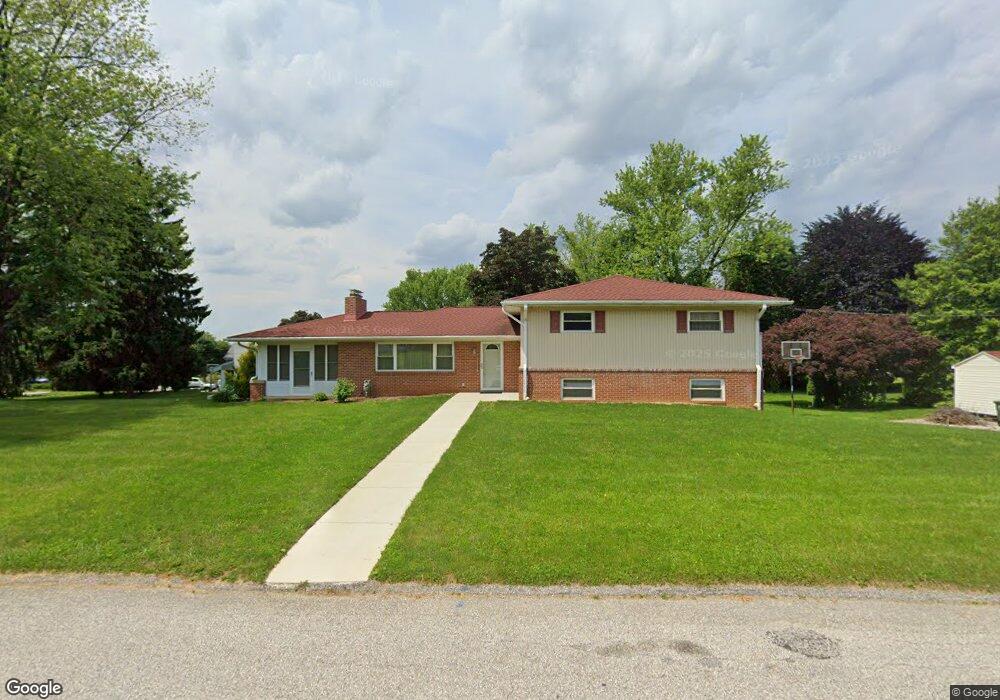
This home is located at 181 Nancy Ave, York, PA 17402 and is currently estimated at $387,790, approximately $117 per square foot. 181 Nancy Ave is a home located in York County with nearby schools including Leaders Heights Elementary School, Dallastown Area Middle School, and Dallastown Area High School.
Ownership History
Date
Name
Owned For
Owner Type
Purchase Details
Closed on
Jul 30, 2009
Sold by
Saylor Charles B and Saylor Margaret L
Bought by
Soha Helen T and Soha Bryan Patrick A
Current Estimated Value
Home Financials for this Owner
Home Financials are based on the most recent Mortgage that was taken out on this home.
Original Mortgage
$222,888
Outstanding Balance
$146,946
Interest Rate
5.43%
Mortgage Type
FHA
Estimated Equity
$240,844
Purchase Details
Closed on
Mar 1, 1986
Bought by
Saylor Charles B
Create a Home Valuation Report for This Property
The Home Valuation Report is an in-depth analysis detailing your home's value as well as a comparison with similar homes in the area
Home Values in the Area
Average Home Value in this Area
Purchase History
| Date | Buyer | Sale Price | Title Company |
|---|---|---|---|
| Soha Helen T | $227,000 | None Available | |
| Saylor Charles B | $85,500 | -- |
Source: Public Records
Mortgage History
| Date | Status | Borrower | Loan Amount |
|---|---|---|---|
| Open | Soha Helen T | $222,888 |
Source: Public Records
Tax History Compared to Growth
Tax History
| Year | Tax Paid | Tax Assessment Tax Assessment Total Assessment is a certain percentage of the fair market value that is determined by local assessors to be the total taxable value of land and additions on the property. | Land | Improvement |
|---|---|---|---|---|
| 2025 | $6,054 | $176,360 | $39,140 | $137,220 |
| 2024 | $5,966 | $176,360 | $39,140 | $137,220 |
| 2023 | $5,966 | $176,360 | $39,140 | $137,220 |
| 2022 | $5,771 | $176,360 | $39,140 | $137,220 |
| 2021 | $5,497 | $176,360 | $39,140 | $137,220 |
| 2020 | $5,497 | $176,360 | $39,140 | $137,220 |
| 2019 | $5,480 | $176,360 | $39,140 | $137,220 |
| 2018 | $5,442 | $176,360 | $39,140 | $137,220 |
| 2017 | $5,226 | $176,360 | $39,140 | $137,220 |
| 2016 | $0 | $176,360 | $39,140 | $137,220 |
| 2015 | -- | $176,360 | $39,140 | $137,220 |
| 2014 | -- | $176,360 | $39,140 | $137,220 |
Source: Public Records
Map
Nearby Homes
- 1899 Powder Mill Rd Unit B
- 1818 Roxboro Rd
- 119 Lexington Rd
- 146 Lexington Rd
- 30 Fox Run Dr
- 189 Tuscarora Dr
- 114 Dew Drop Ct Unit 114
- 2505 Joppa Rd
- 245 Leaders Heights Rd
- 2458 Schultz Way Unit 30
- 2214 S Queen St
- 362 Allegheny Dr
- 2415 Emiray Ct
- 224 Wheatfield Way Unit 71D
- 229 Wheatfield Way Unit 76C
- 519 Middleview Dr
- 2723 S Queen St Unit 96
- 300 Holyoke Dr
- 110 Oak Ridge Ln Unit 110
- 215 Wyntre Brooke Dr Unit 1
- 1859 Ebony Dr
- 180 Nancy Ave
- 1857 Ebony Dr
- 1868 Powder Mill Rd
- 184 Nancy Ave
- 1870 Powder Mill Rd
- 1864 Powder Mill Rd
- 1860 Ebony Dr
- 176 Nancy Ave
- 1862 Powder Mill Rd
- 1874 Powder Mill Rd
- 1855 Ebony Dr
- 1858 Ebony Dr
- 1889 Ebony Dr
- 172 Nancy Ave
- 1858 Powder Mill Rd
- 1878 Powder Mill Rd
- 1853 Ebony Dr
- 1884 Ebony Dr