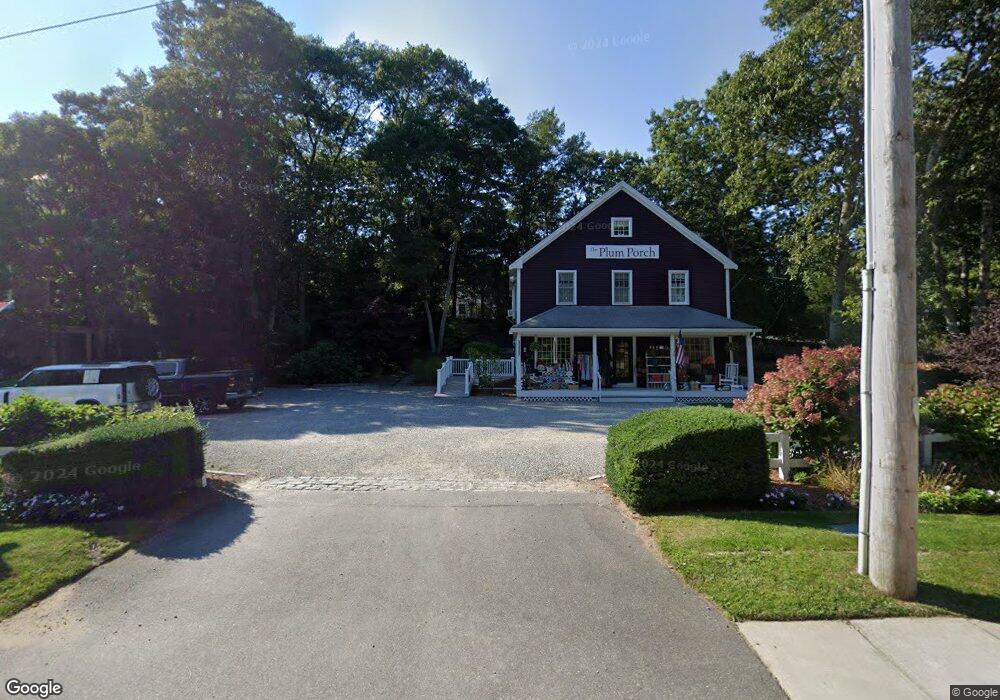
181 Route 149 Barnstable, MA 2632
Marstons Mills NeighborhoodEstimated Value: $1,079,387
2
Beds
1
Bath
2,160
Sq Ft
$500/Sq Ft
Est. Value
About This Home
This home is located at 181 Route 149, Barnstable, MA 2632 and is currently estimated at $1,079,387, approximately $499 per square foot. 181 Route 149 is a home located in Barnstable County with nearby schools including West Villages Elementary School, Barnstable United Elementary School, and Barnstable Intermediate School.
Ownership History
Date
Name
Owned For
Owner Type
Purchase Details
Closed on
Apr 3, 2018
Sold by
149 Plum Llc
Bought by
Cape Cod Capital Llc
Current Estimated Value
Home Financials for this Owner
Home Financials are based on the most recent Mortgage that was taken out on this home.
Original Mortgage
$237,500
Outstanding Balance
$203,075
Interest Rate
4.38%
Mortgage Type
New Conventional
Estimated Equity
$876,312
Purchase Details
Closed on
Jun 8, 2011
Sold by
Anderson Deena M and Despault Deena M
Bought by
149 Plum Llc
Create a Home Valuation Report for This Property
The Home Valuation Report is an in-depth analysis detailing your home's value as well as a comparison with similar homes in the area
Home Values in the Area
Average Home Value in this Area
Purchase History
| Date | Buyer | Sale Price | Title Company |
|---|---|---|---|
| Cape Cod Capital Llc | $585,000 | -- | |
| 149 Plum Llc | -- | -- |
Source: Public Records
Mortgage History
| Date | Status | Borrower | Loan Amount |
|---|---|---|---|
| Open | Cape Cod Capital Llc | $237,500 | |
| Closed | Cape Cod Capital Llc | $166,250 |
Source: Public Records
Tax History
| Year | Tax Paid | Tax Assessment Tax Assessment Total Assessment is a certain percentage of the fair market value that is determined by local assessors to be the total taxable value of land and additions on the property. | Land | Improvement |
|---|---|---|---|---|
| 2025 | -- | $427,800 | $138,000 | $289,800 |
| 2024 | -- | $419,500 | $138,000 | $281,500 |
| 2023 | $0 | $429,300 | $138,000 | $291,300 |
| 2022 | $0 | $444,600 | $153,300 | $291,300 |
| 2021 | $0 | $454,400 | $153,300 | $301,100 |
| 2020 | $0 | $392,200 | $134,100 | $258,100 |
| 2019 | $0 | $388,200 | $134,100 | $254,100 |
| 2018 | $0 | $383,900 | $134,100 | $249,800 |
| 2017 | $0 | $378,400 | $134,100 | $244,300 |
| 2016 | -- | $378,400 | $134,100 | $244,300 |
| 2015 | -- | $364,100 | $144,900 | $219,200 |
Source: Public Records
Map
Nearby Homes
- 68 Hilltop Dr
- 23 Middle Pond Path
- 1415 Old Post Rd
- 192 Sandy Valley Rd
- 152 Wakeby Rd
- 280 Ice Valley Rd
- 359 Baxter Neck Rd
- 15 Geraldine Rd
- 165 Baxter Neck Rd
- 78 Brittany Dr
- 98 Bunker Hill Rd
- 7 Ebenezer
- 602 Putnam Ave
- 564 Cotuit Bay Dr
- 564 Cotuit Bay Dr
- 369 Bumps River Rd
- 32 Willington Ave
- 835 Old Post Rd
- 1456 Santuit-Newtown Rd
- 318 Old Mill Rd
- 181 Massachusetts 149
- 171 Route 149
- 176 Cotuit Rd
- 211 Cotuit Rd
- 211 Cotuit Rd Unit B1
- 200 Cotuit Rd
- 200 Route 149
- 40 River Rd
- 164 Cotuit Rd
- 214 Route 149
- 195 Rte 149 Unit E
- 195 Massachusetts 149 Unit A
- 195 Massachusetts 149
- 195 Rte 149 Unit B
- 195 Rte 149 Unit G
- 195 Rte 149 Unit C
- 195 Rte 149 Unit 2
- 195 Rte 149 Unit 9
- 195 Rte 149 Unit 6
- 195 Rte 149 Unit 8
Your Personal Tour Guide
Ask me questions while you tour the home.