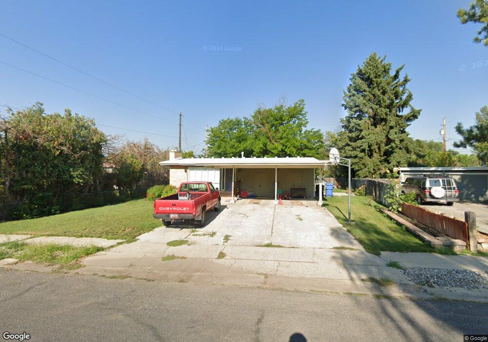
181 S 540 E Logan, UT 84321
Wilson NeighborhoodEstimated Value: $387,000 - $439,000
5
Beds
3
Baths
2,498
Sq Ft
$163/Sq Ft
Est. Value
About This Home
This home is located at 181 S 540 E, Logan, UT 84321 and is currently estimated at $406,828, approximately $162 per square foot. 181 S 540 E is a home located in Cache County with nearby schools including Wilson School, Mount Logan Middle School, and Logan High School.
Ownership History
Date
Name
Owned For
Owner Type
Purchase Details
Closed on
Mar 11, 2013
Sold by
Broadbent J Curtis and Broadbent Marilyn P
Bought by
Broadbent J Curtis and Broadbent Marilyn P
Current Estimated Value
Purchase Details
Closed on
Mar 23, 2011
Sold by
Deutsche Bank National Trust Company
Bought by
Broadbent Joseph C and Broadbent Marilyn
Purchase Details
Closed on
Jan 26, 2011
Sold by
Cranford Janis
Bought by
Deutsche Bank National Trust Company
Purchase Details
Closed on
Mar 20, 2006
Sold by
Cranford Janis
Bought by
Cranford Janis and Cranford Theresa M
Home Financials for this Owner
Home Financials are based on the most recent Mortgage that was taken out on this home.
Original Mortgage
$28,600
Interest Rate
6.25%
Mortgage Type
Stand Alone Second
Purchase Details
Closed on
Mar 17, 2006
Sold by
Monday Billy C and Monday Deborah Baker
Bought by
Cranford Janis
Home Financials for this Owner
Home Financials are based on the most recent Mortgage that was taken out on this home.
Original Mortgage
$28,600
Interest Rate
6.25%
Mortgage Type
Stand Alone Second
Create a Home Valuation Report for This Property
The Home Valuation Report is an in-depth analysis detailing your home's value as well as a comparison with similar homes in the area
Home Values in the Area
Average Home Value in this Area
Purchase History
| Date | Buyer | Sale Price | Title Company |
|---|---|---|---|
| Broadbent J Curtis | -- | None Available | |
| Broadbent Joseph C | -- | Backman Fptp | |
| Deutsche Bank National Trust Company | $126,395 | Etitle Insurance Agency | |
| Cranford Janis | -- | Northern Title Company | |
| Cranford Janis | -- | Northern Title Company |
Source: Public Records
Mortgage History
| Date | Status | Borrower | Loan Amount |
|---|---|---|---|
| Previous Owner | Cranford Janis | $28,600 | |
| Previous Owner | Cranford Janis | $28,600 | |
| Previous Owner | Cranford Janis | $114,400 |
Source: Public Records
Tax History
| Year | Tax Paid | Tax Assessment Tax Assessment Total Assessment is a certain percentage of the fair market value that is determined by local assessors to be the total taxable value of land and additions on the property. | Land | Improvement |
|---|---|---|---|---|
| 2025 | $1,568 | $202,750 | $0 | $0 |
| 2023 | $1,653 | $197,335 | $0 | $0 |
| 2022 | $1,770 | $197,330 | $0 | $0 |
| 2021 | $1,626 | $280,030 | $55,000 | $225,030 |
| 2020 | $1,471 | $228,100 | $55,000 | $173,100 |
| 2019 | $1,538 | $228,100 | $55,000 | $173,100 |
| 2018 | $1,055 | $142,928 | $40,000 | $102,928 |
| 2017 | $1,013 | $72,545 | $0 | $0 |
| 2016 | $1,050 | $72,545 | $0 | $0 |
| 2015 | $1,052 | $72,545 | $0 | $0 |
| 2014 | $951 | $72,545 | $0 | $0 |
| 2013 | -- | $71,740 | $0 | $0 |
Source: Public Records
Map
Nearby Homes
- 426 E 200 S
- 381 E 300 S
- 434 River Heights Blvd
- 45 River Circle Dr
- 664 E Center St
- 174 N 500 E
- 341 E Boulevard St
- 141 E 200 S
- 503 750 E Unit 31
- 540 750 E Unit 41
- 550 750 E Unit 40
- 429 750 E Unit 25
- 560 750 E Unit 39
- 33 N 200 E
- 28 River Pointe Dr
- 694 S 600 E
- 1164 E Mountain Rd
- 167 E 100 N Unit B
- 579 S 850 E
- 255 E 200 N
Your Personal Tour Guide
Ask me questions while you tour the home.