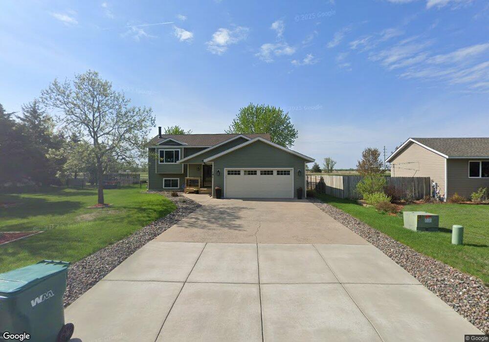
181 Sherburne Ave Big Lake, MN 55309
Estimated Value: $303,000 - $323,000
2
Beds
2
Baths
1,058
Sq Ft
$295/Sq Ft
Est. Value
About This Home
This home is located at 181 Sherburne Ave, Big Lake, MN 55309 and is currently estimated at $312,305, approximately $295 per square foot. 181 Sherburne Ave is a home located in Sherburne County with nearby schools including Liberty Elementary School, Independence Elementary School, and Big Lake Middle School.
Ownership History
Date
Name
Owned For
Owner Type
Purchase Details
Closed on
Jul 20, 2001
Sold by
Scadden Kenneth M and Scadden Leah F
Bought by
Wells Shawn D
Current Estimated Value
Purchase Details
Closed on
Jun 30, 2000
Sold by
Moen Kermit L and Moen Denise K
Bought by
Scadden Kenneth M
Purchase Details
Closed on
Jun 13, 1996
Sold by
Hi Ten Builders Inc
Bought by
Moen Kermit L and Moen Denise K
Create a Home Valuation Report for This Property
The Home Valuation Report is an in-depth analysis detailing your home's value as well as a comparison with similar homes in the area
Home Values in the Area
Average Home Value in this Area
Purchase History
| Date | Buyer | Sale Price | Title Company |
|---|---|---|---|
| Wells Shawn D | $127,500 | -- | |
| Scadden Kenneth M | $108,000 | -- | |
| Moen Kermit L | $89,900 | -- |
Source: Public Records
Tax History Compared to Growth
Tax History
| Year | Tax Paid | Tax Assessment Tax Assessment Total Assessment is a certain percentage of the fair market value that is determined by local assessors to be the total taxable value of land and additions on the property. | Land | Improvement |
|---|---|---|---|---|
| 2025 | $4,360 | $301,200 | $83,200 | $218,000 |
| 2024 | $4,414 | $298,500 | $83,200 | $215,300 |
| 2023 | $4,372 | $301,800 | $87,000 | $214,800 |
| 2022 | $3,192 | $286,400 | $73,700 | $212,700 |
| 2020 | $2,988 | $220,200 | $42,100 | $178,100 |
| 2019 | $2,768 | $204,900 | $37,200 | $167,700 |
| 2018 | $2,442 | $189,500 | $34,200 | $155,300 |
| 2017 | $2,152 | $164,600 | $31,200 | $133,400 |
| 2016 | $2,084 | $144,200 | $28,000 | $116,200 |
| 2015 | $1,890 | $116,800 | $23,700 | $93,100 |
| 2014 | $1,704 | $111,900 | $23,500 | $88,400 |
| 2013 | -- | $95,800 | $22,400 | $73,400 |
Source: Public Records
Map
Nearby Homes
- TBD Highway 10 NW
- 241 Leighton Dr
- 491 Highland Ave
- 679 Lakeshore Dr
- 20050 County Road 81 NW
- 637 Norwood Ln
- 20311 Gordon Ln
- 240 Wyoming Ave
- 874 Independence Dr NW
- TBD Manitou St
- 3300 Lake View Ln
- 100 Park Ave
- 20189 Esther Pkwy
- 541 William St
- 20172 Truman Dr
- 4637 Pond View Cir
- 4265 Lake Ridge Dr
- 5008 Bluff Rd
- 110 Powell Cir E
- 3250 Lake Ridge Dr
- 171 Sherburne Ave
- xxx Highway 10 NW
- 161 Sherburne Ave
- 170 Sherburne Ave
- 170 Sherburne Ave
- 106 Euclid Ave
- 151 Sherburne Ave
- #### Sherburne Ave
- 101 Euclid Ave
- 141 Sherburne Ave
- 150 Sherburne Ave
- 111 Euclid Ave
- 110 Euclid Ave
- 110 Oak Cir
- 111 Oak Cir
- 121 Us Highway 10
- 121 Us Highway 10
- 121 Us Highway 10
- 121 Us Highway 10
- 121 Us Highway 10