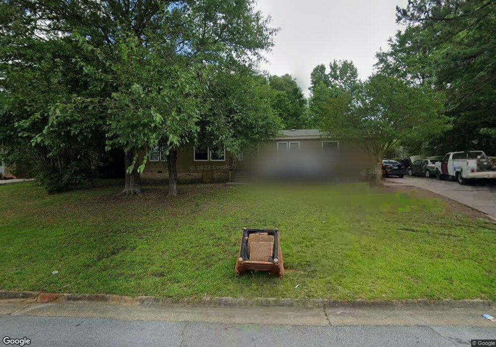
1810 Amber Dr Columbus, GA 31907
Eastern Columbus NeighborhoodEstimated Value: $142,000 - $176,000
3
Beds
3
Baths
1,476
Sq Ft
$106/Sq Ft
Est. Value
About This Home
This home is located at 1810 Amber Dr, Columbus, GA 31907 and is currently estimated at $156,304, approximately $105 per square foot. 1810 Amber Dr is a home located in Muscogee County with nearby schools including Wesley Heights Elementary School, East Columbus Magnet Academy, and Kendrick High School.
Ownership History
Date
Name
Owned For
Owner Type
Purchase Details
Closed on
Oct 2, 2017
Sold by
Hood Vivian
Bought by
Hood Vivian and Hood Clifford
Current Estimated Value
Purchase Details
Closed on
Jun 13, 2017
Sold by
Ayshieka Grant
Bought by
Hood Vivian
Purchase Details
Closed on
Jun 25, 2009
Sold by
Secretary Of Veterans Affairs
Bought by
Grant Ayshieka
Purchase Details
Closed on
Mar 4, 2008
Sold by
Wells Fargo Bank Na
Bought by
Va
Create a Home Valuation Report for This Property
The Home Valuation Report is an in-depth analysis detailing your home's value as well as a comparison with similar homes in the area
Home Values in the Area
Average Home Value in this Area
Purchase History
| Date | Buyer | Sale Price | Title Company |
|---|---|---|---|
| Hood Vivian | -- | -- | |
| Hood Vivian | -- | -- | |
| Grant Ayshieka | -- | None Available | |
| Va | -- | None Available | |
| Wells Fargo Bank Na | $54,641 | None Available |
Source: Public Records
Tax History Compared to Growth
Tax History
| Year | Tax Paid | Tax Assessment Tax Assessment Total Assessment is a certain percentage of the fair market value that is determined by local assessors to be the total taxable value of land and additions on the property. | Land | Improvement |
|---|---|---|---|---|
| 2025 | $191 | $48,696 | $8,384 | $40,312 |
| 2024 | $1,906 | $48,696 | $8,384 | $40,312 |
| 2023 | $1,151 | $48,696 | $8,384 | $40,312 |
| 2022 | $1,433 | $35,092 | $8,384 | $26,708 |
| 2021 | $1,330 | $32,572 | $8,384 | $24,188 |
| 2020 | $1,330 | $32,572 | $8,384 | $24,188 |
| 2019 | $1,335 | $32,572 | $8,384 | $24,188 |
| 2018 | $1,382 | $39,688 | $8,384 | $31,304 |
| 2017 | $1,631 | $39,688 | $8,384 | $31,304 |
| 2016 | $1,208 | $29,276 | $3,741 | $25,535 |
| 2015 | $1,186 | $29,276 | $3,741 | $25,535 |
| 2014 | $484 | $29,276 | $3,741 | $25,535 |
| 2013 | -- | $29,276 | $3,741 | $25,535 |
Source: Public Records
Map
Nearby Homes
- 5920 Gleneden Dr
- 6032 Cordova Rd
- 5833 Gleneden Dr
- 5929 Gleneden Dr
- 2525 Corineth Dr
- 6047 Capri Cir
- 5834 Blueridge Dr
- 5802 Blueridge Dr
- 6213 Fitzgerald Dr
- 6033 Luna Dr
- 5500 Amber Dr
- 1068 Valencia Dr
- 6061 Luna Dr
- 5619 Valleybrook Rd
- 6059 Nassau Cir
- 2807 Doyle Ave
- 1524 Hagan Dr
- 6119 Mill Branch Rd
- 1607 Mazor Dr
- 1754 Mazor Dr
- 1800 Amber Dr
- 5473 Woodgate Dr
- 1900 Amber Dr
- 5479 Woodgate Dr
- 1831 Amber Dr
- 1950 Amber Dr
- 1835 Amber Dr
- 1839 Amber Dr
- 5485 Woodgate Dr
- 1843 Amber Dr
- 1847 Amber Dr
- 5778 Marlette Ct
- 5784 Marlette Ct
- 1700 Amber Dr
- 5474 Woodgate Dr
- 5900 Hunter Rd
- 5491 Woodgate Dr
- 5912 Hunter Rd
- 5779 Marlette Ct
- 5480 Woodgate Dr