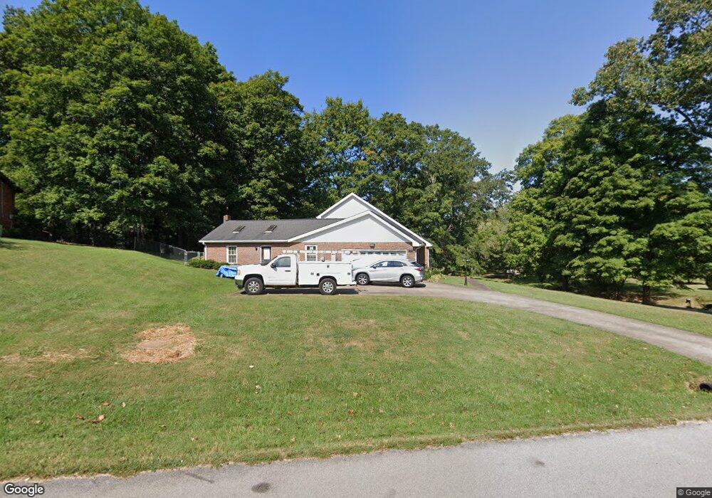
1810 Auburn Dr Clarksville, TN 37043
Estimated Value: $325,000 - $390,000
--
Bed
3
Baths
2,374
Sq Ft
$149/Sq Ft
Est. Value
About This Home
This home is located at 1810 Auburn Dr, Clarksville, TN 37043 and is currently estimated at $352,816, approximately $148 per square foot. 1810 Auburn Dr is a home located in Montgomery County with nearby schools including Rossview Elementary School, Rossview Middle School, and Rossview High School.
Ownership History
Date
Name
Owned For
Owner Type
Purchase Details
Closed on
May 7, 2025
Sold by
David R Pitts Trust and Pitts David R
Bought by
David R Pitts Trust and Pitts
Current Estimated Value
Purchase Details
Closed on
Mar 18, 2010
Sold by
Federal National Mortgage Association
Bought by
Pitts David R
Purchase Details
Closed on
Aug 12, 2009
Sold by
Diehr Justin T
Bought by
Federal National Mortgage Association
Purchase Details
Closed on
May 19, 2004
Sold by
Leavelle R C
Bought by
Diehr Justin T
Purchase Details
Closed on
May 13, 2004
Sold by
Leavelle R C
Bought by
Diehr Justin T
Create a Home Valuation Report for This Property
The Home Valuation Report is an in-depth analysis detailing your home's value as well as a comparison with similar homes in the area
Home Values in the Area
Average Home Value in this Area
Purchase History
| Date | Buyer | Sale Price | Title Company |
|---|---|---|---|
| David R Pitts Trust | -- | None Listed On Document | |
| David R Pitts Trust | -- | None Listed On Document | |
| Pitts David R | $135,000 | -- | |
| Federal National Mortgage Association | $114,980 | -- | |
| Diehr Justin T | $137,500 | -- | |
| Diehr Justin T | $137,500 | -- |
Source: Public Records
Tax History Compared to Growth
Tax History
| Year | Tax Paid | Tax Assessment Tax Assessment Total Assessment is a certain percentage of the fair market value that is determined by local assessors to be the total taxable value of land and additions on the property. | Land | Improvement |
|---|---|---|---|---|
| 2024 | $2,250 | $75,500 | $0 | $0 |
| 2023 | $2,250 | $51,650 | $0 | $0 |
| 2022 | $2,179 | $51,650 | $0 | $0 |
| 2021 | $2,179 | $51,650 | $0 | $0 |
| 2020 | $2,076 | $51,650 | $0 | $0 |
| 2019 | $2,076 | $51,650 | $0 | $0 |
| 2018 | $1,892 | $30,700 | $0 | $0 |
| 2017 | $544 | $43,900 | $0 | $0 |
| 2016 | $1,348 | $43,900 | $0 | $0 |
| 2015 | $1,348 | $43,900 | $0 | $0 |
| 2014 | $1,825 | $43,900 | $0 | $0 |
| 2013 | $1,724 | $39,375 | $0 | $0 |
Source: Public Records
Map
Nearby Homes
- 1986 Stone Valley Ct
- 1421 English Oak Dr
- 1413 English Oak Dr
- 1401 English Oak Dr
- 800 Brooke Valley Trace
- 809 Laurel Dr
- 811 River Run
- 1425 English Oak Dr
- 1387 English Oak Dr
- 1885 Basham Ln
- 405 Kimberly Dr
- 1775 Auburn Dr
- 825 Salisbury Way
- 1992 Hannover Ct
- 1373 English Oak Dr
- 1395 English Oak Dr
- 1412 English Oak Dr
- 1399 English Oak Dr
- 1234 English Oak Dr
- 1404 English Oak Dr
- 1812 Auburn Dr
- 1809 Auburn Dr
- 1809 Warfield Dr
- 1815 Auburn Dr
- 1806 Auburn Dr
- 1807 Auburn Dr
- 1807 Warfield Dr
- 1817 Auburn Dr
- 1805 Auburn Dr
- 1805 Warfield Dr
- 1804 Auburn Dr
- 108 Swan Lake Village
- 1810 Theresa Dr
- 109 Swan Lake Village
- 1803 Auburn Dr
- 808 Dunbar Cave Rd
- 1803 Warfield Dr
- 1808 Theresa Dr
- 812 Dunbar Cave Rd