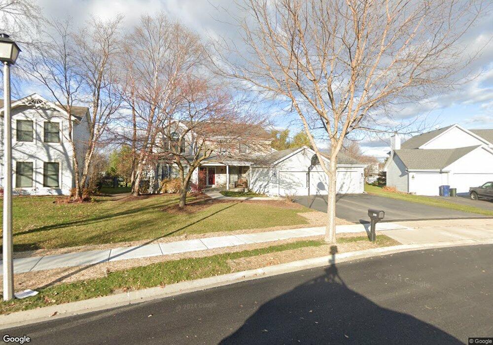
1810 Crofton Dr Algonquin, IL 60102
High Hill Farms NeighborhoodEstimated Value: $419,319 - $526,000
4
Beds
3
Baths
2,634
Sq Ft
$181/Sq Ft
Est. Value
About This Home
This home is located at 1810 Crofton Dr, Algonquin, IL 60102 and is currently estimated at $476,080, approximately $180 per square foot. 1810 Crofton Dr is a home located in McHenry County with nearby schools including Westfield Community School, Kenneth E Neubert Elementary School, and Harry D Jacobs High School.
Ownership History
Date
Name
Owned For
Owner Type
Purchase Details
Closed on
Sep 7, 2022
Sold by
Bliznick Victoria R
Bought by
Victoria R Bliznick Revocable Trust
Current Estimated Value
Purchase Details
Closed on
Jan 28, 1994
Sold by
Boulevard Bank National Association
Bought by
Bliznick Dominick M and Bliznick Victoria R
Home Financials for this Owner
Home Financials are based on the most recent Mortgage that was taken out on this home.
Original Mortgage
$130,000
Interest Rate
7.26%
Create a Home Valuation Report for This Property
The Home Valuation Report is an in-depth analysis detailing your home's value as well as a comparison with similar homes in the area
Home Values in the Area
Average Home Value in this Area
Purchase History
| Date | Buyer | Sale Price | Title Company |
|---|---|---|---|
| Victoria R Bliznick Revocable Trust | -- | None Listed On Document | |
| Bliznick Dominick M | $201,000 | -- |
Source: Public Records
Mortgage History
| Date | Status | Borrower | Loan Amount |
|---|---|---|---|
| Previous Owner | Bliznick Dominick M | $130,000 |
Source: Public Records
Tax History
| Year | Tax Paid | Tax Assessment Tax Assessment Total Assessment is a certain percentage of the fair market value that is determined by local assessors to be the total taxable value of land and additions on the property. | Land | Improvement |
|---|---|---|---|---|
| 2024 | $10,039 | $136,338 | $24,172 | $112,166 |
| 2023 | $9,538 | $121,937 | $21,619 | $100,318 |
| 2022 | $8,844 | $109,130 | $21,044 | $88,086 |
| 2021 | $8,489 | $101,668 | $19,605 | $82,063 |
| 2020 | $8,267 | $98,069 | $18,911 | $79,158 |
| 2019 | $9,134 | $105,477 | $18,100 | $87,377 |
| 2018 | $9,122 | $101,702 | $16,721 | $84,981 |
| 2017 | $8,943 | $95,809 | $15,752 | $80,057 |
| 2016 | $8,819 | $89,860 | $14,774 | $75,086 |
| 2013 | -- | $70,038 | $13,783 | $56,255 |
Source: Public Records
Map
Nearby Homes
- 1820 Crofton Dr
- 741 Regal Ln
- 700 Fairfield Ln
- 760 Regal Ln
- 681 Majestic Dr
- 1033 Interloch Ct Unit 32
- 1920 Jester Ln
- 2233 Dawson Ln Unit 312
- 1157 Sawmill Ln
- 1 N Hubbard St
- SWC Talaga and Algonquin Rd
- 2380 Dawson Ln Unit 165
- 2051 Carlisle St
- 1431 Essex St
- 20 Peach Tree Ct Unit 4153
- 18 Peach Tree Ct Unit 4154
- 145 S Oakleaf Rd
- 135 Arquilla Dr
- 7 Falcon Ridge Ct
- 2069 Peach Tree Ln Unit 4116
- 1800 Crofton Dr
- 1811 Westbury Dr
- 1801 Westbury Dr
- 1821 Westbury Dr
- 1741 Westbury Dr
- 1830 Crofton Dr
- 1740 Crofton Dr
- 1711 Crofton Dr
- 1731 Westbury Dr
- 1721 Crofton Dr
- 1831 Westbury Dr
- 1840 Crofton Dr
- 1730 Crofton Dr
- 1731 Crofton Dr
- 1721 Westbury Dr
- 1841 Westbury Dr
- 831 Southwick Dr
- 1710 Hartley Dr
- 1700 Hartley Dr
- 1741 Crofton Dr
Your Personal Tour Guide
Ask me questions while you tour the home.