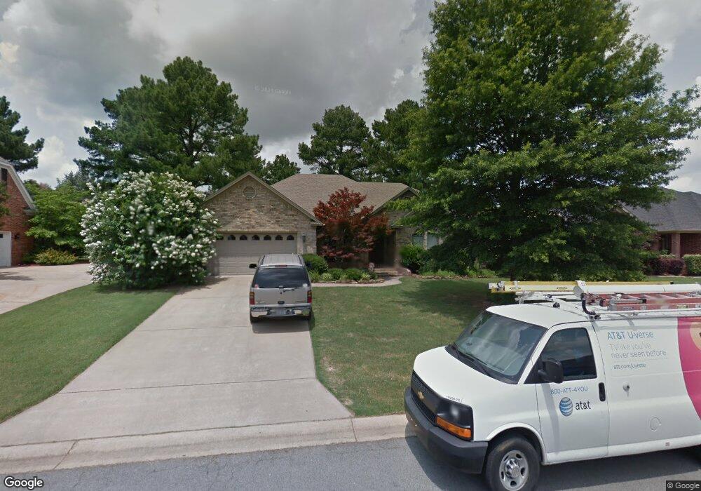
1810 Foster Dr Conway, AR 72034
Downtown Conway NeighborhoodEstimated Value: $308,441 - $353,000
Studio
2
Baths
2,220
Sq Ft
$152/Sq Ft
Est. Value
About This Home
This home is located at 1810 Foster Dr, Conway, AR 72034 and is currently estimated at $336,360, approximately $151 per square foot. 1810 Foster Dr is a home located in Faulkner County with nearby schools including Julia Lee Moore Elementary School, Conway Junior High School, and Conway High School.
Ownership History
Date
Name
Owned For
Owner Type
Purchase Details
Closed on
May 31, 2019
Sold by
Minister Todd A
Bought by
Moshier Earnest Charles and Moshier Jennie L
Current Estimated Value
Purchase Details
Closed on
Apr 2, 2007
Bought by
Minister
Home Financials for this Owner
Home Financials are based on the most recent Mortgage that was taken out on this home.
Original Mortgage
$179,500
Interest Rate
6.3%
Mortgage Type
New Conventional
Purchase Details
Closed on
Mar 23, 2007
Sold by
Westjohn D Scott and Westjohn Amy Lynn
Bought by
Minister Todd A
Home Financials for this Owner
Home Financials are based on the most recent Mortgage that was taken out on this home.
Original Mortgage
$179,500
Interest Rate
6.3%
Mortgage Type
New Conventional
Purchase Details
Closed on
Apr 17, 1998
Bought by
Westjohn
Purchase Details
Closed on
Jun 14, 1996
Bought by
Benzschawel
Purchase Details
Closed on
Feb 13, 1996
Bought by
Generation
Create a Home Valuation Report for This Property
The Home Valuation Report is an in-depth analysis detailing your home's value as well as a comparison with similar homes in the area
Home Values in the Area
Average Home Value in this Area
Purchase History
| Date | Buyer | Sale Price | Title Company |
|---|---|---|---|
| Moshier Earnest Charles | $219,000 | Lenders Title Company | |
| Minister | $204,000 | -- | |
| Minister Todd A | $154,000 | Lenders Title Co | |
| Minister | $204,000 | -- | |
| Westjohn | $166,000 | -- | |
| Benzschawel | $158,000 | -- | |
| Generation | $24,000 | -- |
Source: Public Records
Mortgage History
| Date | Status | Borrower | Loan Amount |
|---|---|---|---|
| Previous Owner | Minister Todd A | $179,500 |
Source: Public Records
Tax History
| Year | Tax Paid | Tax Assessment Tax Assessment Total Assessment is a certain percentage of the fair market value that is determined by local assessors to be the total taxable value of land and additions on the property. | Land | Improvement |
|---|---|---|---|---|
| 2025 | $1,875 | $62,140 | $5,000 | $57,140 |
| 2024 | $1,875 | $62,140 | $5,000 | $57,140 |
| 2023 | $1,875 | $44,170 | $5,000 | $39,170 |
| 2022 | $1,500 | $44,170 | $5,000 | $39,170 |
| 2021 | $1,500 | $44,170 | $5,000 | $39,170 |
| 2020 | $1,500 | $37,060 | $5,000 | $32,060 |
| 2019 | $1,500 | $37,060 | $5,000 | $32,060 |
| 2018 | $1,525 | $37,060 | $5,000 | $32,060 |
| 2017 | $1,525 | $37,060 | $5,000 | $32,060 |
| 2016 | $1,468 | $35,920 | $5,000 | $30,920 |
| 2015 | $1,731 | $34,210 | $5,000 | $29,210 |
| 2014 | $1,381 | $34,210 | $5,000 | $29,210 |
Source: Public Records
Map
Nearby Homes
- 1655 Chicot Dr
- 1660 Chicot Dr
- 3020 Ashley Dr
- 1750 Pearce Dr
- 1810 Amelia Dr
- 3615 Heidi Ct
- 3630 Aspen Cir
- 1715 Royal Dr
- 1810 Royal Dr
- 1940 Royal Dr
- 3285 Nob Hill Dr
- 3660 Irby Dr
- 27 White Oak Dr
- 3 Brandywine Cove
- 1140 Trillium Dr
- 1320 Millers View Rd
- 1330 Millers View Rd
- 41 Tucker Creek Rd
- 2 Pin Oak Dr
- 3720 Monarch Cove
- 1800 Foster Dr
- 1820 Foster Dr
- 1815 Foster Dr
- 1830 Foster Dr
- 3235 Athens Dr
- 1825 Foster Dr
- 1825 Plymouth Dr
- 1805 Foster Dr
- 3245 Athens Dr
- 0 Athens Dr
- 1835 Foster Dr
- 1800 Plymouth Dr
- 1810 Plymouth Dr
- 1750 Plymouth Dr
- 1860 Foster Dr
- 0 Plymouth Dr
- 1820 Plymouth Dr
- 3255 Athens Dr
- 1725 Plymouth Dr
- 3230 Athens Dr
Your Personal Tour Guide
Ask me questions while you tour the home.