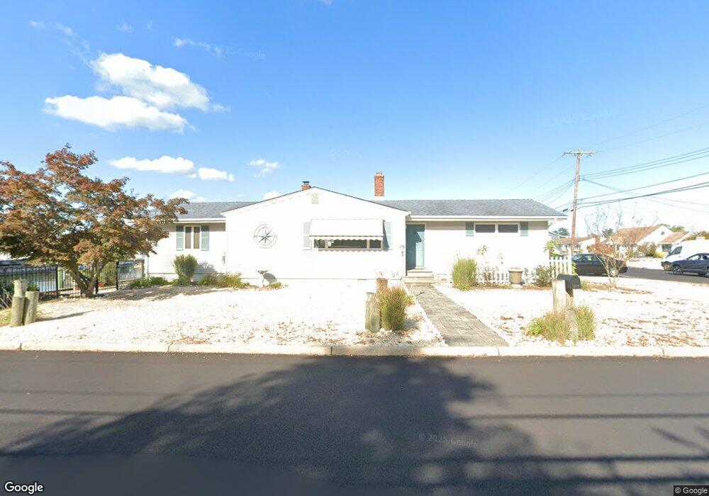
1810 Merrimac Dr Toms River, NJ 08753
Estimated Value: $548,000 - $649,000
3
Beds
2
Baths
1,488
Sq Ft
$407/Sq Ft
Est. Value
About This Home
This home is located at 1810 Merrimac Dr, Toms River, NJ 08753 and is currently estimated at $605,840, approximately $407 per square foot. 1810 Merrimac Dr is a home located in Ocean County.
Ownership History
Date
Name
Owned For
Owner Type
Purchase Details
Closed on
Dec 21, 2010
Sold by
U S Bank National Association
Bought by
Eufemia Anthony
Current Estimated Value
Purchase Details
Closed on
Sep 13, 2010
Sold by
Jinotti Kenneth and Jinotti Carol
Bought by
Us Bank National Association
Purchase Details
Closed on
Jul 14, 2006
Sold by
Gasior Sandra C
Bought by
Jinotti Kenneth and Jinotti Carol
Home Financials for this Owner
Home Financials are based on the most recent Mortgage that was taken out on this home.
Original Mortgage
$94,000
Interest Rate
6.27%
Mortgage Type
Stand Alone Second
Purchase Details
Closed on
Aug 1, 1997
Sold by
Wayda Raymond
Bought by
Gasior Frank
Home Financials for this Owner
Home Financials are based on the most recent Mortgage that was taken out on this home.
Original Mortgage
$117,000
Interest Rate
7.5%
Purchase Details
Closed on
Mar 4, 1994
Sold by
Bokowski Robert
Bought by
Wayda Raymond and Wayda Christine
Home Financials for this Owner
Home Financials are based on the most recent Mortgage that was taken out on this home.
Original Mortgage
$148,000
Interest Rate
6.9%
Create a Home Valuation Report for This Property
The Home Valuation Report is an in-depth analysis detailing your home's value as well as a comparison with similar homes in the area
Home Values in the Area
Average Home Value in this Area
Purchase History
| Date | Buyer | Sale Price | Title Company |
|---|---|---|---|
| Eufemia Anthony | $269,000 | Pinnacle Title Agency Inc | |
| Us Bank National Association | -- | None Available | |
| Jinotti Kenneth | $470,000 | None Available | |
| Gasior Frank | $183,000 | -- | |
| Wayda Raymond | $155,500 | -- |
Source: Public Records
Mortgage History
| Date | Status | Borrower | Loan Amount |
|---|---|---|---|
| Previous Owner | Jinotti Kenneth | $94,000 | |
| Previous Owner | Jinotti Kenneth | $376,000 | |
| Previous Owner | Gasior Frank | $117,000 | |
| Previous Owner | Wayda Raymond | $148,000 |
Source: Public Records
Tax History Compared to Growth
Tax History
| Year | Tax Paid | Tax Assessment Tax Assessment Total Assessment is a certain percentage of the fair market value that is determined by local assessors to be the total taxable value of land and additions on the property. | Land | Improvement |
|---|---|---|---|---|
| 2025 | $8,841 | $485,500 | $295,000 | $190,500 |
| 2024 | $8,404 | $485,500 | $295,000 | $190,500 |
| 2023 | $8,103 | $485,500 | $295,000 | $190,500 |
| 2022 | $8,103 | $485,500 | $295,000 | $190,500 |
| 2021 | $7,275 | $318,900 | $195,400 | $123,500 |
| 2020 | $7,953 | $318,900 | $195,400 | $123,500 |
| 2019 | $7,609 | $318,900 | $195,400 | $123,500 |
| 2018 | $7,507 | $318,900 | $195,400 | $123,500 |
| 2017 | $7,443 | $318,900 | $195,400 | $123,500 |
| 2016 | $7,249 | $318,900 | $195,400 | $123,500 |
| 2015 | $6,974 | $318,900 | $195,400 | $123,500 |
| 2014 | $6,640 | $318,900 | $195,400 | $123,500 |
Source: Public Records
Map
Nearby Homes
- 1145 Kenton Dr
- 1836 Ensign Ct
- 8 Pumpshire Rd
- 1850 Ensign Ct
- 890 Fairview Dr
- 1939 Ship Ct
- 2517 Waters Edge Dr Unit 17
- 1943 Pinta Ct
- 1916 Waters Edge Dr Unit 16
- 1813 Waters Edge Dr
- 1019 Waters Edge Dr
- 1083 Crystal Dr
- 1214 Waters Edge Dr Unit 14
- 141 Yellowbank Rd
- 169 S Shore Dr
- 1035 Tralee Dr
- 5 Dublin Ct
- 1072 Lake Placid Dr
- 230 Christoffer Terrace
- 944 Yellowbank Rd
- 1814 Monitor Dr
- 1813 Merrimac Dr
- 1805 Merrimac Dr
- 1818 Monitor Dr
- 1807 Monitor Dr
- 1811 Monitor Dr
- 1817 Merrimac Dr
- 5 Snug Ct
- 1815 Monitor Dr
- 1801 Merrimac Dr
- 1822 Monitor Dr
- 1819 Monitor Dr
- 7 Snug Ct
- 1826 Monitor Dr
- 1823 Monitor Dr
- 1822 Merrimac Dr
- 1821 Skiff Ct
- 8 Snug Ct
- 1825 Merrimac Dr
- 1830 Monitor Dr