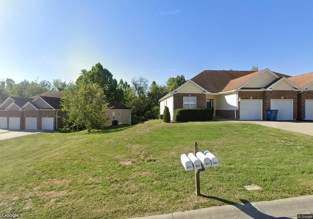
1810 Villa Dr Warrensburg, MO 64093
Estimated Value: $266,000 - $320,000
4
Beds
3
Baths
2,700
Sq Ft
$110/Sq Ft
Est. Value
About This Home
This home is located at 1810 Villa Dr, Warrensburg, MO 64093 and is currently estimated at $297,429, approximately $110 per square foot. 1810 Villa Dr is a home located in Johnson County with nearby schools including Maple Grove Elementary School, Martin Warren Elementary School, and Warrensburg Middle School.
Ownership History
Date
Name
Owned For
Owner Type
Purchase Details
Closed on
Nov 15, 2023
Sold by
Edward C Robison Trust
Bought by
Edward C Robison And Marie M Robison Trust and Robison
Current Estimated Value
Purchase Details
Closed on
Sep 7, 2005
Sold by
Global Capital & Leasing Llc
Bought by
Beyea Richard S and Beyea Rene R
Home Financials for this Owner
Home Financials are based on the most recent Mortgage that was taken out on this home.
Original Mortgage
$115,900
Interest Rate
5.8%
Mortgage Type
New Conventional
Create a Home Valuation Report for This Property
The Home Valuation Report is an in-depth analysis detailing your home's value as well as a comparison with similar homes in the area
Home Values in the Area
Average Home Value in this Area
Purchase History
We collect this data history from publicly available records. To have your information removed, we recommend requesting removal directly through your county’s website.
| Date | Buyer | Sale Price | Title Company |
|---|---|---|---|
| Edward C Robison And Marie M Robison Trust | -- | None Listed On Document | |
| Beyea Richard S | -- | Western Missouri Title Compa |
Source: Public Records
Mortgage History
We collect this data history from publicly available records. To have your information removed, we recommend requesting removal directly through your county’s website.
| Date | Status | Borrower | Loan Amount |
|---|---|---|---|
| Previous Owner | Beyea Richard S | $115,900 |
Source: Public Records
Tax History
| Year | Tax Paid | Tax Assessment Tax Assessment Total Assessment is a certain percentage of the fair market value that is determined by local assessors to be the total taxable value of land and additions on the property. | Land | Improvement |
|---|---|---|---|---|
| 2025 | $2,372 | $31,618 | $0 | $0 |
| 2024 | $2,242 | $29,365 | $0 | $0 |
| 2023 | $2,242 | $29,365 | $0 | $0 |
| 2022 | $2,172 | $28,324 | $0 | $0 |
| 2021 | $2,165 | $28,324 | $0 | $0 |
| 2020 | $2,108 | $27,283 | $0 | $0 |
| 2019 | $2,107 | $27,283 | $0 | $0 |
| 2017 | $2,102 | $27,283 | $0 | $0 |
| 2016 | $1,937 | $27,283 | $0 | $0 |
| 2015 | $1,989 | $27,283 | $0 | $0 |
| 2014 | $2,104 | $27,283 | $0 | $0 |
Source: Public Records
Map
Nearby Homes
- 1803 Villa Dr
- 1208 Half Day Dr
- 1219 S Countryview Ln
- 1205 Half Day Dr
- 1219 Pembrooke Dr
- 1593 Essex Dr
- 1227 Pembrooke Dr
- 1503 Nottingham Dr
- 1208 Cambridge Dr
- 1415 Kimberly Dr
- 1411 Kimberly Dr
- 719 Brookside Dr
- 1011 Eli Ln
- 1103 N Eli Ln
- 711 Shamrock Ln
- 146 SE 180th Rd
- 1030 Anderson St
- 700 Cedar Dr Unit C
- 1014 Anderson St
- 991 S Mitchell St
- 1808 Villa Dr
- 1812 Villa Dr
- 1806 Villa Dr
- 1814 Villa Dr
- 1804 Villa Dr
- 1811 Villa Dr
- 1813 Villa Dr
- 1809 Villa Dr
- 1802 Villa Dr
- 1815 Villa Dr
- 1807 Villa Dr
- 1816 Villa Dr
- 1209 S Country View Ln
- 1805 Villa Dr
- 1210 Nottingham Dr
- 1817 Villa Dr
- 1211 S Country View Ln
- 1818 Villa Dr
- 1800 Villa Dr
- 1212 Nottingham Dr
Your Personal Tour Guide
Ask me questions while you tour the home.