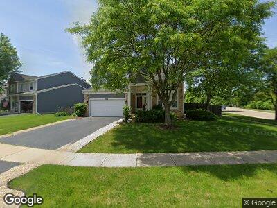
1811 Hobson Ln Aurora, IL 60503
Far Southeast NeighborhoodEstimated Value: $405,000 - $476,000
--
Bed
--
Bath
909
Sq Ft
$480/Sq Ft
Est. Value
About This Home
This home is located at 1811 Hobson Ln, Aurora, IL 60503 and is currently estimated at $436,467, approximately $480 per square foot. 1811 Hobson Ln is a home located in Kendall County with nearby schools including The Wheatlands Elementary School, Bednarcik Jr. High School, and Oswego East High School.
Ownership History
Date
Name
Owned For
Owner Type
Purchase Details
Closed on
Sep 3, 1999
Sold by
Greenfield/Waterbury Llc
Bought by
Tapang Guillermo A and Tapang Annette F
Current Estimated Value
Home Financials for this Owner
Home Financials are based on the most recent Mortgage that was taken out on this home.
Original Mortgage
$191,100
Interest Rate
7.72%
Create a Home Valuation Report for This Property
The Home Valuation Report is an in-depth analysis detailing your home's value as well as a comparison with similar homes in the area
Home Values in the Area
Average Home Value in this Area
Purchase History
| Date | Buyer | Sale Price | Title Company |
|---|---|---|---|
| Tapang Guillermo A | $212,500 | Ticor Title Insurance Compan |
Source: Public Records
Mortgage History
| Date | Status | Borrower | Loan Amount |
|---|---|---|---|
| Open | Tapang Guillermo A | $115,663 | |
| Closed | Tapang Annette F | $240,000 | |
| Closed | Tapang Guillermo A | $224,000 | |
| Closed | Tapang Annette F | $15,000 | |
| Closed | Tapang Guillermo | $195,750 | |
| Previous Owner | Tapang Guillermo A | $191,100 |
Source: Public Records
Tax History Compared to Growth
Tax History
| Year | Tax Paid | Tax Assessment Tax Assessment Total Assessment is a certain percentage of the fair market value that is determined by local assessors to be the total taxable value of land and additions on the property. | Land | Improvement |
|---|---|---|---|---|
| 2023 | $9,525 | $107,652 | $23,465 | $84,187 |
| 2022 | $9,525 | $100,609 | $21,930 | $78,679 |
| 2021 | $9,001 | $92,302 | $20,119 | $72,183 |
| 2020 | $8,537 | $86,264 | $18,803 | $67,461 |
| 2019 | $8,353 | $82,747 | $18,803 | $63,944 |
| 2018 | $8,765 | $85,926 | $19,525 | $66,401 |
| 2017 | $8,616 | $81,062 | $18,420 | $62,642 |
| 2016 | $8,268 | $76,836 | $17,460 | $59,376 |
| 2015 | $8,354 | $71,810 | $16,318 | $55,492 |
| 2014 | -- | $69,719 | $15,843 | $53,876 |
| 2013 | -- | $70,423 | $16,003 | $54,420 |
Source: Public Records
Map
Nearby Homes
- 1932 Royal Ln
- 1874 Wisteria Dr Unit 333
- 1913 Misty Ridge Ln Unit 5
- 2355 Avalon Ct
- 1917 Turtle Creek Ct
- 2410 Oakfield Ct
- 2520 Dorothy Dr
- 2525 Ridge Rd Unit 6
- 2270 Twilight Dr Unit 2270
- 2278 Twilight Dr
- 3326 Fulshear Cir
- 3328 Fulshear Cir
- 3408 Fulshear Cir
- 2675 Dorothy Dr
- 2013 Eastwick Ln
- 2690 Moss Ln
- 2495 Hafenrichter Rd
- 2665 Tiffany St
- 2645 Lindrick Ln
- 2197 Wilson Creek Cir Unit 3
- 1811 Hobson Ln
- 1821 Hobson Ln
- 2219 Keating Dr Unit 2B
- 1831 Hobson Ln Unit 2B
- 2215 Keating Dr
- 1800 Hobson Ln
- 1820 Hobson Ln
- 1810 Hobson Ln
- 1830 Hobson Ln
- 2226 Halsted Ct
- 2211 Keating Dr
- 2234 Halsted Ct
- 2242 Halsted Ct
- 2218 Halsted Ct
- 1840 Hobson Ln
- 2235 Keating Dr Unit 2B
- 2207 Keating Dr
- 2210 Halsted Ct
- 2278 Conrad Ct
- 2258 Halsted Ln Unit 2B