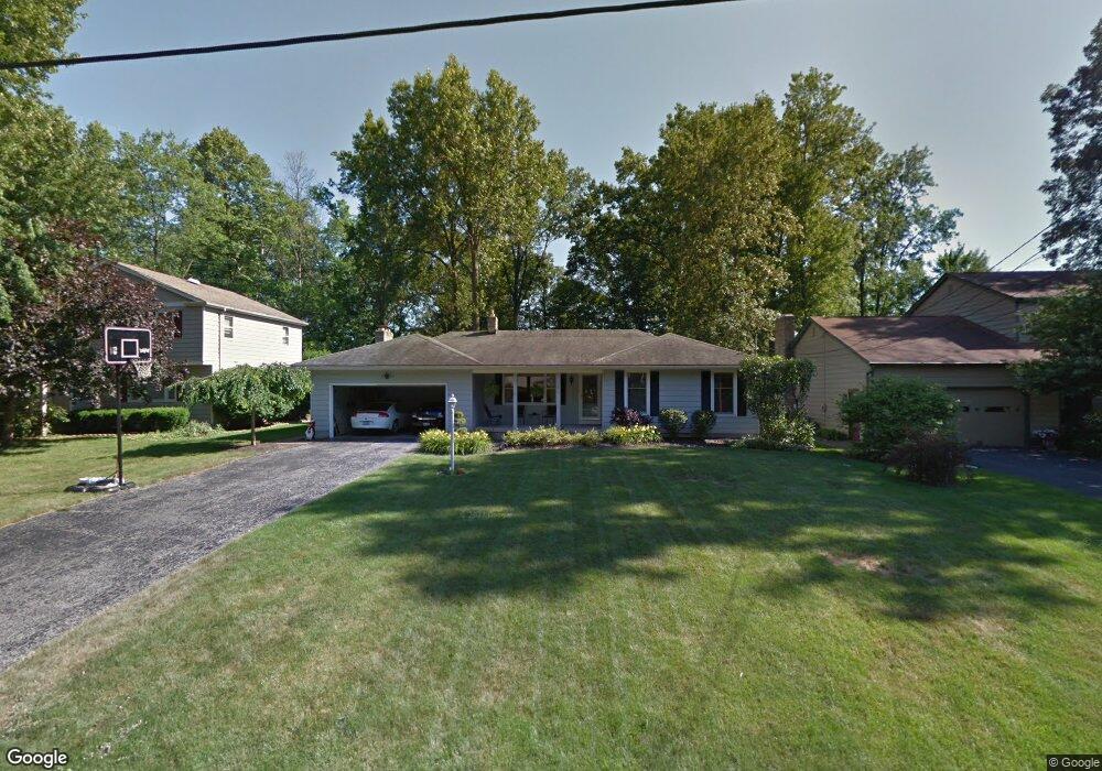
1811 Johnston Place Youngstown, OH 44514
Estimated Value: $223,813 - $248,000
3
Beds
1
Bath
1,518
Sq Ft
$158/Sq Ft
Est. Value
About This Home
This home is located at 1811 Johnston Place, Youngstown, OH 44514 and is currently estimated at $239,203, approximately $157 per square foot. 1811 Johnston Place is a home located in Mahoning County with nearby schools including Poland Union Elementary School, Poland Middle School, and Poland Seminary High School.
Ownership History
Date
Name
Owned For
Owner Type
Purchase Details
Closed on
Nov 20, 1996
Sold by
Paris Joseph A
Bought by
Edward Douglas and Weitzman Sherry L
Current Estimated Value
Home Financials for this Owner
Home Financials are based on the most recent Mortgage that was taken out on this home.
Original Mortgage
$103,700
Outstanding Balance
$10,085
Interest Rate
7.94%
Mortgage Type
New Conventional
Estimated Equity
$229,118
Purchase Details
Closed on
Jun 6, 1985
Bought by
Paris Joseph A
Create a Home Valuation Report for This Property
The Home Valuation Report is an in-depth analysis detailing your home's value as well as a comparison with similar homes in the area
Home Values in the Area
Average Home Value in this Area
Purchase History
| Date | Buyer | Sale Price | Title Company |
|---|---|---|---|
| Edward Douglas | $122,000 | -- | |
| Paris Joseph A | $68,200 | -- |
Source: Public Records
Mortgage History
| Date | Status | Borrower | Loan Amount |
|---|---|---|---|
| Open | Edward Douglas | $103,700 |
Source: Public Records
Tax History Compared to Growth
Tax History
| Year | Tax Paid | Tax Assessment Tax Assessment Total Assessment is a certain percentage of the fair market value that is determined by local assessors to be the total taxable value of land and additions on the property. | Land | Improvement |
|---|---|---|---|---|
| 2024 | $3,271 | $63,190 | $9,520 | $53,670 |
| 2023 | $3,232 | $63,190 | $9,520 | $53,670 |
| 2022 | $2,784 | $45,210 | $9,770 | $35,440 |
| 2021 | $2,789 | $45,210 | $9,770 | $35,440 |
| 2020 | $2,800 | $45,210 | $9,770 | $35,440 |
| 2019 | $2,713 | $39,650 | $8,560 | $31,090 |
| 2018 | $2,551 | $39,650 | $8,560 | $31,090 |
| 2017 | $2,586 | $39,650 | $8,560 | $31,090 |
| 2016 | $2,652 | $40,000 | $10,150 | $29,850 |
| 2015 | $2,602 | $40,000 | $10,150 | $29,850 |
| 2014 | $2,610 | $40,000 | $10,150 | $29,850 |
| 2013 | $2,580 | $40,000 | $10,150 | $29,850 |
Source: Public Records
Map
Nearby Homes
- 1804 Alverne Dr
- 1827 Alverne Dr
- 1738 Island Dr
- 1894 Lealand Ave
- 1859 Mathews Rd
- 1890 Mathews Rd
- 0 Mathews Rd Unit 5149232
- 0 Mathews Rd Unit 5143059
- 2035 Woodward Ave
- 34 Venloe Dr
- 0 Oles Ave
- 43 Venloe Dr
- 0 Woodlawn Ave
- 5710 Youngstown Poland Rd
- 1841 Wingate Rd
- 2128 Lyon Blvd
- 1919 Wingate Rd
- 928 Edenridge Dr
- 2153 Lyon Blvd
- 2295 Bel Aire Ln
- 1807 Johnston Place
- 1815 Johnston Place
- 1819 Johnston Place
- 1764 Alverne Dr
- 1768 Alverne Dr
- 1760 Alverne Dr
- 1823 Johnston Place
- 1800 Alverne Dr
- 1772 Alverne Dr
- 1810 Alverne Dr
- 1794 Alverne Dr
- 1752 Alverne Dr
- 1827 Johnston Place
- 1810 Johnston Place
- 1784 Alverne Dr
- 1814 Johnston Place
- 1806 Johnston Place
- 1818 Johnston Place
- 1820 Alverne Dr
- 1748 Alverne Dr