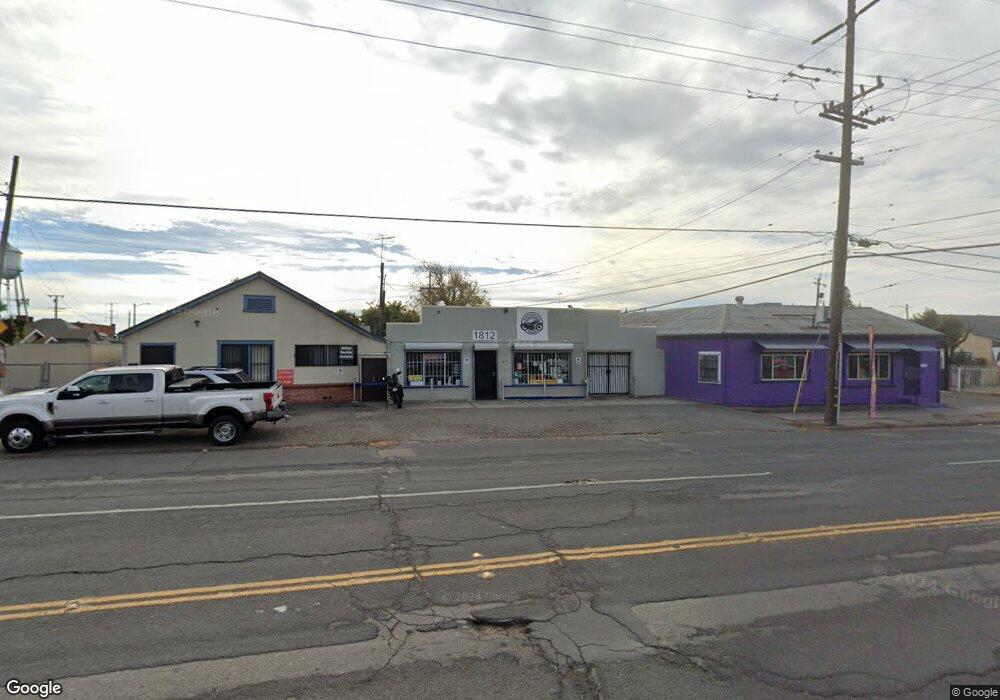
1812 E Harding Way Stockton, CA 95205
Downtown Stockton NeighborhoodEstimated Value: $283,208
1
Bed
1
Bath
802
Sq Ft
$353/Sq Ft
Est. Value
About This Home
This home is located at 1812 E Harding Way, Stockton, CA 95205 and is currently estimated at $283,208, approximately $353 per square foot. 1812 E Harding Way is a home located in San Joaquin County with nearby schools including Grunsky Elementary School, August Elementary School, and Harrison Elementary School.
Ownership History
Date
Name
Owned For
Owner Type
Purchase Details
Closed on
Oct 15, 2018
Sold by
Sage Terry and Sage Shawn
Bought by
American Motorcycle Company Llc
Current Estimated Value
Home Financials for this Owner
Home Financials are based on the most recent Mortgage that was taken out on this home.
Original Mortgage
$190,000
Outstanding Balance
$166,044
Interest Rate
4.6%
Mortgage Type
Purchase Money Mortgage
Estimated Equity
$117,164
Create a Home Valuation Report for This Property
The Home Valuation Report is an in-depth analysis detailing your home's value as well as a comparison with similar homes in the area
Home Values in the Area
Average Home Value in this Area
Purchase History
| Date | Buyer | Sale Price | Title Company |
|---|---|---|---|
| American Motorcycle Company Llc | $190,000 | Old Republic Title Company |
Source: Public Records
Mortgage History
| Date | Status | Borrower | Loan Amount |
|---|---|---|---|
| Open | American Motorcycle Company Llc | $190,000 |
Source: Public Records
Tax History
| Year | Tax Paid | Tax Assessment Tax Assessment Total Assessment is a certain percentage of the fair market value that is determined by local assessors to be the total taxable value of land and additions on the property. | Land | Improvement |
|---|---|---|---|---|
| 2025 | $3,124 | $253,162 | $79,199 | $173,963 |
| 2024 | $3,252 | $262,698 | $77,647 | $185,051 |
| 2023 | $3,010 | $243,605 | $76,125 | $130,500 |
| 2022 | $2,921 | $234,102 | $74,633 | $159,469 |
| 2021 | $2,770 | $226,467 | $73,170 | $153,297 |
| 2020 | $2,698 | $214,050 | $72,420 | $141,630 |
| 2019 | $2,436 | $190,000 | $71,000 | $119,000 |
| 2018 | $1,599 | $124,231 | $34,995 | $89,236 |
| 2017 | $1,515 | $121,796 | $34,309 | $87,487 |
| 2016 | $1,543 | $119,408 | $33,636 | $85,772 |
| 2014 | $802 | $62,000 | $19,000 | $43,000 |
Source: Public Records
Map
Nearby Homes
- 1902 E Harding Way
- 1600 Sunnyside Ave
- 1702 Sunnyside Ave
- 1926 E Roosevelt St
- 1816 N Sierra Nevada St
- 1141 N E St
- 1205 N Airport Way
- 1217 E Harding Way
- 1450 Belvedere Ave
- 2379 E Willow St
- 1262 N Union St
- 1111 Pinchot St
- 2421 Hackberry St
- 1404 E Park St
- 1825 N Filbert St
- 644 N Airport Way
- 1322 N Filbert St
- 1306 N Filbert St
- 1143 E Park St
- 2340 Sanguinetti Ln Unit 54
- 1267 Sunnyside Ave
- 1802 E Harding Way
- 1902 E Harding Way Unit 1
- 1268 Sunnyside Ave
- 1255 Sunnyside Ave
- 1800 E Harding Way
- 1258 Sunnyside Ave
- 1266 Sycamore Ave
- 1505 Sunnyside Ave
- 1243 Sunnyside Ave
- 1506 Sunnyside Ave
- 1254 Sunnyside Ave
- 1809 E Harding Way
- 1801 E Willow St
- 1504 Sycamore Ave
- 1510 Sunnyside Ave
- 1241 Sunnyside Ave
- 1242 Sunnyside Ave
- 1521 Sunnyside Ave
- 1512 Sycamore Ave
Your Personal Tour Guide
Ask me questions while you tour the home.