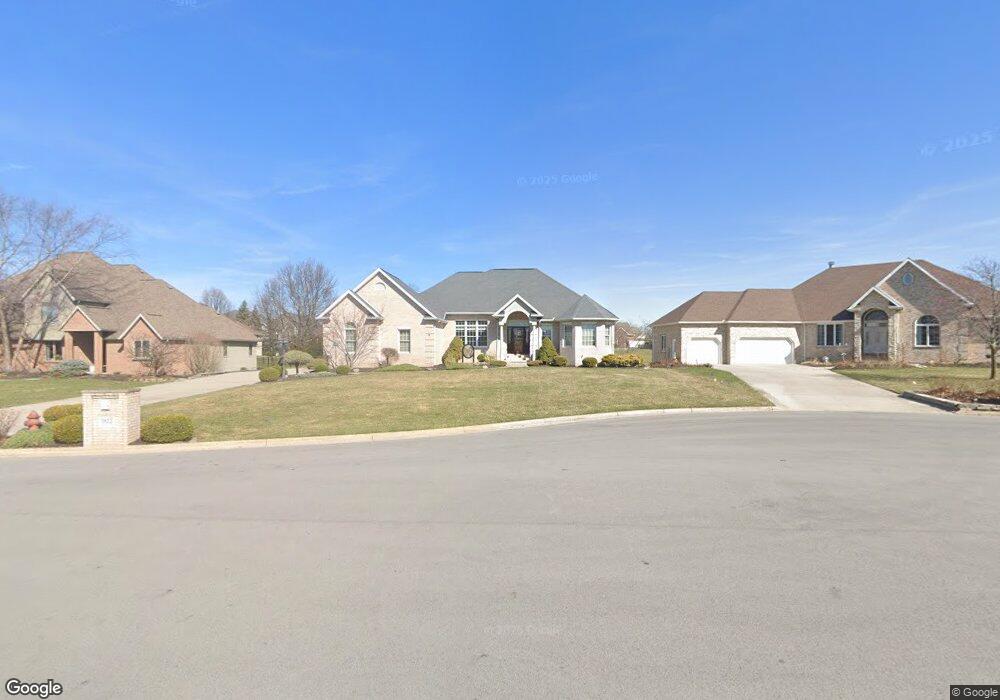
1812 Lakeland Dr Findlay, OH 45840
Estimated Value: $481,000 - $637,000
4
Beds
4
Baths
2,166
Sq Ft
$254/Sq Ft
Est. Value
About This Home
This home is located at 1812 Lakeland Dr, Findlay, OH 45840 and is currently estimated at $549,571, approximately $253 per square foot. 1812 Lakeland Dr is a home located in Hancock County with nearby schools including Liberty-Benton Elementary School, Liberty-Benton Middle School, and Liberty-Benton High School.
Ownership History
Date
Name
Owned For
Owner Type
Purchase Details
Closed on
Jul 29, 2006
Sold by
Sharrett James R and Sharrett Jolynn
Bought by
Wilson Charles D and Wilson Karen S
Current Estimated Value
Home Financials for this Owner
Home Financials are based on the most recent Mortgage that was taken out on this home.
Original Mortgage
$62,900
Interest Rate
6.85%
Mortgage Type
Unknown
Create a Home Valuation Report for This Property
The Home Valuation Report is an in-depth analysis detailing your home's value as well as a comparison with similar homes in the area
Home Values in the Area
Average Home Value in this Area
Purchase History
| Date | Buyer | Sale Price | Title Company |
|---|---|---|---|
| Wilson Charles D | $74,000 | None Available |
Source: Public Records
Mortgage History
| Date | Status | Borrower | Loan Amount |
|---|---|---|---|
| Closed | Wilson Charles D | $62,900 |
Source: Public Records
Tax History Compared to Growth
Tax History
| Year | Tax Paid | Tax Assessment Tax Assessment Total Assessment is a certain percentage of the fair market value that is determined by local assessors to be the total taxable value of land and additions on the property. | Land | Improvement |
|---|---|---|---|---|
| 2024 | $5,128 | $147,750 | $23,080 | $124,670 |
| 2023 | $5,030 | $147,750 | $23,080 | $124,670 |
| 2022 | $4,996 | $147,750 | $23,080 | $124,670 |
| 2021 | $4,754 | $125,510 | $23,100 | $102,410 |
| 2020 | $4,794 | $125,510 | $23,100 | $102,410 |
| 2019 | $4,600 | $125,510 | $23,100 | $102,410 |
| 2018 | $3,892 | $117,810 | $15,400 | $102,410 |
| 2017 | $2,008 | $117,810 | $15,400 | $102,410 |
| 2016 | $3,889 | $117,810 | $15,400 | $102,410 |
| 2015 | $4,227 | $124,190 | $13,310 | $110,880 |
| 2014 | $4,266 | $124,190 | $13,310 | $110,880 |
| 2012 | $4,454 | $124,190 | $13,310 | $110,880 |
Source: Public Records
Map
Nearby Homes
- 1405 Cypress Lake
- 0 County Road 95 Unit 6097574
- 3106 Saddlebrook
- 6535 Silver Lake Dr
- 3018 Gleneagle Dr
- 0 Rock Candy Rd Or Bushwillow Dr Unit Lot 173
- 0 Rock Candy Rd Unit Lot 159
- 0 Rock Candy Rd Unit Lot 170
- 0 Rock Candy Rd Unit Lot 172 206819
- 0 Rock Candy Rd Unit Lot 162
- 0 Rock Candy Rd Unit Lot 171
- 0 Rock Candy Rd Unit Lot 168
- 0 Bushwillow Dr Or Rock Candy Rd Unit Lot 157
- 0 Bearcat Way Or Rock Candy Rd Unit Lot 167
- 1310 Muirfield Dr
- 0 County Road 140
- 933 Laurel Ln
- 0 Allen Township 142
- 925 W Melrose Ave
- 905 W Melrose Ave
- 1818 Lakeland Dr
- 1806 Lakeland Dr
- 1802 Lakeland Dr
- 3101 Bay Tree Dr
- 3107 Bay Tree Dr
- 1813 Lakeland Dr
- 1819 Lakeland Dr
- 1817 Forest Park
- 1807 Lakeland Dr
- 1809 Forest Park
- 3113 Bay Tree Dr
- 1825 Lakeland Dr
- 1831 Lakeland Dr
- 1801 Forest Park
- 2910 Pebble Beach Ct
- 3119 Bay Tree Dr
- 1726 Pinehurst Dr
- 3100 Bay Tree Dr
- 1720 Pinehurst Dr
- 1714 Pinehurst Dr