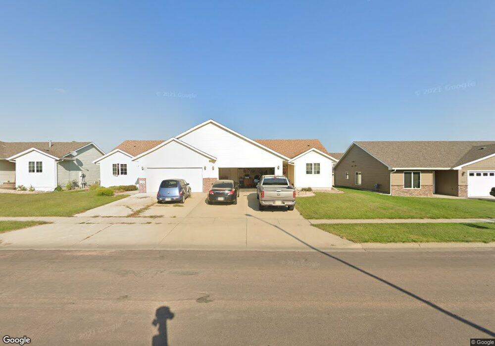
1812 Mulberry Ave Unit H Brandon, SD 57005
Estimated Value: $232,929 - $241,000
3
Beds
2
Baths
1,180
Sq Ft
$200/Sq Ft
Est. Value
About This Home
This home is located at 1812 Mulberry Ave Unit H, Brandon, SD 57005 and is currently estimated at $235,732, approximately $199 per square foot. 1812 Mulberry Ave Unit H is a home located in Minnehaha County with nearby schools including Robert Bennis Elementary School, Brandon Valley Intermediate School, and Brandon Valley Middle School.
Ownership History
Date
Name
Owned For
Owner Type
Purchase Details
Closed on
Jul 28, 2023
Sold by
Hokenstad Michael L and Hokenstad Anne M
Bought by
Bowar Jenna Lynn
Current Estimated Value
Home Financials for this Owner
Home Financials are based on the most recent Mortgage that was taken out on this home.
Original Mortgage
$117,000
Outstanding Balance
$114,284
Interest Rate
6.71%
Mortgage Type
Purchase Money Mortgage
Estimated Equity
$121,448
Create a Home Valuation Report for This Property
The Home Valuation Report is an in-depth analysis detailing your home's value as well as a comparison with similar homes in the area
Home Values in the Area
Average Home Value in this Area
Purchase History
| Date | Buyer | Sale Price | Title Company |
|---|---|---|---|
| Bowar Jenna Lynn | $172,000 | -- | |
| Bowar Jenna Lynn | $172,000 | -- |
Source: Public Records
Mortgage History
| Date | Status | Borrower | Loan Amount |
|---|---|---|---|
| Open | Bowar Jenna Lynn | $117,000 | |
| Closed | Bowar Jenna Lynn | $117,000 |
Source: Public Records
Tax History Compared to Growth
Tax History
| Year | Tax Paid | Tax Assessment Tax Assessment Total Assessment is a certain percentage of the fair market value that is determined by local assessors to be the total taxable value of land and additions on the property. | Land | Improvement |
|---|---|---|---|---|
| 2024 | $2,222 | $168,300 | $5,400 | $162,900 |
| 2023 | $2,417 | $174,200 | $5,400 | $168,800 |
| 2022 | $2,252 | $153,600 | $5,400 | $148,200 |
| 2021 | $1,947 | $131,300 | $0 | $0 |
| 2020 | $1,947 | $123,500 | $0 | $0 |
| 2019 | $2,065 | $128,564 | $0 | $0 |
| 2018 | $1,764 | $113,738 | $0 | $0 |
| 2017 | $1,782 | $108,511 | $2,585 | $105,926 |
| 2016 | $1,782 | $107,760 | $2,585 | $105,175 |
| 2015 | $1,850 | $107,070 | $1,895 | $105,175 |
| 2014 | $1,840 | $106,320 | $1,895 | $104,425 |
Source: Public Records
Map
Nearby Homes
- 201 W Greenwood St
- 1205 S Moonlight Dr Dr
- 1208 S Moonlight Dr Dr
- 1204 S Moonlight Dr Dr
- 1200 S Moonlight Dr Dr
- 1116 S Moonlight Dr Dr
- 1113 S Moonlight Dr Dr
- 1121 S Oakland Cir
- 1101 S Oakland Cir
- 1113 S Oakland Cir
- 1125 S Oakland Cir
- 1204 S Oakland Cir
- 1208 S Oakland Cir
- 1200 S Oakland Cir
- 1201 S Oakland Cir
- 1205 S Oakland Cir
- 1209 S Oakland Cir
- 1117 S Oakland Cir
- 1112 S Moonlight Dr Dr
- 1109 S Moonlight Dr Dr
- 1812 Mulberry Ave Unit K
- 1812 Mulberry Ave Unit J
- 1812 Mulberry Ave Unit G
- 1812 Mulberry Ave Unit F
- 1812 Mulberry Ave Unit E
- 1812 Mulberry Ave Unit D
- 1812 Mulberry Ave Unit C
- 1812 Mulberry Ave Unit B
- 1812 Mulberry Ave Unit A
- 1812 Mulberry Ave
- 1812 S Mulberry Ave Unit H
- 1812 S Mulberry Ave Unit E
- 1812 S Mulberry Ave Unit F
- 1812 S Mulberry Ave Unit C
- 1808 Locust Ave
- 1806 Locust Ave
- 1812 S Locust Ave
- 1808 S Mulberry Ave Unit A
- 1808 S Mulberry Ave
- 1808 S Mulberry Ave Unit F