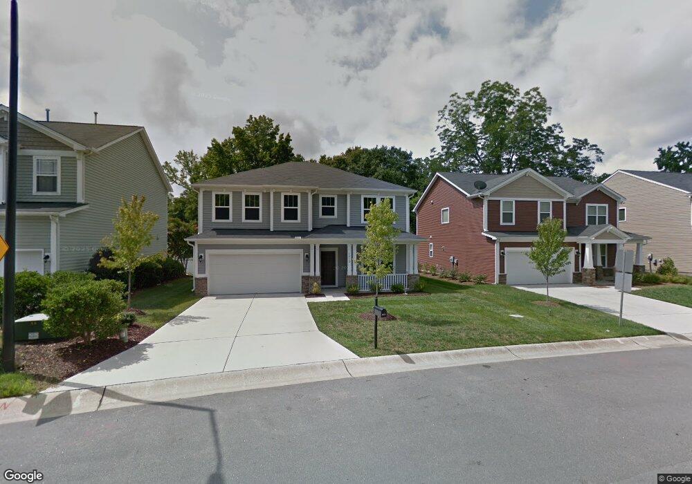
1812 Pear Tree Ln Durham, NC 27703
Estimated Value: $448,458 - $480,000
3
Beds
3
Baths
2,454
Sq Ft
$190/Sq Ft
Est. Value
About This Home
This home is located at 1812 Pear Tree Ln, Durham, NC 27703 and is currently estimated at $466,615, approximately $190 per square foot. 1812 Pear Tree Ln is a home with nearby schools including R.N. Harris Elementary School, James E. Shepard Middle School, and Hillside High School.
Ownership History
Date
Name
Owned For
Owner Type
Purchase Details
Closed on
Sep 12, 2013
Sold by
Beazer Homes Corp
Bought by
Crocco Anne
Current Estimated Value
Create a Home Valuation Report for This Property
The Home Valuation Report is an in-depth analysis detailing your home's value as well as a comparison with similar homes in the area
Home Values in the Area
Average Home Value in this Area
Purchase History
| Date | Buyer | Sale Price | Title Company |
|---|---|---|---|
| Crocco Anne | $206,500 | None Available |
Source: Public Records
Tax History Compared to Growth
Tax History
| Year | Tax Paid | Tax Assessment Tax Assessment Total Assessment is a certain percentage of the fair market value that is determined by local assessors to be the total taxable value of land and additions on the property. | Land | Improvement |
|---|---|---|---|---|
| 2025 | $4,725 | $476,617 | $84,750 | $391,867 |
| 2024 | $3,547 | $254,312 | $47,812 | $206,500 |
| 2023 | $3,331 | $254,312 | $47,812 | $206,500 |
| 2022 | $3,255 | $254,312 | $47,812 | $206,500 |
| 2021 | $3,240 | $254,312 | $47,812 | $206,500 |
| 2020 | $3,163 | $254,312 | $47,812 | $206,500 |
| 2019 | $3,163 | $254,312 | $47,812 | $206,500 |
| 2018 | $2,973 | $219,186 | $39,375 | $179,811 |
| 2017 | $2,951 | $219,186 | $39,375 | $179,811 |
| 2016 | $2,852 | $234,822 | $39,375 | $195,447 |
| 2015 | $2,553 | $184,398 | $41,399 | $142,999 |
| 2014 | $2,553 | $184,398 | $41,399 | $142,999 |
Source: Public Records
Map
Nearby Homes
- 2638 S Alston Ave
- 130 Holly Berry Ln
- 2605 Magnolia Tree Ln
- 108 Lowe Wood Ct
- 2513 Magnolia Tree Ln
- 13 Flowering Apricot Dr
- 3027 Courtney Creek Blvd
- 104 Brennan Ct
- 3005 Courtney Creek Blvd
- 1633 Snow Mass Way
- 703 Tambor Rd
- 700 Tambor Rd
- 2458 S Alston Ave
- 1218 Helms St
- 1222 Helms St
- Cadence Plan at Courtney Creek
- Ballad Plan at Courtney Creek
- Aria Plan at Courtney Creek
- 1226 Helms St
- 2713 Wyntercrest Ln
- 1808 Pear Tree Ln
- 1816 Pear Tree Ln
- 1804 Pear Tree Ln
- 1820 Pear Tree Ln
- 2633 S Alston Ave
- 1824 Pear Tree Ln
- 1001 Oak Park Dr
- 1902 Pear Tree Ln
- 2619 S Alston Ave
- 1003 Oak Park Dr
- 2624 S Alston Ave
- 24 White Spruce Ct
- 2628 S Alston Ave
- 1906 Pear Tree Ln
- 26 White Spruce Ct
- 1005 Oak Park Dr
- 1903 Pear Tree Ln
- 2641 S Alston Ave
- 2634 S Alston Ave
- 1910 Pear Tree Ln