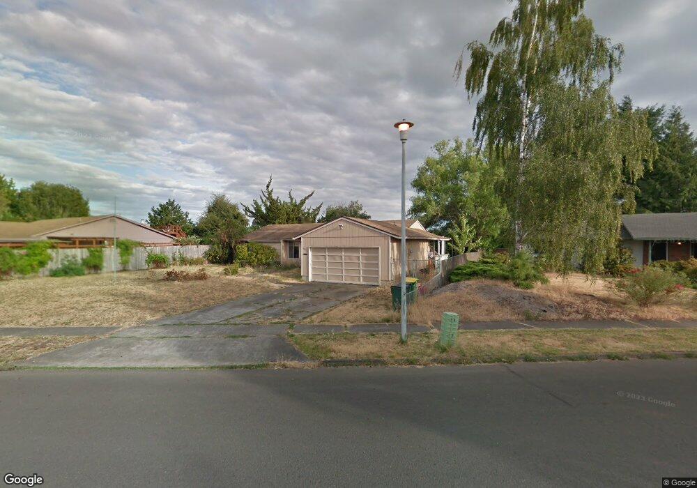
1812 Tamarack Way Forest Grove, OR 97116
Estimated Value: $434,000 - $462,000
3
Beds
2
Baths
1,348
Sq Ft
$335/Sq Ft
Est. Value
About This Home
This home is located at 1812 Tamarack Way, Forest Grove, OR 97116 and is currently estimated at $451,923, approximately $335 per square foot. 1812 Tamarack Way is a home located in Washington County with nearby schools including Fern Hill Elementary School, Neil Armstrong Middle School, and Tom McCall Upper Elementary School.
Ownership History
Date
Name
Owned For
Owner Type
Purchase Details
Closed on
Sep 30, 1999
Sold by
Pettijohn Leroy H and Pettijohn Marsha E
Bought by
Murphy Phillip A and Murphy Maureen V
Current Estimated Value
Home Financials for this Owner
Home Financials are based on the most recent Mortgage that was taken out on this home.
Original Mortgage
$132,050
Outstanding Balance
$38,896
Interest Rate
7.97%
Estimated Equity
$413,027
Purchase Details
Closed on
Apr 4, 1996
Sold by
Walker Michael L and Walker Amy E
Bought by
Pettijohn Leroy H and Pettijohn Marsha E
Home Financials for this Owner
Home Financials are based on the most recent Mortgage that was taken out on this home.
Original Mortgage
$99,200
Interest Rate
7.34%
Create a Home Valuation Report for This Property
The Home Valuation Report is an in-depth analysis detailing your home's value as well as a comparison with similar homes in the area
Home Values in the Area
Average Home Value in this Area
Purchase History
| Date | Buyer | Sale Price | Title Company |
|---|---|---|---|
| Murphy Phillip A | $139,000 | Ticor Title Insurance | |
| Pettijohn Leroy H | $124,900 | Stewart Title Company |
Source: Public Records
Mortgage History
| Date | Status | Borrower | Loan Amount |
|---|---|---|---|
| Open | Murphy Phillip A | $132,050 | |
| Previous Owner | Pettijohn Leroy H | $99,200 |
Source: Public Records
Tax History Compared to Growth
Tax History
| Year | Tax Paid | Tax Assessment Tax Assessment Total Assessment is a certain percentage of the fair market value that is determined by local assessors to be the total taxable value of land and additions on the property. | Land | Improvement |
|---|---|---|---|---|
| 2026 | $3,650 | $204,990 | -- | -- |
| 2025 | $3,650 | $199,020 | -- | -- |
| 2024 | $3,522 | $193,230 | -- | -- |
| 2023 | $3,522 | $187,610 | $0 | $0 |
| 2022 | $3,079 | $187,610 | $0 | $0 |
| 2021 | $3,040 | $176,850 | $0 | $0 |
| 2020 | $3,023 | $171,700 | $0 | $0 |
| 2019 | $2,956 | $166,700 | $0 | $0 |
| 2018 | $2,865 | $161,850 | $0 | $0 |
| 2017 | $2,777 | $157,140 | $0 | $0 |
| 2016 | $2,699 | $152,570 | $0 | $0 |
| 2015 | $2,595 | $148,130 | $0 | $0 |
| 2014 | $2,582 | $143,820 | $0 | $0 |
Source: Public Records
Map
Nearby Homes
- 1835 Tamarack Ct
- 1832 Vine Ct
- 3831 Pacific Ave Unit D5
- 3831 Pacific Ave Unit D2
- 3404 19th Ave Unit 103
- 3404 19th Ave Unit 215
- 1506 Pioneer Cir
- 3839 Pacific Ave Unit 102
- 1504 Frontier Cir
- 0 22nd Ave Unit 11
- 1402 Pioneer Way
- 1509 Centennial Cir
- 4303 Settlers Loop
- 4403 Wagon Wheel Cir
- 3213 Maple Place
- 332 S Tarrybrook Dr
- 3128 Brittany Dr
- 2369 NW Martin Rd
- 2303 NW Martin Rd
- 2341 NW Martin Rd
- 1816 Tamarack Way
- 1810 Tamarack Way
- 1820 Tamarack Way
- 1830 Tamarack Ct
- 1806 Tamarack Way
- 1823 Tamarack Way
- 1809 Tamarack Way
- 1824 Tamarack Way
- 1802 Tamarack Way
- 1833 Tamarack Way
- 1832 Tamarack Ct
- 1831 Tamarack Ct
- 1828 Tamarack Way
- 1801 Tamarack Way
- 1800 Tamarack Way
- 1835 Tamarack Way
- 1834 Tamarack Ct
- 1803 Sequoia Ct
- 1721 Sequoia Ct
- 1835 Tamarack Ct