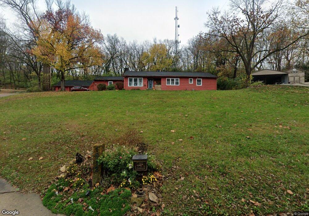
1812 Westwood Dr Leavenworth, KS 66048
Estimated Value: $293,000 - $320,000
3
Beds
2
Baths
2,174
Sq Ft
$142/Sq Ft
Est. Value
About This Home
This home is located at 1812 Westwood Dr, Leavenworth, KS 66048 and is currently estimated at $309,167, approximately $142 per square foot. 1812 Westwood Dr is a home located in Leavenworth County with nearby schools including Henry Leavenworth, Richard Warren Middle School, and Leavenworth Senior High School.
Ownership History
Date
Name
Owned For
Owner Type
Purchase Details
Closed on
Feb 27, 2004
Sold by
Thomas Donald L and Thomas Lynn M
Bought by
Sheridan Anne Marie
Current Estimated Value
Create a Home Valuation Report for This Property
The Home Valuation Report is an in-depth analysis detailing your home's value as well as a comparison with similar homes in the area
Home Values in the Area
Average Home Value in this Area
Purchase History
| Date | Buyer | Sale Price | Title Company |
|---|---|---|---|
| Sheridan Anne Marie | $162,260 | -- |
Source: Public Records
Mortgage History
| Date | Status | Borrower | Loan Amount |
|---|---|---|---|
| Closed | Sheridan Anne Marie | $122,000 |
Source: Public Records
Tax History Compared to Growth
Tax History
| Year | Tax Paid | Tax Assessment Tax Assessment Total Assessment is a certain percentage of the fair market value that is determined by local assessors to be the total taxable value of land and additions on the property. | Land | Improvement |
|---|---|---|---|---|
| 2025 | $3,236 | $28,437 | $7,029 | $21,408 |
| 2024 | $3,217 | $27,610 | $6,560 | $21,050 |
| 2023 | $3,217 | $26,806 | $6,560 | $20,246 |
| 2022 | $2,815 | $23,309 | $5,619 | $17,690 |
| 2021 | $2,698 | $20,999 | $3,993 | $17,006 |
| 2020 | $2,488 | $19,205 | $3,993 | $15,212 |
| 2019 | $2,461 | $18,826 | $3,993 | $14,833 |
| 2018 | $2,386 | $18,101 | $3,993 | $14,108 |
| 2017 | $2,316 | $17,685 | $3,993 | $13,692 |
| 2016 | $2,251 | $17,170 | $3,993 | $13,177 |
| 2015 | $2,237 | $17,170 | $3,993 | $13,177 |
| 2014 | $2,142 | $16,521 | $3,993 | $12,528 |
Source: Public Records
Map
Nearby Homes
- 1929 Westwood Dr
- 1715 Klemp St
- 1605 Ridge Rd
- 1316 Vilas St
- 1700 Lawrence Ave
- 1509 10th Ave
- 1917 Canterbury Ct
- 1305 Klemp St
- 1208 Quincy St
- 1106 S 14th St
- 1036 Vilas St
- 1601 Holman St
- 1621 Vilas St
- 1116 Quincy St
- 2021 Vilas St
- 2017 Vilas St
- 938 S 17th St
- 1912 Montezuma St
- 914 Madison St
- 1158 Randolph St
- 1808 Westwood Dr
- 1816 Westwood Dr
- 1804 Westwood Dr
- 1908 Westwood Dr
- 1800 Westwood Dr
- 1914 Westwood Dr
- 1801 Forest Ln
- Lots 3-7 Forest Ln
- 1704 Westwood Dr
- 1918 Westwood Dr
- 1311 Pilot Knob St
- 1702 Forest Ln
- 1310 Pilot Knob St
- 1700 Westwood Dr
- 1605 Westwood Dr
- 1917 Westwood Dr
- Lots 11-14 Westwood Dr
- 1605 Forest Ln
- 1921 Westwood Dr
- 1606 Westwood Dr