Estimated Value: $200,852 - $269,000
--
Bed
1
Bath
970
Sq Ft
$236/Sq Ft
Est. Value
About This Home
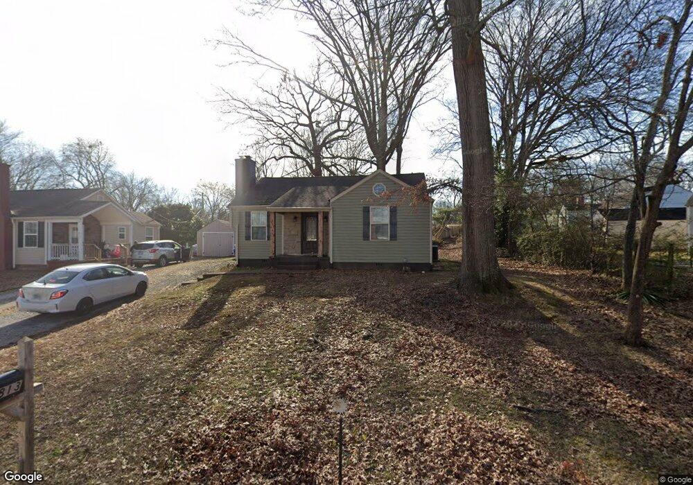
This home is located at 1813 Dalton St, Alcoa, TN 37701 and is currently estimated at $228,713, approximately $235 per square foot. 1813 Dalton St is a home located in Blount County with nearby schools including Alcoa Elementary School, Alcoa Middle School, and Alcoa High School.
Ownership History
Date
Name
Owned For
Owner Type
Purchase Details
Closed on
Jun 16, 2011
Sold by
Johnson Timmy
Bought by
Johnson Darrell G
Current Estimated Value
Home Financials for this Owner
Home Financials are based on the most recent Mortgage that was taken out on this home.
Original Mortgage
$93,750
Outstanding Balance
$64,629
Interest Rate
4.63%
Mortgage Type
Commercial
Estimated Equity
$164,084
Purchase Details
Closed on
Dec 11, 2001
Sold by
Lane Kim
Bought by
Johnson Timmy
Home Financials for this Owner
Home Financials are based on the most recent Mortgage that was taken out on this home.
Original Mortgage
$40,000
Interest Rate
6.42%
Purchase Details
Closed on
Jun 6, 1980
Bought by
Stinnett Marshall A
Create a Home Valuation Report for This Property
The Home Valuation Report is an in-depth analysis detailing your home's value as well as a comparison with similar homes in the area
Home Values in the Area
Average Home Value in this Area
Purchase History
| Date | Buyer | Sale Price | Title Company |
|---|---|---|---|
| Johnson Darrell G | $30,582 | -- | |
| Johnson Timmy | $46,000 | -- | |
| Stinnett Marshall A | -- | -- |
Source: Public Records
Mortgage History
| Date | Status | Borrower | Loan Amount |
|---|---|---|---|
| Open | Johnson Darrell G | $93,750 | |
| Previous Owner | Stinnett Marshall A | $40,000 |
Source: Public Records
Tax History Compared to Growth
Tax History
| Year | Tax Paid | Tax Assessment Tax Assessment Total Assessment is a certain percentage of the fair market value that is determined by local assessors to be the total taxable value of land and additions on the property. | Land | Improvement |
|---|---|---|---|---|
| 2024 | $1,353 | $41,250 | $10,125 | $31,125 |
| 2023 | $1,353 | $41,250 | $10,125 | $31,125 |
| 2022 | $1,197 | $25,250 | $5,625 | $19,625 |
| 2021 | $1,197 | $25,250 | $5,625 | $19,625 |
| 2020 | $1,197 | $25,250 | $5,625 | $19,625 |
| 2019 | $1,197 | $25,250 | $5,625 | $19,625 |
| 2018 | $999 | $22,550 | $5,625 | $16,925 |
| 2017 | $999 | $22,550 | $5,625 | $16,925 |
| 2016 | $999 | $22,550 | $5,625 | $16,925 |
| 2015 | $927 | $22,550 | $5,625 | $16,925 |
| 2014 | $1,103 | $22,550 | $5,625 | $16,925 |
| 2013 | $1,103 | $26,850 | $0 | $0 |
Source: Public Records
Map
Nearby Homes
- 1761 Dalton St
- 1852 Kettering Rd
- 1765 N Wright Rd
- 1791 Ramsay St
- 1533 Springbrook Rd
- 1321 Nobel St Unit E
- 1340 Dalton St
- 0 N Wright Rd
- 947 Poplar St
- 946 Poplar St
- 960 Poplar St
- 966 Poplar St
- 1574 Tsuga Dr
- 1439 St Thomas Way
- 1420 St Thomas Way
- 1569 Ashwood Place
- 1536 Tsuga Dr
- 1534 Tsuga Dr
- 1439 Edenbridge Dr
- 2620 Marshall St