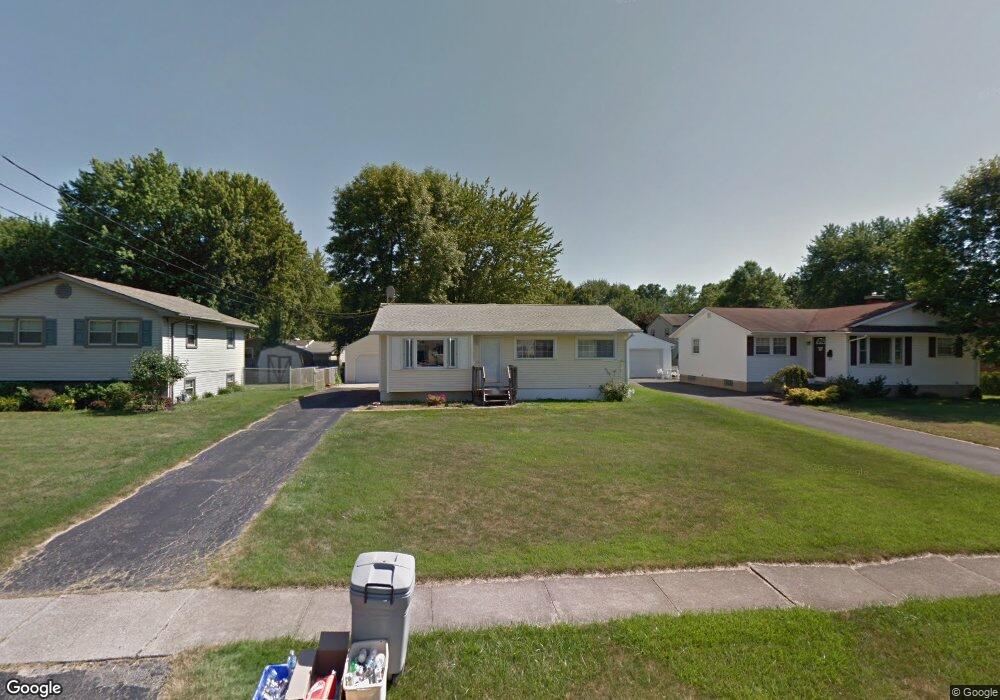
1813 Lealand Ave Youngstown, OH 44514
Estimated Value: $153,863 - $168,000
3
Beds
1
Bath
1,039
Sq Ft
$155/Sq Ft
Est. Value
About This Home
This home is located at 1813 Lealand Ave, Youngstown, OH 44514 and is currently estimated at $161,216, approximately $155 per square foot. 1813 Lealand Ave is a home located in Mahoning County with nearby schools including Poland Union Elementary School, Poland Middle School, and Poland Seminary High School.
Ownership History
Date
Name
Owned For
Owner Type
Purchase Details
Closed on
Oct 7, 2000
Sold by
Ford Michael L and Lynn Ford Karen
Bought by
Yuhas Jennifer J
Current Estimated Value
Home Financials for this Owner
Home Financials are based on the most recent Mortgage that was taken out on this home.
Original Mortgage
$67,450
Outstanding Balance
$24,792
Interest Rate
8.03%
Estimated Equity
$136,424
Purchase Details
Closed on
Feb 27, 1973
Bought by
Guzaski Guzaski J and Guzaski Snyder S
Create a Home Valuation Report for This Property
The Home Valuation Report is an in-depth analysis detailing your home's value as well as a comparison with similar homes in the area
Home Values in the Area
Average Home Value in this Area
Purchase History
| Date | Buyer | Sale Price | Title Company |
|---|---|---|---|
| Yuhas Jennifer J | $71,000 | Midland Title | |
| Guzaski Guzaski J | -- | -- |
Source: Public Records
Mortgage History
| Date | Status | Borrower | Loan Amount |
|---|---|---|---|
| Open | Yuhas Jennifer J | $67,450 |
Source: Public Records
Tax History Compared to Growth
Tax History
| Year | Tax Paid | Tax Assessment Tax Assessment Total Assessment is a certain percentage of the fair market value that is determined by local assessors to be the total taxable value of land and additions on the property. | Land | Improvement |
|---|---|---|---|---|
| 2024 | $2,145 | $41,150 | $5,410 | $35,740 |
| 2023 | $2,119 | $41,150 | $5,410 | $35,740 |
| 2022 | $1,717 | $27,600 | $5,220 | $22,380 |
| 2021 | $1,720 | $27,600 | $5,220 | $22,380 |
| 2020 | $1,727 | $27,600 | $5,220 | $22,380 |
| 2019 | $1,531 | $21,730 | $4,110 | $17,620 |
| 2018 | $1,408 | $21,730 | $4,110 | $17,620 |
| 2017 | $1,566 | $21,730 | $4,110 | $17,620 |
| 2016 | $1,746 | $26,310 | $6,060 | $20,250 |
| 2015 | $1,713 | $26,310 | $6,060 | $20,250 |
| 2014 | $1,718 | $26,310 | $6,060 | $20,250 |
| 2013 | $1,698 | $26,310 | $6,060 | $20,250 |
Source: Public Records
Map
Nearby Homes
- 1859 Mathews Rd
- 0 Mathews Rd Unit 5149232
- 0 Mathews Rd Unit 5143059
- 1894 Lealand Ave
- 1890 Mathews Rd
- 0 Oles Ave
- 1804 Alverne Dr
- 0 Woodlawn Ave
- 1827 Alverne Dr
- 1841 Wingate Rd
- 1738 Island Dr
- 2035 Woodward Ave
- 1919 Wingate Rd
- 5710 Youngstown Poland Rd
- 1828 Basil Ave
- 34 Venloe Dr
- 928 Edenridge Dr
- 43 Venloe Dr
- 2128 Lyon Blvd
- 2035 Holbrook Rd
- 1809 Lealand Ave
- 1817 Lealand Ave
- 1800 Lemont Dr
- 1796 Lemont Dr
- 1804 Lemont Dr
- 1821 Lealand Ave
- 1792 Lemont Dr
- 1814 Lealand Ave
- 1801 Lealand Ave
- 1810 Lealand Ave
- 1818 Lealand Ave
- 1808 Lemont Dr
- 1806 Lealand Ave
- 1822 Lealand Ave
- 1788 Lemont Dr
- 1833 Lealand Ave
- 1812 Lemont Dr
- 1802 Lealand Ave
- 1828 Lealand Ave
- 1841 Lealand Ave