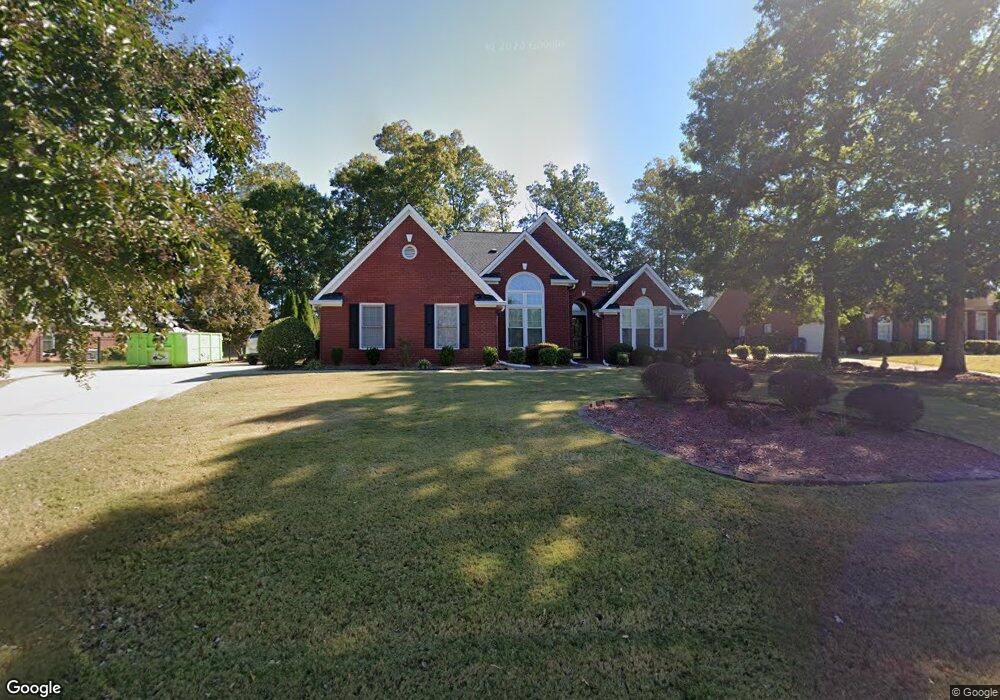
1813 Phillips Ct Unit 6 Conyers, GA 30094
Estimated Value: $380,142 - $450,000
3
Beds
4
Baths
2,931
Sq Ft
$144/Sq Ft
Est. Value
About This Home
This home is located at 1813 Phillips Ct Unit 6, Conyers, GA 30094 and is currently estimated at $421,036, approximately $143 per square foot. 1813 Phillips Ct Unit 6 is a home located in Rockdale County with nearby schools including Flat Shoals Elementary School, Edwards Middle School, and Rockdale County High School.
Ownership History
Date
Name
Owned For
Owner Type
Purchase Details
Closed on
Jun 2, 2004
Sold by
Scornik Hugo and Scornik Staci L
Bought by
Bradham Barbara J
Current Estimated Value
Home Financials for this Owner
Home Financials are based on the most recent Mortgage that was taken out on this home.
Original Mortgage
$177,500
Outstanding Balance
$86,128
Interest Rate
5.89%
Mortgage Type
New Conventional
Estimated Equity
$334,908
Purchase Details
Closed on
May 26, 1998
Sold by
D R Horton Custom Homes Inc
Bought by
Scornik Hugo
Home Financials for this Owner
Home Financials are based on the most recent Mortgage that was taken out on this home.
Original Mortgage
$174,550
Interest Rate
7.02%
Mortgage Type
New Conventional
Create a Home Valuation Report for This Property
The Home Valuation Report is an in-depth analysis detailing your home's value as well as a comparison with similar homes in the area
Home Values in the Area
Average Home Value in this Area
Purchase History
| Date | Buyer | Sale Price | Title Company |
|---|---|---|---|
| Bradham Barbara J | $221,900 | -- | |
| Scornik Hugo | $183,800 | -- |
Source: Public Records
Mortgage History
| Date | Status | Borrower | Loan Amount |
|---|---|---|---|
| Open | Bradham Barbara J | $177,500 | |
| Previous Owner | Scornik Hugo | $174,550 |
Source: Public Records
Tax History Compared to Growth
Tax History
| Year | Tax Paid | Tax Assessment Tax Assessment Total Assessment is a certain percentage of the fair market value that is determined by local assessors to be the total taxable value of land and additions on the property. | Land | Improvement |
|---|---|---|---|---|
| 2024 | $3,748 | $176,840 | $30,920 | $145,920 |
| 2023 | $2,976 | $153,880 | $30,800 | $123,080 |
| 2022 | $2,567 | $125,680 | $24,960 | $100,720 |
| 2021 | $2,190 | $105,560 | $20,800 | $84,760 |
| 2020 | $1,878 | $92,920 | $17,760 | $75,160 |
| 2019 | $1,721 | $85,960 | $10,800 | $75,160 |
| 2018 | $1,367 | $74,200 | $10,800 | $63,400 |
| 2017 | $1,227 | $69,240 | $10,800 | $58,440 |
| 2016 | $1,096 | $69,240 | $10,800 | $58,440 |
| 2015 | $855 | $60,920 | $9,320 | $51,600 |
| 2014 | $531 | $54,000 | $8,000 | $46,000 |
| 2013 | -- | $87,560 | $13,600 | $73,960 |
Source: Public Records
Map
Nearby Homes
- 2197 Boxwood Cir
- Boston Plan at Millers Pointe
- Atlanta Plan at Millers Pointe
- Columbus Plan at Millers Pointe
- Astrid Plan at Alder Park
- Harrison Plan at Alder Park
- Baker Plan at Alder Park
- Oliver Plan at Alder Park
- 2464 Lennox Rd SE
- 1242 Saxony Dr SE
- 1402 Aramore Dr SE
- 1019 Henna Ct SE
- 1408 Aramore Dr SE
- 2608 Downing Park Dr SE
- 660 Kirkus Dr SE
- 2537 Lennox Rd SE
- 2474 Harvest Dr SE
- 1870 Parker Rd SE
- 1420 Hillside Place SE
- 0 Georgia 20 Unit 10439576
- 1815 Phillips Ct
- 1811 Phillips Ct Unit 6
- 2112 Boxwood Cir SE
- 2101 Boxwood Cir SE
- 2201 Boxwood Cir SE
- 1809 Phillips Ct
- 0 Phillips Ct Unit 7244601
- 0 Phillips Ct Unit 3174630
- 1808 Phillips Ct Unit 6
- 1806 Phillips Ct
- 1810 Phillips Ct Unit 6
- 1807 Phillips Ct
- 1804 Phillips Ct
- 1804 Phillips Ct Unit 6
- 2133 Boxwood Cir
- 1802 Phillips Ct
- 1805 Phillips Ct Unit 6
- 1913 Sheldon Ln Unit 6
- 1753 Hayes Ct
- 1911 Sheldon Ln