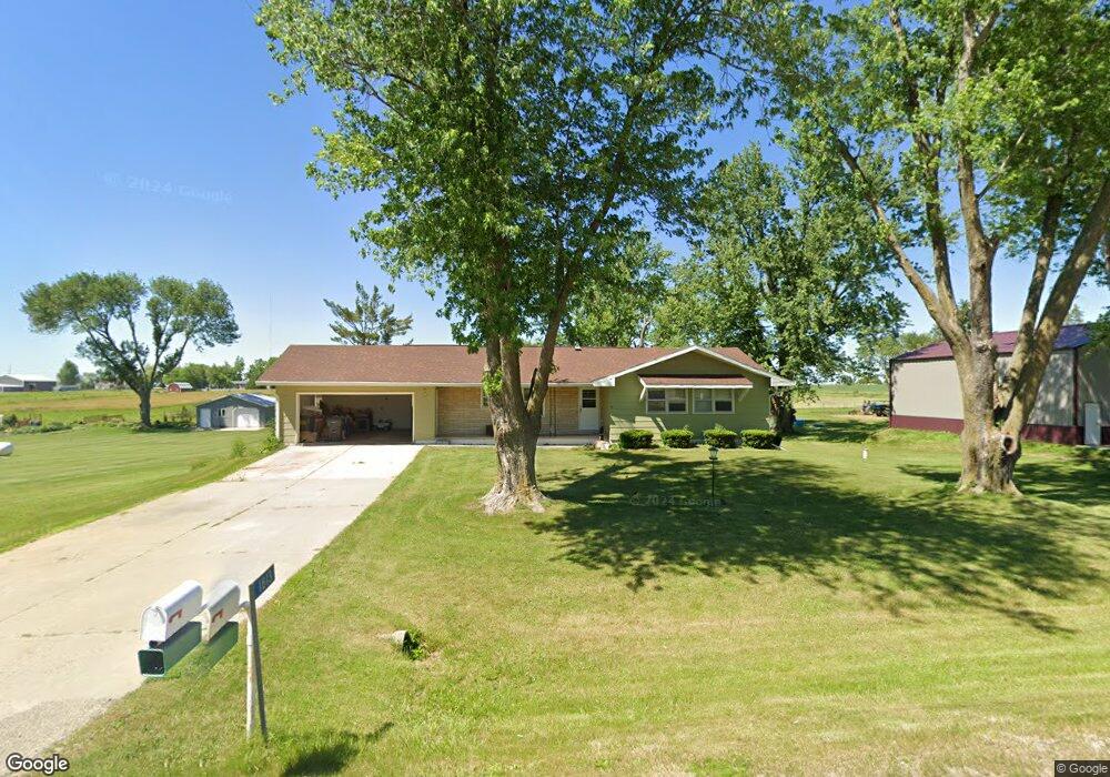
1813 Somerset Dr Marion, IA 52302
Estimated Value: $302,000 - $365,000
3
Beds
2
Baths
1,444
Sq Ft
$224/Sq Ft
Est. Value
About This Home
This home is located at 1813 Somerset Dr, Marion, IA 52302 and is currently estimated at $322,965, approximately $223 per square foot. 1813 Somerset Dr is a home located in Linn County with nearby schools including Linn Grove Elementary School, Excelsior Middle School, and Linn-Mar High School.
Ownership History
Date
Name
Owned For
Owner Type
Purchase Details
Closed on
Jul 26, 2006
Sold by
Dicus Arlene M
Bought by
Covington Michael J and Covington Shannon M
Current Estimated Value
Home Financials for this Owner
Home Financials are based on the most recent Mortgage that was taken out on this home.
Original Mortgage
$142,000
Outstanding Balance
$85,116
Interest Rate
6.73%
Mortgage Type
Purchase Money Mortgage
Estimated Equity
$237,849
Create a Home Valuation Report for This Property
The Home Valuation Report is an in-depth analysis detailing your home's value as well as a comparison with similar homes in the area
Home Values in the Area
Average Home Value in this Area
Purchase History
| Date | Buyer | Sale Price | Title Company |
|---|---|---|---|
| Covington Michael J | $145,500 | None Available |
Source: Public Records
Mortgage History
| Date | Status | Borrower | Loan Amount |
|---|---|---|---|
| Open | Covington Michael J | $142,000 |
Source: Public Records
Tax History Compared to Growth
Tax History
| Year | Tax Paid | Tax Assessment Tax Assessment Total Assessment is a certain percentage of the fair market value that is determined by local assessors to be the total taxable value of land and additions on the property. | Land | Improvement |
|---|---|---|---|---|
| 2025 | $3,512 | $282,100 | $65,000 | $217,100 |
| 2024 | $3,336 | $271,600 | $65,000 | $206,600 |
| 2023 | $3,336 | $271,600 | $65,000 | $206,600 |
| 2022 | $3,226 | $221,300 | $65,000 | $156,300 |
| 2021 | $3,010 | $221,300 | $65,000 | $156,300 |
| 2020 | $3,010 | $188,900 | $50,200 | $138,700 |
| 2019 | $2,734 | $176,500 | $50,200 | $126,300 |
| 2018 | $2,608 | $176,500 | $50,200 | $126,300 |
| 2017 | $2,659 | $169,700 | $50,200 | $119,500 |
| 2016 | $2,659 | $169,700 | $50,200 | $119,500 |
| 2015 | $2,679 | $169,700 | $50,200 | $119,500 |
| 2014 | $2,542 | $169,700 | $50,200 | $119,500 |
| 2013 | $2,438 | $169,700 | $50,200 | $119,500 |
Source: Public Records
Map
Nearby Homes
- 2638 Fields Dr
- 2770 Burns Dr
- 2750 Burns Dr
- 2760 Burns Dr
- 2701 Roycroft Dr
- 2488 Bluegrass St
- 2465 Bluegrass St
- 2466 Roycroft Alley
- 2734 Rookwood Ln
- 2700 Rookwood Ln
- 2436 Roycroft Alley
- 2398 Bluegrass St
- 2390 Bluegrass St
- 2375 Bluegrass St
- 2367 Rookwood Ln
- 2363 Rookwood Ln
- 2362 Bluegrass St
- Lots 130-137 Rookwood Estates
- 0 Robinwood Ln
- Yuma Expanded - Cedar Rapids Plan at Prairie Ridge Estates
- 1821 Somerset Dr
- 1805 Somerset Dr
- 1814 Somerset Dr
- 1806 Somerset Dr
- 1822 Somerset Dr
- 1829 Somerset Dr
- 1830 Somerset Dr
- 0 Fields Dr
- 2634 Fields Dr
- 1835 Somerset Dr
- 1836 Somerset Dr
- 2622 Fields Dr
- 2678 Fields Dr
- 2625 Fields Dr
- 1843 Somerset Dr
- 2616 Fields Dr
- 1818 Radio Rd
- 1826 Radio Rd
- 2614 Fields Dr
- 1800 Radio Rd