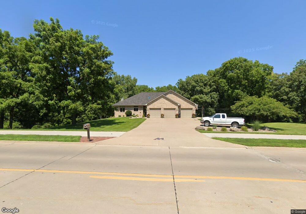
1815 Cedar St Muscatine, IA 52761
Estimated Value: $454,000 - $595,000
--
Bed
5
Baths
2,537
Sq Ft
$202/Sq Ft
Est. Value
About This Home
This home is located at 1815 Cedar St, Muscatine, IA 52761 and is currently estimated at $511,887, approximately $201 per square foot. 1815 Cedar St is a home located in Muscatine County with nearby schools including Mulberry Elementary School, Susan Clark Junior High School, and Muscatine High School.
Ownership History
Date
Name
Owned For
Owner Type
Purchase Details
Closed on
Jun 8, 2022
Sold by
Timothy W Garvin Revocable Trust and Susan L Garvin Revocable Trust
Bought by
Oleary Adam P and Oleary Tara N
Current Estimated Value
Home Financials for this Owner
Home Financials are based on the most recent Mortgage that was taken out on this home.
Original Mortgage
$275,000
Outstanding Balance
$261,732
Interest Rate
5.3%
Mortgage Type
New Conventional
Estimated Equity
$250,155
Purchase Details
Closed on
Apr 20, 2016
Sold by
Garvin Timothy W and Garvin Susan L
Bought by
Garvin Timothy W and Timothy W Garvin Revocable Tru
Create a Home Valuation Report for This Property
The Home Valuation Report is an in-depth analysis detailing your home's value as well as a comparison with similar homes in the area
Home Values in the Area
Average Home Value in this Area
Purchase History
| Date | Buyer | Sale Price | Title Company |
|---|---|---|---|
| Oleary Adam P | $487,000 | None Listed On Document | |
| Garvin Timothy W | $500 | None Available |
Source: Public Records
Mortgage History
| Date | Status | Borrower | Loan Amount |
|---|---|---|---|
| Open | Oleary Adam P | $275,000 |
Source: Public Records
Tax History Compared to Growth
Tax History
| Year | Tax Paid | Tax Assessment Tax Assessment Total Assessment is a certain percentage of the fair market value that is determined by local assessors to be the total taxable value of land and additions on the property. | Land | Improvement |
|---|---|---|---|---|
| 2025 | $9,062 | $483,930 | $85,860 | $398,070 |
| 2024 | $9,062 | $510,050 | $115,540 | $394,510 |
| 2023 | $8,718 | $511,302 | $115,540 | $395,762 |
| 2022 | $7,432 | $402,490 | $109,000 | $293,490 |
| 2021 | $7,432 | $376,640 | $109,000 | $267,640 |
| 2020 | $6,996 | $345,140 | $77,500 | $267,640 |
| 2019 | $7,256 | $340,260 | $0 | $0 |
| 2018 | $7,152 | $340,260 | $0 | $0 |
| 2017 | $7,152 | $340,260 | $0 | $0 |
| 2016 | $6,710 | $308,730 | $0 | $0 |
| 2015 | $6,710 | $307,330 | $0 | $0 |
| 2014 | $6,798 | $284,830 | $0 | $0 |
Source: Public Records
Map
Nearby Homes
- 297 Burnside Ave
- 310 Wood Creek Ln
- 35 Colony Dr
- 602 W Fulliam Ave
- 1807 Mulberry Ave
- 1506 Buell St
- 241 Dillaway St
- 205 Amherst Ave
- 606 Leroy St
- PARCEL ID 0834280023 Dillaway St
- 709 Leroy St
- 518 Roscoe Ave
- 3 Wilson Dr
- 2109 Americana Ave
- 1619 Devitt Ave
- 1102 Cedar St
- 2106 Clarabek St
- 2108 Clarabek St
- 1617 W Acre Dr
- 108 Middle Rd
- 2006 Cedar St
- 1807 Cedar St
- 2201 Stonebrook Dr
- 1803 Cedar St
- 2205 Stonebrook Dr
- 2209 Stonebrook Dr
- 2204 Stonebrook Dr
- 1902 Wildwood Ln
- 1749 Arbor Oaks Dr
- 1907 Wildwood Ln
- 2020 Burnside Dr
- 2014 Burnside Dr
- LOT 11 Stonebrook
- 2006 Burnside Dr
- 2002 Burnside Dr
- 1913 Wildwood Ln
- 2220 Stonebrook Dr
- 1914 Wildwood Ln
- 1823 Logan St
- 1737 Arbor Oaks Dr