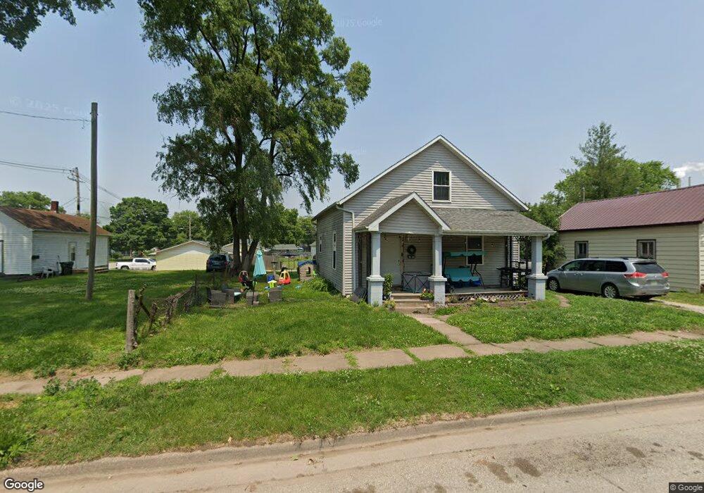
1815 Demorest Ave Muscatine, IA 52761
Estimated Value: $82,000 - $117,000
2
Beds
1
Bath
1,321
Sq Ft
$77/Sq Ft
Est. Value
About This Home
This home is located at 1815 Demorest Ave, Muscatine, IA 52761 and is currently estimated at $101,517, approximately $76 per square foot. 1815 Demorest Ave is a home located in Muscatine County with nearby schools including Franklin Elementary School, Susan Clark Junior High School, and Muscatine High School.
Ownership History
Date
Name
Owned For
Owner Type
Purchase Details
Closed on
May 2, 2008
Sold by
Gochee Robert and Gochee Shirley
Bought by
Hagerty Ryan
Current Estimated Value
Home Financials for this Owner
Home Financials are based on the most recent Mortgage that was taken out on this home.
Original Mortgage
$49,300
Outstanding Balance
$31,221
Interest Rate
5.88%
Mortgage Type
Future Advance Clause Open End Mortgage
Estimated Equity
$70,296
Create a Home Valuation Report for This Property
The Home Valuation Report is an in-depth analysis detailing your home's value as well as a comparison with similar homes in the area
Home Values in the Area
Average Home Value in this Area
Purchase History
| Date | Buyer | Sale Price | Title Company |
|---|---|---|---|
| Hagerty Ryan | $15,000 | None Available |
Source: Public Records
Mortgage History
| Date | Status | Borrower | Loan Amount |
|---|---|---|---|
| Open | Hagerty Ryan | $49,300 |
Source: Public Records
Tax History Compared to Growth
Tax History
| Year | Tax Paid | Tax Assessment Tax Assessment Total Assessment is a certain percentage of the fair market value that is determined by local assessors to be the total taxable value of land and additions on the property. | Land | Improvement |
|---|---|---|---|---|
| 2025 | $1,310 | $77,220 | $9,770 | $67,450 |
| 2024 | $1,310 | $72,250 | $9,770 | $62,480 |
| 2023 | $594 | $71,338 | $9,794 | $61,544 |
| 2022 | $1,172 | $65,920 | $9,240 | $56,680 |
| 2021 | $1,430 | $57,420 | $9,240 | $48,180 |
| 2020 | $1,102 | $52,470 | $7,920 | $44,550 |
| 2019 | $1,102 | $49,870 | $0 | $0 |
| 2018 | $1,086 | $49,870 | $0 | $0 |
| 2017 | $1,086 | $46,640 | $0 | $0 |
| 2016 | $1,054 | $46,640 | $0 | $0 |
| 2015 | $1,054 | $47,770 | $0 | $0 |
| 2014 | $1,088 | $47,770 | $0 | $0 |
Source: Public Records
Map
Nearby Homes
- 1708 Schley Ave
- 1908 Sampson St
- 1909 Wallace St
- 0 Towhead Island Unit 23-716
- 2108 Breese Ave
- 609 Liberty St
- LOTS 30-34 Evans St
- 111 Gilbert St
- LOT 5 Pine Ridge
- LOT 4 Pine Ridge
- LOT 6 Pine Ridge
- 1903 Hershey Ave
- 1827 Hershey Ave
- 900 W 3rd St
- 0 Parcel 1302108019 (Busch St)
- 701 W Mississippi Dr
- 1603 Lucas St
- 0 High Street Parcel
- 613 W 5th St
- 208 Fletcher Ave
- 1809 Demorest Ave
- 1817 Demorest Ave
- 1807 Demorest Ave
- 1814 Miles Ave
- 1810 Miles Ave
- 1818 Miles Ave
- 1818 Demorest Ave
- 1808 Demorest Ave
- 1808 Miles Ave
- 1803 Demorest Ave
- 1606 Kansas St
- 1515 Kansas St
- 1804 Miles Ave
- 1607 Stewart Rd
- 1608 Kansas St
- 1505 Kansas St
- 1603 Stewart Rd
- 1711 Demorest Ave
- 1611 Stewart Rd
- 1907 Demorest Ave