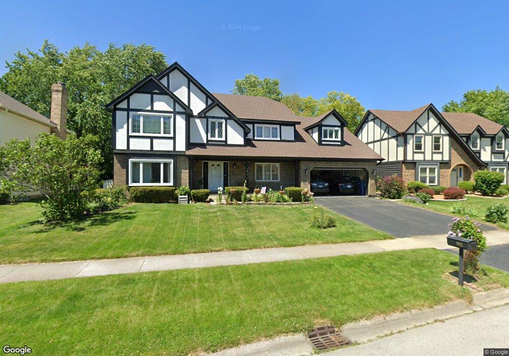
1815 Denison Rd Naperville, IL 60565
Ranch View NeighborhoodEstimated Value: $701,000 - $795,000
Studio
--
Bath
3,441
Sq Ft
$218/Sq Ft
Est. Value
About This Home
This home is located at 1815 Denison Rd, Naperville, IL 60565 and is currently estimated at $749,185, approximately $217 per square foot. 1815 Denison Rd is a home located in DuPage County with nearby schools including Ranch View Elementary School, Kennedy Junior High School, and Naperville Central High School.
Ownership History
Date
Name
Owned For
Owner Type
Purchase Details
Closed on
Sep 15, 1998
Sold by
Moore Steven J and Moore Anne C
Bought by
Hessefort Norbert and Hessefort Yin
Current Estimated Value
Home Financials for this Owner
Home Financials are based on the most recent Mortgage that was taken out on this home.
Original Mortgage
$225,000
Outstanding Balance
$48,397
Interest Rate
6.98%
Estimated Equity
$700,788
Create a Home Valuation Report for This Property
The Home Valuation Report is an in-depth analysis detailing your home's value as well as a comparison with similar homes in the area
Home Values in the Area
Average Home Value in this Area
Purchase History
| Date | Buyer | Sale Price | Title Company |
|---|---|---|---|
| Hessefort Norbert | $281,500 | -- |
Source: Public Records
Mortgage History
| Date | Status | Borrower | Loan Amount |
|---|---|---|---|
| Open | Hessefort Norbert | $225,000 | |
| Closed | Hessefort Norbert | $28,150 |
Source: Public Records
Tax History
| Year | Tax Paid | Tax Assessment Tax Assessment Total Assessment is a certain percentage of the fair market value that is determined by local assessors to be the total taxable value of land and additions on the property. | Land | Improvement |
|---|---|---|---|---|
| 2024 | $12,594 | $213,584 | $69,697 | $143,887 |
| 2023 | $12,147 | $194,930 | $63,610 | $131,320 |
| 2022 | $11,402 | $182,180 | $59,450 | $122,730 |
| 2021 | $10,989 | $175,290 | $57,200 | $118,090 |
| 2020 | $10,756 | $172,140 | $56,170 | $115,970 |
| 2019 | $10,445 | $164,690 | $53,740 | $110,950 |
| 2018 | $10,717 | $168,780 | $53,740 | $115,040 |
| 2017 | $10,505 | $163,090 | $51,930 | $111,160 |
| 2016 | $10,298 | $157,190 | $50,050 | $107,140 |
| 2015 | $10,238 | $148,020 | $47,130 | $100,890 |
| 2014 | $10,250 | $143,710 | $45,760 | $97,950 |
| 2013 | $10,096 | $144,060 | $45,870 | $98,190 |
Source: Public Records
Map
Nearby Homes
- 1896 Appaloosa Dr Unit 7
- 1909 Montclair Dr
- 1405 E Bailey Rd
- 1406 River Oak Dr
- 1217 River Oak Dr
- 1509 Shiva Ln
- 1123 Mill Race Ln
- 2243 Aster Ct
- 3805 Gladstone Dr
- 1285 Stonebriar Ct
- 2103 Primrose Ln
- 2250 Lisson Rd
- 1612 Indian Trail Dr
- 8S230 Hampton Cir
- 23W731 Hobson Rd
- 23W711 Hobson Rd
- 25 W 500 Royce Rd
- 627 Bourbon Ct
- 1715 Amelia Ct
- 621 Bourbon Ct
- 1811 Denison Rd
- 1819 Denison Rd
- 1824 Auburn Ave
- 1807 Denison Rd
- 1828 Auburn Ave
- 1823 Denison Rd
- 1820 Auburn Ave
- 1812 Denison Rd
- 1832 Auburn Ave
- 1808 Denison Rd
- 1803 Denison Rd
- 1824 Denison Rd
- 1820 Denison Rd
- 1816 Auburn Ave
- 1816 Denison Rd
- 1804 Denison Rd
- 1836 Auburn Ave
- 1799 Denison Rd
- 1812 Auburn Ave
- 1840 Auburn Ave
Your Personal Tour Guide
Ask me questions while you tour the home.