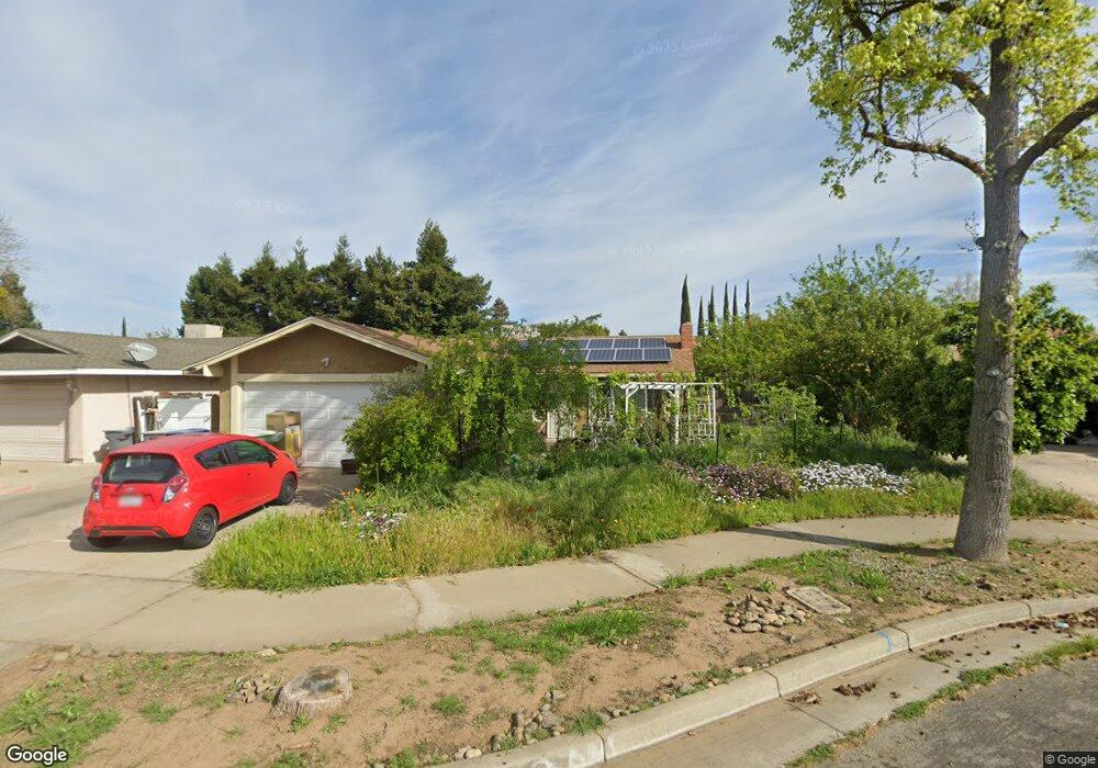
1815 Shadowbrook Dr Merced, CA 95348
Estimated Value: $312,000 - $341,171
3
Beds
2
Baths
1,106
Sq Ft
$291/Sq Ft
Est. Value
About This Home
This home is located at 1815 Shadowbrook Dr, Merced, CA 95348 and is currently estimated at $321,793, approximately $290 per square foot. 1815 Shadowbrook Dr is a home located in Merced County with nearby schools including Luther Burbank Elementary School, Tenaya Middle School, and Merced High School.
Ownership History
Date
Name
Owned For
Owner Type
Purchase Details
Closed on
Jul 25, 2007
Sold by
Cortez John Martin and Estate Of Jesse Mendoza Cortez
Bought by
Rodgers Edwin T and Rodgers Jane H
Current Estimated Value
Home Financials for this Owner
Home Financials are based on the most recent Mortgage that was taken out on this home.
Original Mortgage
$187,000
Outstanding Balance
$118,338
Interest Rate
6.74%
Mortgage Type
Purchase Money Mortgage
Estimated Equity
$203,455
Purchase Details
Closed on
Sep 26, 2001
Sold by
Thomas Max D and Thomas Inez C
Bought by
Cortez Jesse M
Home Financials for this Owner
Home Financials are based on the most recent Mortgage that was taken out on this home.
Original Mortgage
$110,016
Interest Rate
6.9%
Mortgage Type
FHA
Create a Home Valuation Report for This Property
The Home Valuation Report is an in-depth analysis detailing your home's value as well as a comparison with similar homes in the area
Purchase History
| Date | Buyer | Sale Price | Title Company |
|---|---|---|---|
| Rodgers Edwin T | $187,000 | Transcounty Title Company | |
| Cortez Jesse M | $111,000 | Chicago Title Co |
Source: Public Records
Mortgage History
| Date | Status | Borrower | Loan Amount |
|---|---|---|---|
| Open | Rodgers Edwin T | $187,000 | |
| Previous Owner | Cortez Jesse M | $110,016 |
Source: Public Records
Tax History
| Year | Tax Paid | Tax Assessment Tax Assessment Total Assessment is a certain percentage of the fair market value that is determined by local assessors to be the total taxable value of land and additions on the property. | Land | Improvement |
|---|---|---|---|---|
| 2025 | $2,511 | $245,612 | $118,208 | $127,404 |
| 2024 | $2,511 | $240,797 | $115,891 | $124,906 |
| 2023 | $2,475 | $236,076 | $113,619 | $122,457 |
| 2022 | $2,440 | $231,448 | $111,392 | $120,056 |
| 2021 | $2,433 | $226,910 | $109,208 | $117,702 |
| 2020 | $2,451 | $224,585 | $108,089 | $116,496 |
| 2019 | $2,062 | $189,000 | $65,000 | $124,000 |
| 2018 | $1,902 | $187,500 | $55,000 | $132,500 |
| 2017 | $1,786 | $167,000 | $45,000 | $122,000 |
| 2016 | $1,358 | $128,000 | $45,000 | $83,000 |
| 2015 | $1,357 | $128,000 | $45,000 | $83,000 |
| 2014 | $1,109 | $106,000 | $30,000 | $76,000 |
Source: Public Records
Map
Nearby Homes
- 1541 W North Bear Creek Dr
- 1648 W North Bear Creek Dr
- 1646 W North Bear Creek Dr
- 1963 Shadowbrook Dr
- 1973 Shadowbrook Dr
- 1656 W North Bear Creek Dr Unit 9
- 2500 N State Highway 59 Unit 36
- 2500 N State Highway 59 Unit 278
- 2500 N State Highway 59 Unit 239
- 2500 N State Highway 59 Unit 18
- 2500 N State Highway 59
- 1441 W 20th St
- 1664 W North Bear Creek Dr Unit 5
- 1438 W 19th St
- 1463 W 25th St
- 1482 Autry Way
- 2790 N State Highway 59
- 1145 W 22nd St
- 1044 W 20th St
- 1127 W 23rd St
- 1823 Shadowbrook Dr
- 1803 Shadowbrook Dr
- 1840 Brookside Dr
- 1854 Brookside Dr
- 1830 Brookside Dr
- 1833 Shadowbrook Dr
- 2470 Crystal Springs Ave
- 1866 Brookside Dr
- 2451 Crystal Springs Ave
- 1820 Brookside Dr
- 2460 Crystal Springs Ave
- 2460 Crystal Springs Ave
- 1843 Shadowbrook Dr
- 1878 Brookside Dr
- 2452 Driftwood Dr
- 2441 Crystal Springs Ave
- 1853 Shadowbrook Dr
- 1890 Brookside Dr
- 1843 Brookside Dr
- 2442 Driftwood Dr
Your Personal Tour Guide
Ask me questions while you tour the home.