Estimated Value: $345,000 - $382,000
4
Beds
4
Baths
2,142
Sq Ft
$169/Sq Ft
Est. Value
About This Home
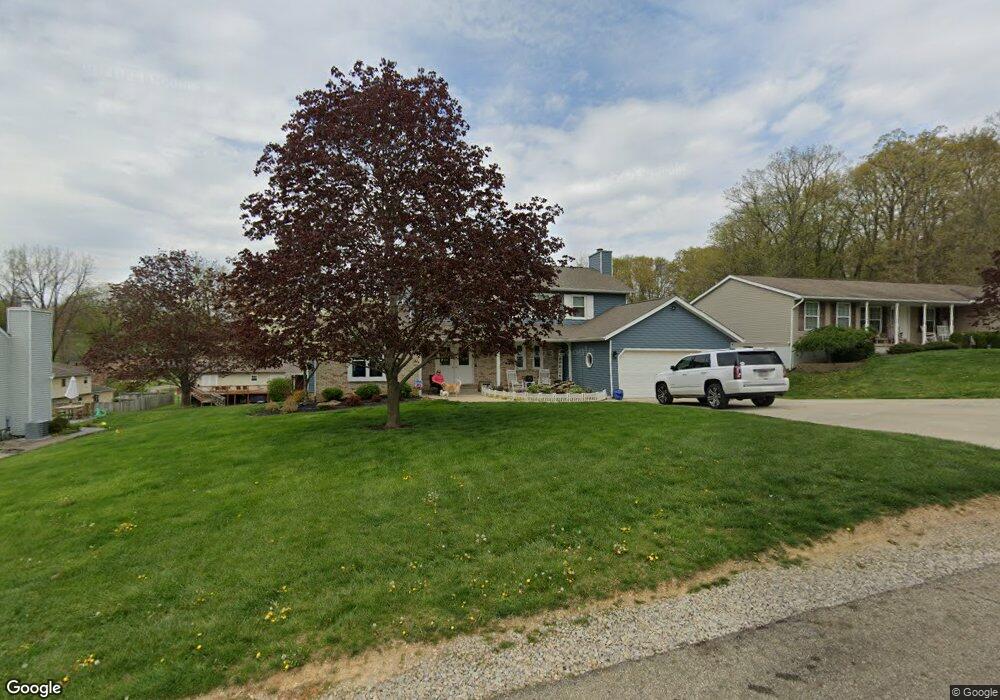
This home is located at 1816 Cedar Cir, Heath, OH 43056 and is currently estimated at $361,620, approximately $168 per square foot. 1816 Cedar Cir is a home located in Licking County with nearby schools including Garfield Elementary School, Stevenson Elementary School, and Heath Middle School.
Ownership History
Date
Name
Owned For
Owner Type
Purchase Details
Closed on
Mar 17, 2017
Sold by
Mitchell Kathy L and Mitchell Anthony E
Bought by
Mitchell Anthony E
Current Estimated Value
Purchase Details
Closed on
Jan 21, 2014
Sold by
Mitchell Anthony E and Mitchell Kathy L
Bought by
Mitchell Anthony E and Mitchell Kathy L
Home Financials for this Owner
Home Financials are based on the most recent Mortgage that was taken out on this home.
Original Mortgage
$175,500
Interest Rate
4.5%
Mortgage Type
VA
Create a Home Valuation Report for This Property
The Home Valuation Report is an in-depth analysis detailing your home's value as well as a comparison with similar homes in the area
Home Values in the Area
Average Home Value in this Area
Purchase History
| Date | Buyer | Sale Price | Title Company |
|---|---|---|---|
| Mitchell Anthony E | -- | None Available | |
| Mitchell Anthony E | -- | None Available |
Source: Public Records
Mortgage History
| Date | Status | Borrower | Loan Amount |
|---|---|---|---|
| Previous Owner | Mitchell Anthony E | $175,500 |
Source: Public Records
Tax History Compared to Growth
Tax History
| Year | Tax Paid | Tax Assessment Tax Assessment Total Assessment is a certain percentage of the fair market value that is determined by local assessors to be the total taxable value of land and additions on the property. | Land | Improvement |
|---|---|---|---|---|
| 2024 | $3,566 | $102,450 | $20,790 | $81,660 |
| 2023 | $4,007 | $102,450 | $20,790 | $81,660 |
| 2022 | $3,935 | $72,630 | $12,150 | $60,480 |
| 2021 | $4,016 | $72,630 | $12,150 | $60,480 |
| 2020 | $4,041 | $72,630 | $12,150 | $60,480 |
| 2019 | $3,540 | $64,760 | $12,150 | $52,610 |
| 2018 | $3,578 | $0 | $0 | $0 |
| 2017 | $3,680 | $0 | $0 | $0 |
| 2016 | $3,721 | $0 | $0 | $0 |
| 2015 | $3,784 | $0 | $0 | $0 |
| 2014 | $5,323 | $0 | $0 | $0 |
| 2013 | $1,744 | $0 | $0 | $0 |
Source: Public Records
Map
Nearby Homes
- 1933 Blue Jay Rd
- 5185 Linnville Rd
- 606 Kimberly Ct
- 1903 Willow Ridge Dr
- 602 Piedmont Ln
- 0 Cumberland Crest
- 1782 Cumberland Crest
- 57 Bluebonnett Dr
- 3185 Ritchey Rd
- 0 Blue Jay Rd
- 5280 Cotterman Rd SE
- 7881 Dorsey Mill Rd SE
- 87 Crestline Rd
- 4151 Jacksontown Rd
- 748 Francis Dr
- 720 Francis Dr
- 728 Francis Dr
- 5832 Linnville Rd
- 1309 Kacey Ct
- 1310 Kacey St