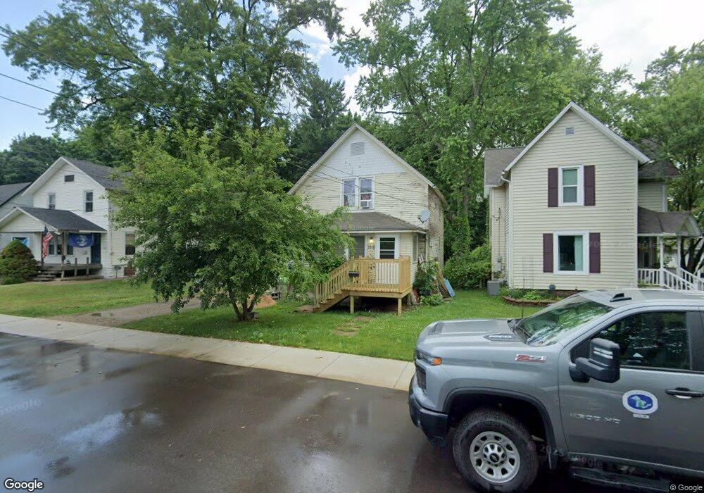
1816 Commonwealth Ave Kalamazoo, MI 49006
Westwood NeighborhoodEstimated Value: $190,000 - $222,000
3
Beds
2
Baths
1,180
Sq Ft
$173/Sq Ft
Est. Value
About This Home
This home is located at 1816 Commonwealth Ave, Kalamazoo, MI 49006 and is currently estimated at $204,046, approximately $172 per square foot. 1816 Commonwealth Ave is a home located in Kalamazoo County with nearby schools including Northglade Montessori School, Hillside Middle School, and Kalamazoo Central High School.
Ownership History
Date
Name
Owned For
Owner Type
Purchase Details
Closed on
Apr 6, 2021
Sold by
Taylor Robert M and Smith Lawrence R
Bought by
Birch Steven J and Tuyl Laura K
Current Estimated Value
Purchase Details
Closed on
Aug 14, 2007
Sold by
Federal Home Loan Mortgage Corporation
Bought by
Zirkelbach Jessica and Powers Rex
Purchase Details
Closed on
Nov 16, 2006
Sold by
Love Matthew A
Bought by
Federal Home Loan Mortgage Corporation
Purchase Details
Closed on
May 6, 2004
Sold by
Hascall Dag and Hascall Jennifer
Bought by
Love Matthew A
Home Financials for this Owner
Home Financials are based on the most recent Mortgage that was taken out on this home.
Original Mortgage
$82,500
Interest Rate
5%
Mortgage Type
Purchase Money Mortgage
Create a Home Valuation Report for This Property
The Home Valuation Report is an in-depth analysis detailing your home's value as well as a comparison with similar homes in the area
Home Values in the Area
Average Home Value in this Area
Purchase History
| Date | Buyer | Sale Price | Title Company |
|---|---|---|---|
| Birch Steven J | -- | None Available | |
| Zirkelbach Jessica | $63,000 | Attorneys Title | |
| Federal Home Loan Mortgage Corporation | $82,599 | None Available | |
| Love Matthew A | $76,000 | -- |
Source: Public Records
Mortgage History
| Date | Status | Borrower | Loan Amount |
|---|---|---|---|
| Previous Owner | Love Matthew A | $82,500 |
Source: Public Records
Tax History Compared to Growth
Tax History
| Year | Tax Paid | Tax Assessment Tax Assessment Total Assessment is a certain percentage of the fair market value that is determined by local assessors to be the total taxable value of land and additions on the property. | Land | Improvement |
|---|---|---|---|---|
| 2025 | $2,959 | $90,700 | $0 | $0 |
| 2024 | $572 | $84,000 | $0 | $0 |
| 2023 | $545 | $73,600 | $0 | $0 |
| 2022 | $2,688 | $68,500 | $0 | $0 |
| 2021 | $2,284 | $57,100 | $0 | $0 |
| 2020 | $2,111 | $49,600 | $0 | $0 |
| 2019 | $2,017 | $45,000 | $0 | $0 |
| 2018 | $1,967 | $40,100 | $0 | $0 |
| 2017 | $0 | $40,100 | $0 | $0 |
| 2016 | -- | $38,700 | $0 | $0 |
| 2015 | -- | $38,400 | $0 | $0 |
| 2014 | -- | $36,200 | $0 | $0 |
Source: Public Records
Map
Nearby Homes
- 2010 Commonwealth Ave
- 1709 Jefferson Ave
- 204 Nelson Ave
- 426 Pinehurst Blvd
- 1605 W North St
- 1455 W North St
- 2306 Kenwood St
- 1416 Forbes St
- 1108 Warren Place
- 1338 Summit Ave
- 1332 Summit Ave
- 629 Jefferson Place
- 115 Monroe St
- 613 Summer St
- 707 Jenks Blvd
- 150 Carberry Hill Ct Unit C
- 204 Monroe St
- 124 Lanark Ct Unit 64
- 154 Carberry Hill Ct Unit 43
- 1206 Summit Ave
- 1812 Commonwealth Ave
- 1822 Commonwealth Ave
- 52224 N Berkley St
- 53032 N Berkley St
- 51820 N Berkley St
- 51416 N Berkley St
- 1808 Commonwealth Ave
- 445 N Berkley St
- 1828 Commonwealth Ave
- 507 N Berkley St
- 425 N Berkley St
- 0 N Clarendon St
- 425427 N Clarendon St
- 30 N Berkley St
- 0 N Berkley St
- 522524 N Berkley St
- 514516 N Berkley St
- 1813 Commonwealth Ave
- 1819 Commonwealth Ave
- 1902 Commonwealth Ave