Estimated Value: $343,000 - $389,000
4
Beds
3
Baths
2,517
Sq Ft
$147/Sq Ft
Est. Value
About This Home
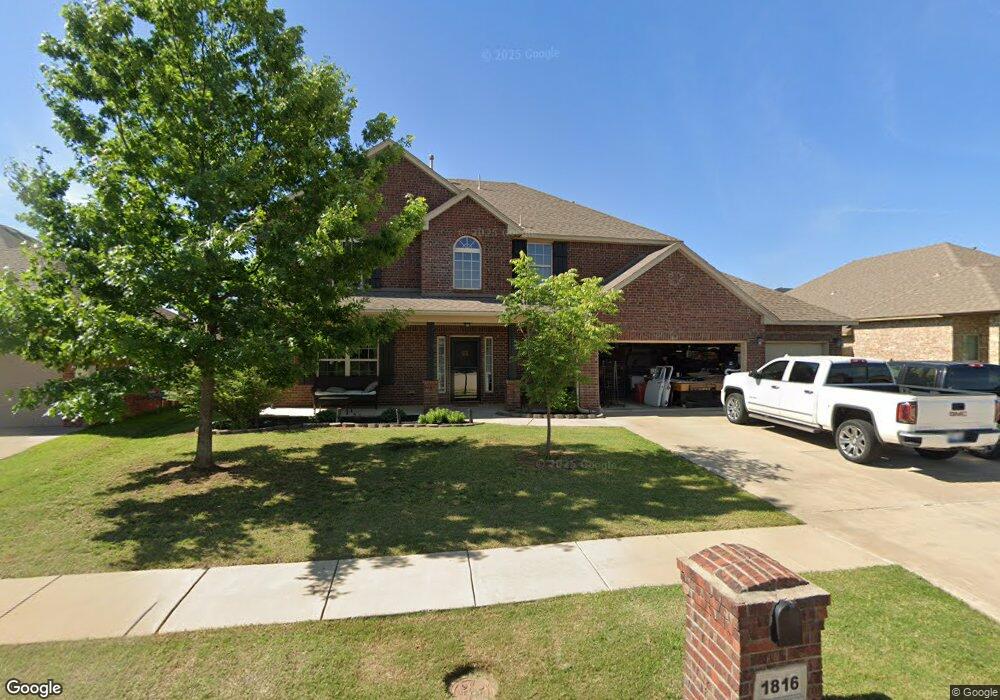
This home is located at 1816 Derail St, Yukon, OK 73099 and is currently estimated at $371,094, approximately $147 per square foot. 1816 Derail St is a home with nearby schools including Banner School and St. John Nepomuk Catholic School.
Ownership History
Date
Name
Owned For
Owner Type
Purchase Details
Closed on
Sep 12, 2014
Sold by
D R Horton Texas Ltd Lp
Bought by
Romines David and Romines Macayla
Current Estimated Value
Home Financials for this Owner
Home Financials are based on the most recent Mortgage that was taken out on this home.
Original Mortgage
$243,849
Outstanding Balance
$183,029
Interest Rate
3.62%
Mortgage Type
FHA
Estimated Equity
$188,065
Purchase Details
Closed on
Oct 24, 2013
Sold by
Okc Properties Llc
Bought by
D R Horton Texas Ltd and D R Horton Texas Ltd Lp
Create a Home Valuation Report for This Property
The Home Valuation Report is an in-depth analysis detailing your home's value as well as a comparison with similar homes in the area
Home Values in the Area
Average Home Value in this Area
Purchase History
| Date | Buyer | Sale Price | Title Company |
|---|---|---|---|
| Romines David | $248,500 | American Eagle Title Group | |
| D R Horton Texas Ltd | $32,500 | American Eagle Title Group | |
| Okc Properties Llc | -- | American Eagle Title Group |
Source: Public Records
Mortgage History
| Date | Status | Borrower | Loan Amount |
|---|---|---|---|
| Open | Romines David | $243,849 |
Source: Public Records
Tax History Compared to Growth
Tax History
| Year | Tax Paid | Tax Assessment Tax Assessment Total Assessment is a certain percentage of the fair market value that is determined by local assessors to be the total taxable value of land and additions on the property. | Land | Improvement |
|---|---|---|---|---|
| 2024 | $2,514 | $33,801 | $5,280 | $28,521 |
| 2023 | $2,514 | $32,817 | $5,280 | $27,537 |
| 2022 | $2,472 | $31,861 | $5,280 | $26,581 |
| 2021 | $2,418 | $30,933 | $5,280 | $25,653 |
| 2020 | $2,326 | $30,032 | $5,280 | $24,752 |
| 2019 | $2,276 | $29,157 | $5,280 | $23,877 |
| 2018 | $2,247 | $28,308 | $5,280 | $23,028 |
| 2017 | $2,293 | $28,559 | $5,280 | $23,279 |
| 2016 | $2,225 | $29,142 | $4,960 | $24,182 |
| 2015 | -- | $27,470 | $3,900 | $23,570 |
| 2014 | -- | $425 | $425 | $0 |
Source: Public Records
Map
Nearby Homes
- 632 Signalman
- 409 Frisco Ridge Rd
- 1913 Tinder St
- 613 Side Track Rd
- 0 U S Route 66
- 417 Garth Brooks Blvd
- 611 Garth Brooks Blvd
- 1016 Maple Ave
- 9116 Anaum Ln
- 1101 W Main St
- 624 Frisco Ridge Rd
- 1004 Cedar Ave
- 11325 SW 34th Terrace
- 705 Yukon Ave
- 600 S 8th St
- 601 S 8th St
- 10712 Two Lakes Dr
- 10608 Blue Creek Dr
- 11625 NW 104th St
- 10301 Two Lakes Dr
- 1820 Derail St
- 1817 Flagman St
- 1808 Derail St
- 1813 Flagman St
- 1824 Derail St
- 1821 Flagman St
- 1817 Derail St
- 1825 Flagman St
- 1813 Derail St
- 1809 Flagman St
- 1809 Derail St
- 516 Swingman Rd
- 1804 Derail St
- 1805 Flagman St
- 608 Signalman
- 1805 Derail St
- 512 Swingman Rd
- 1800 Derail St
- 1812 Caboose St
- 508 Swingman Rd