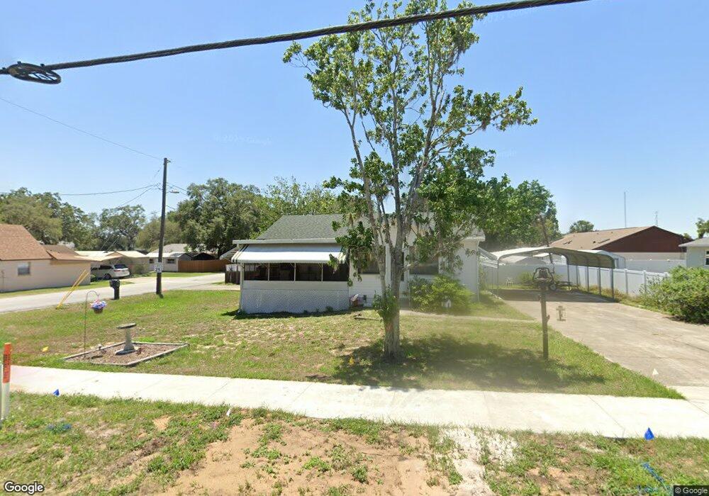
1816 S Grove St Eustis, FL 32726
Estimated Value: $184,000 - $225,000
2
Beds
1
Bath
984
Sq Ft
$213/Sq Ft
Est. Value
About This Home
This home is located at 1816 S Grove St, Eustis, FL 32726 and is currently estimated at $209,574, approximately $212 per square foot. 1816 S Grove St is a home located in Lake County with nearby schools including Eustis Heights Elementary School, Eustis Middle School, and Eustis High School.
Ownership History
Date
Name
Owned For
Owner Type
Purchase Details
Closed on
Nov 23, 2022
Sold by
Lanier Shirley
Bought by
Lanier Shirley and Milner Luwana L
Current Estimated Value
Purchase Details
Closed on
Oct 27, 2015
Sold by
Lanier John G and Lanier Shirley
Bought by
Lanier John G and Lanier Shirley
Purchase Details
Closed on
Aug 11, 1993
Sold by
Lanier John G and Lanier Shirley
Bought by
Lanier John G
Home Financials for this Owner
Home Financials are based on the most recent Mortgage that was taken out on this home.
Original Mortgage
$33,000
Interest Rate
7.26%
Create a Home Valuation Report for This Property
The Home Valuation Report is an in-depth analysis detailing your home's value as well as a comparison with similar homes in the area
Home Values in the Area
Average Home Value in this Area
Purchase History
| Date | Buyer | Sale Price | Title Company |
|---|---|---|---|
| Lanier Shirley | -- | None Listed On Document | |
| Lanier Shirley | -- | None Listed On Document | |
| Lanier John G | -- | Attorney | |
| Lanier John G | $25,000 | -- |
Source: Public Records
Mortgage History
| Date | Status | Borrower | Loan Amount |
|---|---|---|---|
| Previous Owner | Lanier John G | $33,000 |
Source: Public Records
Tax History
| Year | Tax Paid | Tax Assessment Tax Assessment Total Assessment is a certain percentage of the fair market value that is determined by local assessors to be the total taxable value of land and additions on the property. | Land | Improvement |
|---|---|---|---|---|
| 2026 | $564 | $88,040 | -- | -- |
| 2025 | $770 | $85,640 | -- | -- |
| 2024 | $770 | $85,640 | -- | -- |
| 2023 | $770 | $80,730 | $0 | $0 |
| 2022 | $736 | $78,380 | $0 | $0 |
| 2021 | $695 | $76,099 | $0 | $0 |
| 2020 | $702 | $75,049 | $0 | $0 |
| 2019 | $702 | $73,362 | $0 | $0 |
| 2018 | $674 | $71,995 | $0 | $0 |
| 2017 | $672 | $70,515 | $0 | $0 |
| 2016 | $674 | $69,065 | $0 | $0 |
| 2015 | $690 | $68,585 | $0 | $0 |
| 2014 | $691 | $68,041 | $0 | $0 |
Source: Public Records
Map
Nearby Homes
- 102 W Saint Louis Ave
- 105 W Golf Links Ave
- 118 W Chesley Ave
- 507 Firewood Ave
- 301 E Atwater Ave
- 436 E Atwater Ave
- 615 Briarcliff Rd
- 1215 Morin St
- 203 E Lakeview Ave
- 1300 Saint Andrews Blvd
- 1033 S Grove St
- 1122 Virginia Ct
- 322 Palm Ave
- 1901 Prevatt St
- 1111 South St
- 630 Cedar Elm Ct
- 1021 Titcomb St
- 646 Cedar Elm Ct
- 650 Cedar Elm Ct
- 2250 Red Pine Ct
- 111 E Saint Louis Ave
- 116 E Golf Links Ave
- 1902 S Grove St
- 103 E Saint Louis Ave
- 1910 S Grove St
- 102 E Golf Links Ave
- 102 E Saint Louis Ave
- 210 South Ave
- 101 E Saint Louis Ave
- 233 Bluff Pass Dr
- 225 Bluff Pass Dr
- 100 E Golf Links Ave
- 100 E Saint Louis Ave
- 115 E Golf Links Ave
- 217 Bluff Pass Dr
- 35 E Saint Louis Ave
- 113 E Golf Links Ave
- 36 E Saint Louis Ave
- 26 E Golf Links Ave
- 241 Bluff Pass Dr
Your Personal Tour Guide
Ask me questions while you tour the home.