Estimated Value: $295,890 - $321,000
3
Beds
2
Baths
1,821
Sq Ft
$169/Sq Ft
Est. Value
About This Home
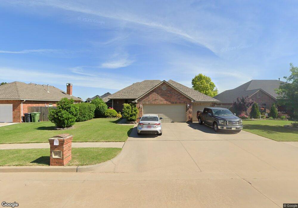
This home is located at 1817 Derail St, Yukon, OK 73099 and is currently estimated at $307,973, approximately $169 per square foot. 1817 Derail St is a home located in Canadian County with nearby schools including Banner School and St. John Nepomuk Catholic School.
Ownership History
Date
Name
Owned For
Owner Type
Purchase Details
Closed on
Jan 26, 2023
Sold by
Price William Grant
Bought by
William And Karen Price Family Trust
Current Estimated Value
Purchase Details
Closed on
Sep 25, 2009
Sold by
First Star Homes Inc
Bought by
Price William Grant and Price Karen Lee
Home Financials for this Owner
Home Financials are based on the most recent Mortgage that was taken out on this home.
Original Mortgage
$170,848
Interest Rate
5.16%
Mortgage Type
FHA
Create a Home Valuation Report for This Property
The Home Valuation Report is an in-depth analysis detailing your home's value as well as a comparison with similar homes in the area
Home Values in the Area
Average Home Value in this Area
Purchase History
| Date | Buyer | Sale Price | Title Company |
|---|---|---|---|
| William And Karen Price Family Trust | -- | -- | |
| Price William Grant | $174,000 | The Oklahoma City Abstract & |
Source: Public Records
Mortgage History
| Date | Status | Borrower | Loan Amount |
|---|---|---|---|
| Previous Owner | Price William Grant | $170,848 |
Source: Public Records
Tax History
| Year | Tax Paid | Tax Assessment Tax Assessment Total Assessment is a certain percentage of the fair market value that is determined by local assessors to be the total taxable value of land and additions on the property. | Land | Improvement |
|---|---|---|---|---|
| 2025 | $2,099 | $28,716 | $5,280 | $23,436 |
| 2024 | $2,139 | $27,879 | $5,280 | $22,599 |
| 2023 | $2,139 | $27,068 | $5,280 | $21,788 |
| 2022 | $2,065 | $25,779 | $5,280 | $20,499 |
| 2021 | $2,010 | $24,888 | $5,280 | $19,608 |
| 2020 | $1,994 | $24,888 | $5,280 | $19,608 |
| 2019 | $1,994 | $24,665 | $5,280 | $19,385 |
| 2018 | $1,940 | $23,574 | $5,280 | $18,294 |
| 2017 | $1,961 | $23,574 | $5,280 | $18,294 |
| 2016 | $1,922 | $24,644 | $5,280 | $19,364 |
| 2015 | $1,714 | $22,452 | $3,886 | $18,566 |
| 2014 | $1,714 | $21,383 | $3,815 | $17,568 |
Source: Public Records
Map
Nearby Homes
- 1804 Flagman St
- 1901 Tinder St
- 1805 Hobo St
- 0 U S Route 66
- 1309 Sandstone Dr
- 1016 Maple Ave
- 905 Stone Creek Blvd
- 930 Maple St
- 1005 Cedar Ave
- 428 S 8th St
- 601 S 8th St
- 744 Kingston Dr
- 621 Kingston Dr
- 12816 Torretta Way
- 12828 Torretta Way
- 12916 Florence Ln
- 12857 Torretta Way
- 12925 Florence Ln
- 12832 Torretta Way
- 12920 Florence Ln
- 1813 Derail St
- 1812 Caboose St
- 1809 Derail St
- 1816 Caboose St
- 1816 Derail St
- 1808 Caboose St
- 1812 Derail St
- 1820 Derail St
- 1824 Derail St
- 1808 Derail St
- 1805 Derail St
- 508 Swingman Rd
- 1804 Caboose St
- 504 Swingman Rd
- 512 Swingman Rd
- 516 Swingman Rd
- 500 Swingman Rd
- 1817 Flagman St
- 1800 Caboose St
- 1801 Derail St
Your Personal Tour Guide
Ask me questions while you tour the home.