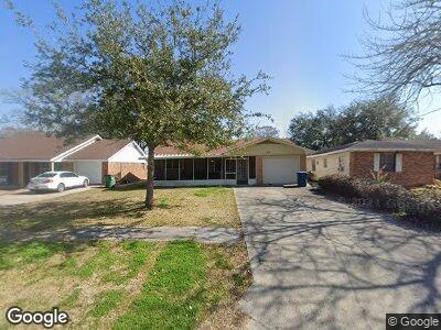
1818 Maple St Morgan City, LA 70380
Estimated Value: $66,000 - $122,000
--
Bed
--
Bath
--
Sq Ft
6,098
Sq Ft Lot
About This Home
This home is located at 1818 Maple St, Morgan City, LA 70380 and is currently estimated at $90,340. 1818 Maple St is a home located in St. Mary Parish with nearby schools including M.E. Norman Elementary School, Morgan City Junior High School, and Morgan City High School.
Ownership History
Date
Name
Owned For
Owner Type
Purchase Details
Closed on
Jan 31, 2023
Sold by
Sanford Rentals Llc
Bought by
Peak Rentals Llc
Current Estimated Value
Purchase Details
Closed on
Apr 11, 2012
Sold by
Romero Essie Renfroe and Romero Samuel Paul
Bought by
Sanford Rentals Llc
Home Financials for this Owner
Home Financials are based on the most recent Mortgage that was taken out on this home.
Original Mortgage
$100,000
Interest Rate
3.97%
Mortgage Type
Future Advance Clause Open End Mortgage
Create a Home Valuation Report for This Property
The Home Valuation Report is an in-depth analysis detailing your home's value as well as a comparison with similar homes in the area
Home Values in the Area
Average Home Value in this Area
Purchase History
| Date | Buyer | Sale Price | Title Company |
|---|---|---|---|
| Peak Rentals Llc | $45,000 | -- | |
| Sanford Rentals Llc | $50,000 | First American Title Insuran |
Source: Public Records
Mortgage History
| Date | Status | Borrower | Loan Amount |
|---|---|---|---|
| Open | Peak Rentals Llc | $100,000 | |
| Previous Owner | Sanford Rentals Llc | $100,000 |
Source: Public Records
Tax History Compared to Growth
Tax History
| Year | Tax Paid | Tax Assessment Tax Assessment Total Assessment is a certain percentage of the fair market value that is determined by local assessors to be the total taxable value of land and additions on the property. | Land | Improvement |
|---|---|---|---|---|
| 2024 | $431 | $4,467 | $1,855 | $2,612 |
| 2023 | $343 | $4,467 | $1,855 | $2,612 |
| 2022 | $579 | $6,100 | $1,855 | $4,245 |
| 2021 | $579 | $6,100 | $1,855 | $4,245 |
| 2020 | $579 | $6,100 | $1,855 | $4,245 |
| 2019 | $467 | $5,100 | $1,641 | $3,459 |
| 2018 | $467 | $5,100 | $1,641 | $3,459 |
| 2017 | $472 | $5,100 | $1,641 | $3,459 |
| 2016 | $380 | $5,100 | $1,641 | $3,459 |
| 2015 | $462 | $3,391 | $0 | $3,391 |
| 2014 | $462 | $3,391 | $0 | $3,391 |
| 2013 | $463 | $3,391 | $0 | $3,391 |
Source: Public Records
Map
Nearby Homes
- 1905 Maple St
- 1817 W Garner Dr
- 1709 W Garner Dr
- 1002 Hilda St
- 1233 N Prescott Dr
- 910 Onstead St
- 908 Franklin St
- 1003 Spruce St
- 803 Hilda St
- 2312 Maple St
- 1501 Cedar St
- 1901 6th St
- 814 Spruce St
- 717 Aucoin St
- 613 Louisa St
- 913 Fig St
- 601 Marshall St
- 514 Louisa St
- 1201 Sixth St
- 3819,3803,3817 Pharr St