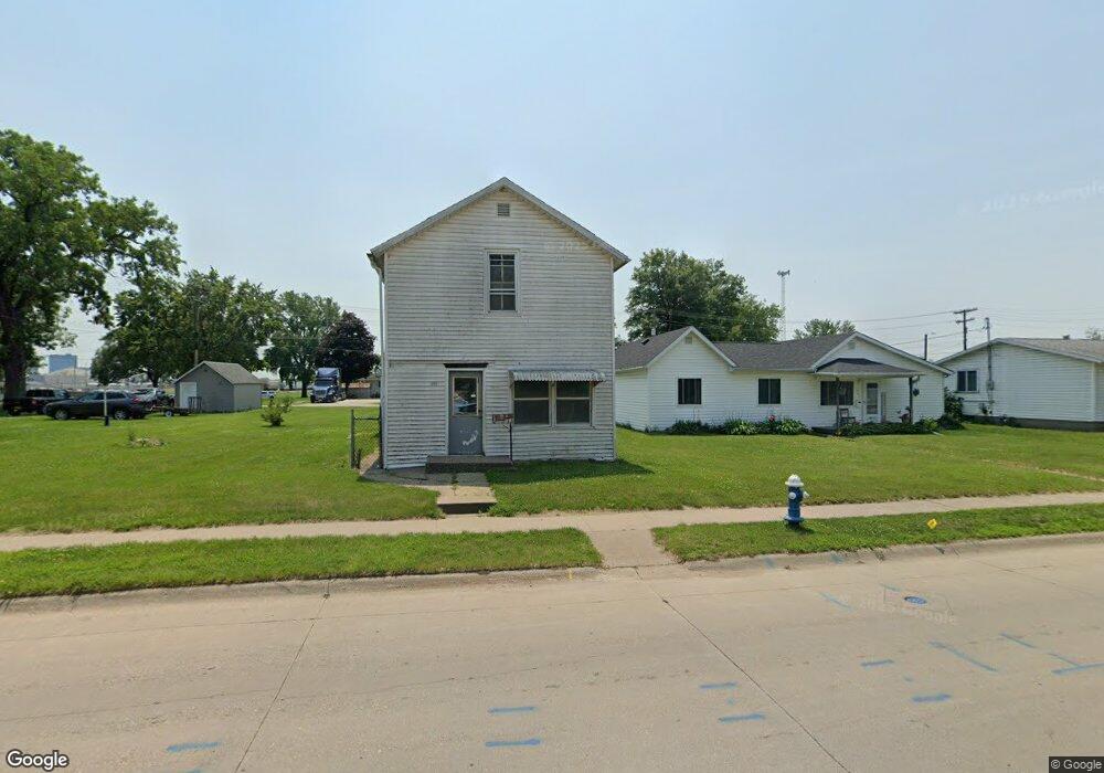
1818 Sampson St Muscatine, IA 52761
Estimated Value: $56,506 - $110,000
2
Beds
1
Bath
1,060
Sq Ft
$82/Sq Ft
Est. Value
About This Home
This home is located at 1818 Sampson St, Muscatine, IA 52761 and is currently estimated at $87,377, approximately $82 per square foot. 1818 Sampson St is a home located in Muscatine County with nearby schools including Franklin Elementary School, Susan Clark Junior High School, and Muscatine High School.
Ownership History
Date
Name
Owned For
Owner Type
Purchase Details
Closed on
Jan 13, 2022
Sold by
Gerels Jason J and Gerels Jo Bobbie
Bought by
Phw Llc
Current Estimated Value
Purchase Details
Closed on
Jun 28, 2018
Sold by
Benefiel Jeff
Bought by
Gerels Jason J
Purchase Details
Closed on
Mar 12, 2015
Sold by
Txbyr74llc
Bought by
Gerels Jasonj
Purchase Details
Closed on
Oct 30, 2014
Sold by
Zybarth Amy L
Bought by
Txbyr 74 Llc
Create a Home Valuation Report for This Property
The Home Valuation Report is an in-depth analysis detailing your home's value as well as a comparison with similar homes in the area
Home Values in the Area
Average Home Value in this Area
Purchase History
| Date | Buyer | Sale Price | Title Company |
|---|---|---|---|
| Phw Llc | $15,000 | None Listed On Document | |
| Gerels Jason J | -- | None Available | |
| Gerels Jasonj | -- | None Available | |
| Txbyr 74 Llc | -- | None Available |
Source: Public Records
Tax History Compared to Growth
Tax History
| Year | Tax Paid | Tax Assessment Tax Assessment Total Assessment is a certain percentage of the fair market value that is determined by local assessors to be the total taxable value of land and additions on the property. | Land | Improvement |
|---|---|---|---|---|
| 2025 | $316 | $17,890 | $11,100 | $6,790 |
| 2024 | $316 | $17,390 | $11,100 | $6,290 |
| 2023 | $326 | $17,363 | $11,130 | $6,233 |
| 2022 | $1,062 | $16,220 | $10,500 | $5,720 |
| 2021 | $1,062 | $52,040 | $10,500 | $41,540 |
| 2020 | $996 | $47,410 | $9,000 | $38,410 |
| 2019 | $994 | $0 | $0 | $0 |
| 2018 | $1,309 | $0 | $0 | $0 |
| 2017 | $1,008 | $44,610 | $0 | $0 |
| 2016 | $1,008 | $44,610 | $0 | $0 |
| 2015 | $1,008 | $45,870 | $0 | $0 |
| 2014 | $1,044 | $45,870 | $0 | $0 |
Source: Public Records
Map
Nearby Homes
- 1909 Wallace St
- 1908 Sampson St
- 1708 Schley Ave
- 2108 Breese Ave
- 0 Towhead Island Unit 23-716
- 609 Liberty St
- LOTS 30-34 Evans St
- 111 Gilbert St
- 1903 Hershey Ave
- LOT 5 Pine Ridge
- LOT 4 Pine Ridge
- LOT 6 Pine Ridge
- 1827 Hershey Ave
- 0 Parcel 1302108019 (Busch St)
- 900 W 3rd St
- 701 W Mississippi Dr
- 1603 Lucas St
- 0 High Street Parcel
- 613 W 5th St
- 208 Fletcher Ave
- 1904 Sampson St
- 1815 Wallace St
- 1709 Stewart Rd
- 1615 Kansas St
- 1903 Wallace St
- 1815 Sampson St
- 1711 Stewart Rd
- 1910 Sampson St
- 1703 Stewart Rd
- 1611 Kansas St
- 1907 Wallace St
- 1608 Kansas St
- 1609 Kansas St
- 1914 Sampson St
- 1606 Kansas St
- 1906 Demorest Ave
- 1906 Demore St
- 1911 Wallace St
- 1614 Wisconsin St
- 1818 Demorest Ave