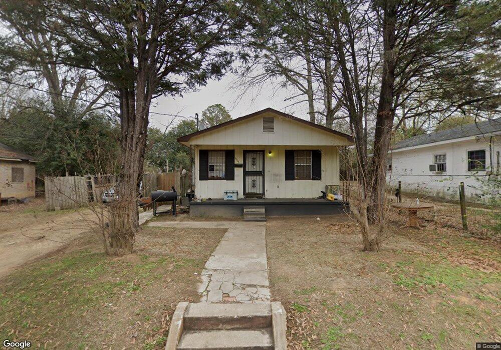
1819 Michael St Montgomery, AL 36108
West Montgomery NeighborhoodEstimated Value: $30,000 - $61,000
3
Beds
1
Bath
800
Sq Ft
$63/Sq Ft
Est. Value
About This Home
This home is located at 1819 Michael St, Montgomery, AL 36108 and is currently estimated at $50,171, approximately $62 per square foot. 1819 Michael St is a home located in Montgomery County with nearby schools including E. D. Nixon Elementary School, Southlawn Middle School, and Carver Senior High School.
Ownership History
Date
Name
Owned For
Owner Type
Purchase Details
Closed on
Jun 16, 2016
Sold by
Wilson Ashayla
Bought by
Knight Mary
Current Estimated Value
Purchase Details
Closed on
Mar 25, 2016
Sold by
Steven Stovall
Bought by
Knight Mary France
Purchase Details
Closed on
May 19, 2010
Sold by
The United States Department Of Housing
Bought by
Jones Anthony M and Wilson Shanerkoua
Purchase Details
Closed on
Dec 14, 2009
Sold by
Wells Fargo Bank Na
Bought by
The Secretary Of Housing & Urban Develop
Purchase Details
Closed on
Jul 31, 2009
Sold by
Moorer Carolyn A
Bought by
Wells Fargo Bank Na
Create a Home Valuation Report for This Property
The Home Valuation Report is an in-depth analysis detailing your home's value as well as a comparison with similar homes in the area
Home Values in the Area
Average Home Value in this Area
Purchase History
| Date | Buyer | Sale Price | Title Company |
|---|---|---|---|
| Knight Mary | $11,500 | None Available | |
| Knight Mary France | $1,500 | None Available | |
| Jones Anthony M | $4,400 | None Available | |
| The Secretary Of Housing & Urban Develop | -- | None Available | |
| Wells Fargo Bank Na | $22,424 | None Available |
Source: Public Records
Tax History Compared to Growth
Tax History
| Year | Tax Paid | Tax Assessment Tax Assessment Total Assessment is a certain percentage of the fair market value that is determined by local assessors to be the total taxable value of land and additions on the property. | Land | Improvement |
|---|---|---|---|---|
| 2024 | $160 | $3,220 | $400 | $2,820 |
| 2023 | $160 | $3,220 | $400 | $2,820 |
| 2022 | $109 | $2,880 | $400 | $2,480 |
| 2021 | $94 | $2,480 | $460 | $2,020 |
| 2020 | $94 | $2,480 | $460 | $2,020 |
| 2019 | $42 | $2,480 | $460 | $2,020 |
| 2018 | $98 | $0 | $0 | $0 |
| 2017 | $88 | $2,300 | $460 | $1,840 |
| 2014 | -- | $1,150 | $230 | $920 |
| 2013 | -- | $5,440 | $460 | $4,980 |
Source: Public Records
Map
Nearby Homes
- 2345 Edward J Nettles Ln
- 80 Mobile Hwy
- 2654 Rutland St
- 3303 Boone St
- 2716 Rutland St
- 3324 W Tuskegee Cir
- 1573 Oakland St
- 3414 Suwanee Dr
- 3338 Loveless Curve
- 3518 Santee Dr
- 2700 W Edgemont Ave
- 1701 S Holt St
- 3406 Mobile Dr
- 1148 Bragg St
- 1161 Bragg St
- 3227 Agate St
- 701 Woodrow St
- 3261 Upchurch Cir
- 3412 Doris Cir
- 2624 Springfield Dr
- 1813 Michael St
- 1821 Michael St
- 1809 Michael St
- 1833 Michael St
- 1826 Michael St Unit 1824
- 1816 Myles St
- 1820 Myles St
- 1810 Myles St
- 1818 Michael St
- 1837 Michael St
- 1803 Michael St
- 1826 Myles St
- 1810 Michael St
- 1802 Myles St
- 1832 Myles St
- 2411 Patrick St
- 1913 Michael St Unit 1911
- 1823 Myles St
- 1838 Michael St
- 2259 Ajax St