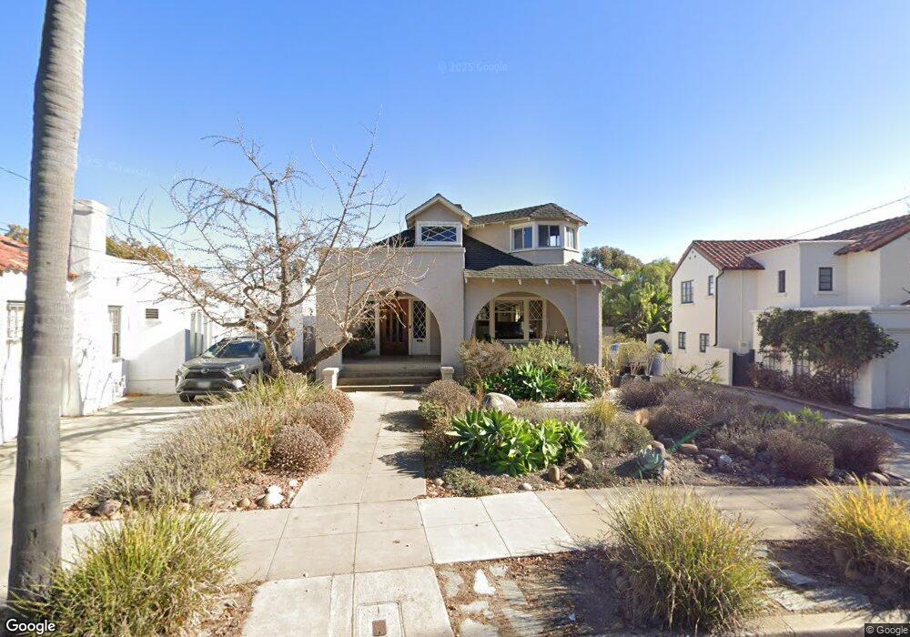
1819 Sheridan Ave San Diego, CA 92103
Mission Hills NeighborhoodEstimated Value: $843,000 - $2,110,000
2
Beds
1
Bath
1,400
Sq Ft
$1,145/Sq Ft
Est. Value
About This Home
This home is located at 1819 Sheridan Ave, San Diego, CA 92103 and is currently estimated at $1,603,371, approximately $1,145 per square foot. 1819 Sheridan Ave is a home located in San Diego County with nearby schools including Grant K-8, Richard Henry Dana Middle School, and Roosevelt International Middle School.
Ownership History
Date
Name
Owned For
Owner Type
Purchase Details
Closed on
Oct 13, 2011
Sold by
Demer David and Demer Shirley
Bought by
Demer David and Demer Shirley
Current Estimated Value
Purchase Details
Closed on
Jan 24, 1996
Sold by
Wayne Bank and Oconnor Patrick James
Bought by
Demer David and Demer Shirley
Home Financials for this Owner
Home Financials are based on the most recent Mortgage that was taken out on this home.
Original Mortgage
$194,800
Interest Rate
6.73%
Create a Home Valuation Report for This Property
The Home Valuation Report is an in-depth analysis detailing your home's value as well as a comparison with similar homes in the area
Home Values in the Area
Average Home Value in this Area
Purchase History
| Date | Buyer | Sale Price | Title Company |
|---|---|---|---|
| Demer David | -- | None Available | |
| Demer David | $243,500 | Stewart Title Company |
Source: Public Records
Mortgage History
| Date | Status | Borrower | Loan Amount |
|---|---|---|---|
| Closed | Demer David | $194,800 |
Source: Public Records
Tax History Compared to Growth
Tax History
| Year | Tax Paid | Tax Assessment Tax Assessment Total Assessment is a certain percentage of the fair market value that is determined by local assessors to be the total taxable value of land and additions on the property. | Land | Improvement |
|---|---|---|---|---|
| 2025 | $4,819 | $404,491 | $249,177 | $155,314 |
| 2024 | $4,819 | $396,561 | $244,292 | $152,269 |
| 2023 | $4,711 | $388,786 | $239,502 | $149,284 |
| 2022 | $4,584 | $381,163 | $234,806 | $146,357 |
| 2021 | $4,551 | $373,690 | $230,202 | $143,488 |
| 2020 | $4,495 | $369,859 | $227,842 | $142,017 |
| 2019 | $4,414 | $362,608 | $223,375 | $139,233 |
| 2018 | $4,126 | $355,499 | $218,996 | $136,503 |
| 2017 | $4,026 | $348,529 | $214,702 | $133,827 |
| 2016 | $3,960 | $341,696 | $210,493 | $131,203 |
| 2015 | $3,901 | $336,565 | $207,332 | $129,233 |
| 2014 | $3,838 | $329,973 | $203,271 | $126,702 |
Source: Public Records
Map
Nearby Homes
- 1753 W Lewis St
- 1864 Sunset Blvd
- 1728 W Lewis St
- 1860 W Montecito Way
- 3770 Keating St
- 4232 Arden Way
- 1329 Fort Stockton Dr
- Lot 19 Randolph St
- 2120 Pine St
- 1695 Neale St
- 1694 Torrance St
- 2147 Pine St
- 3972 Jackdaw St
- 3972 Jackdaw St Unit 109
- 4112 Jackdaw St
- 3625 Keating St Unit 4
- 1806 Mckee St Unit A2
- 1806 Mckee St Unit A9
- 3903 California St Unit 3
- 4109 Ibis St
- 1815 Sheridan Ave
- 1823 Sheridan Ave
- 1811 Sheridan Ave
- 1825 Sheridan Ave
- 1807 Sheridan Ave
- 1816 Sheridan Ave
- 1801 Sheridan Ave
- 1801 Lyndon Rd
- 1815 Sunset Blvd
- 1783 Sunset Blvd
- 1811 Lyndon Rd
- 1773 Sunset Blvd
- 1834 Sheridan Ave
- 1805 Lyndon Rd
- 1821 Sunset Blvd
- 1819 Lyndon Rd
- 1755 Fort Stockton Dr
- 1763 Sunset Blvd
- 1840 Sheridan Ave
- 1829 Sunset Blvd