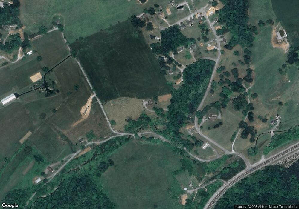
182 Barren Creek Rd New Tazewell, TN 37825
Estimated Value: $272,000 - $403,211
3
Beds
2
Baths
2,015
Sq Ft
$174/Sq Ft
Est. Value
About This Home
This home is located at 182 Barren Creek Rd, New Tazewell, TN 37825 and is currently estimated at $350,553, approximately $173 per square foot. 182 Barren Creek Rd is a home located in Claiborne County with nearby schools including Heriage Christian Academy.
Ownership History
Date
Name
Owned For
Owner Type
Purchase Details
Closed on
Jul 15, 2015
Sold by
Davis Lindsay Leigh
Bought by
Davis Lindsay Leigh and Davis Bradford Monroe
Current Estimated Value
Home Financials for this Owner
Home Financials are based on the most recent Mortgage that was taken out on this home.
Original Mortgage
$188,120
Outstanding Balance
$147,601
Interest Rate
4.04%
Mortgage Type
New Conventional
Estimated Equity
$202,952
Purchase Details
Closed on
Mar 26, 1997
Sold by
Davis Jeffrey S
Bought by
Davis Jeffrey S
Purchase Details
Closed on
Jan 1, 1953
Bought by
Davis Bradford J Betty
Create a Home Valuation Report for This Property
The Home Valuation Report is an in-depth analysis detailing your home's value as well as a comparison with similar homes in the area
Home Values in the Area
Average Home Value in this Area
Purchase History
| Date | Buyer | Sale Price | Title Company |
|---|---|---|---|
| Davis Lindsay Leigh | $125,000 | -- | |
| Davis Jeffrey S | $25,000 | -- | |
| Davis Bradford J Betty | -- | -- |
Source: Public Records
Mortgage History
| Date | Status | Borrower | Loan Amount |
|---|---|---|---|
| Open | Davis Lindsay Leigh | $188,120 |
Source: Public Records
Tax History Compared to Growth
Tax History
| Year | Tax Paid | Tax Assessment Tax Assessment Total Assessment is a certain percentage of the fair market value that is determined by local assessors to be the total taxable value of land and additions on the property. | Land | Improvement |
|---|---|---|---|---|
| 2024 | $1,150 | $49,150 | $6,900 | $42,250 |
| 2023 | $1,150 | $49,150 | $6,900 | $42,250 |
| 2022 | $983 | $49,150 | $6,900 | $42,250 |
| 2021 | $881 | $34,175 | $5,600 | $28,575 |
| 2020 | $881 | $34,175 | $5,600 | $28,575 |
| 2019 | $881 | $34,175 | $5,600 | $28,575 |
| 2018 | $881 | $34,175 | $5,600 | $28,575 |
| 2017 | $881 | $34,175 | $5,600 | $28,575 |
| 2016 | $903 | $35,000 | $5,850 | $29,150 |
| 2015 | $868 | $35,000 | $5,850 | $29,150 |
| 2014 | $868 | $35,504 | $0 | $0 |
Source: Public Records
Map
Nearby Homes
- 115 Red Oak Ln
- 216 Mountain Rd
- 306 Mountain Rd
- 137 Adair Dr
- 162 Wilderness Dr
- 218 Adair Dr
- 346 Bailey Dr
- 352 Rutherford Dr
- 411 Cole Hollow Rd
- 0 Harmon Cir
- 0 Cole Hollow Rd
- 323 Harmon Rd
- Lot 1 Harmon Rd
- 0 Harmon Rd
- 117 Mallory Dr
- 275 Grandview Ln
- 170 Mallory Dr
- 1264 Rowe St
- 1210 Rowe St
- 112 Sunflower Ln
- 416 Doe Ct
- 412 Doe Ct
- 315 Fawn Trail Dr
- 409 Doe Ct
- 0 Fawn Trail Dr Unit 1221792
- 0 Fawn Trail Dr Unit 667033
- 0 Fawn Trail Dr Unit 702856
- 0 Fawn Trail Dr Unit 1184210
- 408 Doe Ct
- 0 Doe Ct
- 219 Barren Creek Rd
- 320 Fawn Trail Dr
- 000 Fawn Trail Dr
- 107 Fawn Trail Dr
- 312 Fawn Trail Dr
- 404 Doe Ct
- 313 Fawn Trail Dr
- 294 Barren Creek Rd
- 105 Fawn Trail Dr
- 311 Fawn Trail Dr
