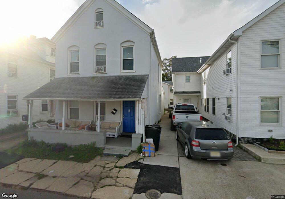
182 Belmont Ave Long Branch, NJ 07740
Estimated Value: $599,043 - $731,000
5
Beds
2
Baths
1,600
Sq Ft
$415/Sq Ft
Est. Value
About This Home
This home is located at 182 Belmont Ave, Long Branch, NJ 07740 and is currently estimated at $663,261, approximately $414 per square foot. 182 Belmont Ave is a home located in Monmouth County with nearby schools including Long Branch High School and Holy Trinity School.
Ownership History
Date
Name
Owned For
Owner Type
Purchase Details
Closed on
Apr 12, 2018
Sold by
Stetz Jill A
Bought by
I A J Belmont Llc
Current Estimated Value
Purchase Details
Closed on
Mar 17, 2008
Sold by
Albatross Realty Corp
Bought by
Stetz Jill A
Purchase Details
Closed on
Aug 16, 2006
Sold by
Wolfs Head Properties Inc
Bought by
Albatross Realty Corp
Purchase Details
Closed on
Jun 1, 2004
Sold by
Max Sadie Inc
Bought by
Wolfs Head Properties Inc
Create a Home Valuation Report for This Property
The Home Valuation Report is an in-depth analysis detailing your home's value as well as a comparison with similar homes in the area
Home Values in the Area
Average Home Value in this Area
Purchase History
| Date | Buyer | Sale Price | Title Company |
|---|---|---|---|
| I A J Belmont Llc | $140,000 | None Available | |
| Stetz Jill A | -- | None Available | |
| Albatross Realty Corp | -- | -- | |
| Wolfs Head Properties Inc | $140,000 | -- |
Source: Public Records
Tax History Compared to Growth
Tax History
| Year | Tax Paid | Tax Assessment Tax Assessment Total Assessment is a certain percentage of the fair market value that is determined by local assessors to be the total taxable value of land and additions on the property. | Land | Improvement |
|---|---|---|---|---|
| 2025 | $7,613 | $519,800 | $184,300 | $335,500 |
| 2024 | $6,465 | $495,300 | $174,300 | $321,000 |
| 2023 | $6,465 | $416,300 | $169,300 | $247,000 |
| 2022 | $4,548 | $382,000 | $164,300 | $217,700 |
| 2021 | $4,548 | $185,300 | $156,300 | $29,000 |
| 2020 | $3,833 | $183,400 | $155,300 | $28,100 |
| 2019 | $3,681 | $175,100 | $154,300 | $20,800 |
| 2018 | $3,505 | $165,800 | $150,300 | $15,500 |
| 2017 | $3,320 | $161,100 | $148,300 | $12,800 |
| 2016 | $5,764 | $162,100 | $149,300 | $12,800 |
| 2015 | $3,953 | $177,500 | $149,200 | $28,300 |
| 2014 | $4,135 | $195,700 | $170,600 | $25,100 |
Source: Public Records
Map
Nearby Homes
- 143 Stokes Place
- 145 Stokes Place
- 167 Chelsea Ave
- 166 Franklin Ave Unit 8
- 103 Franklin Ave
- 150 Franklin Ave Unit 5
- 152 Franklin Ave
- 158 Franklin Ave
- 170 Franklin Ave
- 144 Westwood Ave
- 40 N 5th Ave
- 14 Slocum Place
- 55 Melrose Terrace Unit 209
- 55 Melrose Terrace Unit 112
- 20 Melrose Terrace Unit 202
- 20 Melrose Terrace Unit 408
- 20 Melrose Terrace Unit 305
- 30 Melrose Terrace Unit 209
- 30 Melrose Terrace Unit 303
- 15 Morris Ave Unit 206
- 180 Belmont Ave
- 177 Garfield Ave
- 185 Garfield Ave
- 36 Memorial Pkwy
- 38 Memorial Pkwy
- 189 Garfield Ave
- 169 Garfield Ave
- 181 Garfield Ave
- 193 Garfield Ave
- 197 Garfield Ave
- 50 Memorial Pkwy Unit 48
- 50 Memorial Pkwy Unit 38
- 50 Memorial Pkwy Unit 46
- 50 Memorial Pkwy
- 27 3rd Ave Unit 211
- 27 3rd Ave Unit 205
- 27 3rd Ave Unit 201
- 27 3rd Ave Unit 403
- 27 3rd Ave Unit 401
- 27 3rd Ave Unit 308