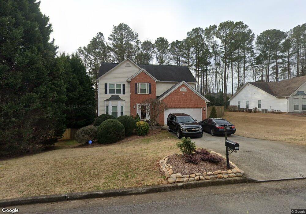
182 Marston Dr Suwanee, GA 30024
Estimated Value: $395,094 - $419,000
3
Beds
2
Baths
2,220
Sq Ft
$183/Sq Ft
Est. Value
About This Home
This home is located at 182 Marston Dr, Suwanee, GA 30024 and is currently estimated at $405,274, approximately $182 per square foot. 182 Marston Dr is a home located in Gwinnett County with nearby schools including Walnut Grove Elementary School, Creekland Middle School, and Collins Hill High School.
Ownership History
Date
Name
Owned For
Owner Type
Purchase Details
Closed on
Apr 30, 2009
Sold by
Suntrust Bank
Bought by
Struycken Leo
Current Estimated Value
Purchase Details
Closed on
May 6, 2008
Sold by
Yang Chul M
Bought by
Suntrust Bank
Purchase Details
Closed on
Jul 23, 1998
Sold by
Mckeon John J and Mckeon Michelle A
Bought by
Yang Chul M and Yang Stephanie
Home Financials for this Owner
Home Financials are based on the most recent Mortgage that was taken out on this home.
Original Mortgage
$135,000
Interest Rate
7.02%
Mortgage Type
New Conventional
Purchase Details
Closed on
Mar 28, 1997
Sold by
West Palm Assoc Lp
Bought by
Mckeon John J and Mckeon Michelle A
Home Financials for this Owner
Home Financials are based on the most recent Mortgage that was taken out on this home.
Original Mortgage
$114,000
Interest Rate
7.86%
Mortgage Type
New Conventional
Create a Home Valuation Report for This Property
The Home Valuation Report is an in-depth analysis detailing your home's value as well as a comparison with similar homes in the area
Home Values in the Area
Average Home Value in this Area
Purchase History
| Date | Buyer | Sale Price | Title Company |
|---|---|---|---|
| Struycken Leo | $153,000 | -- | |
| Suntrust Bank | $134,394 | -- | |
| Yang Chul M | $150,000 | -- | |
| Mckeon John J | $142,500 | -- |
Source: Public Records
Mortgage History
| Date | Status | Borrower | Loan Amount |
|---|---|---|---|
| Previous Owner | Yang Chul M | $135,000 | |
| Previous Owner | Mckeon John J | $114,000 |
Source: Public Records
Tax History
| Year | Tax Paid | Tax Assessment Tax Assessment Total Assessment is a certain percentage of the fair market value that is determined by local assessors to be the total taxable value of land and additions on the property. | Land | Improvement |
|---|---|---|---|---|
| 2025 | $4,312 | $149,200 | $33,600 | $115,600 |
| 2024 | $4,443 | $149,200 | $33,600 | $115,600 |
| 2023 | $4,443 | $175,560 | $33,600 | $141,960 |
| 2022 | $0 | $91,600 | $20,200 | $71,400 |
| 2021 | $2,872 | $91,600 | $20,200 | $71,400 |
| 2020 | $2,872 | $93,720 | $20,200 | $73,520 |
| 2019 | $2,773 | $76,000 | $15,200 | $60,800 |
| 2018 | $2,772 | $76,000 | $15,200 | $60,800 |
| 2016 | $1,612 | $42,280 | $8,160 | $34,120 |
| 2015 | $1,624 | $42,280 | $8,160 | $34,120 |
| 2014 | -- | $35,938 | $6,936 | $29,002 |
Source: Public Records
Map
Nearby Homes
- 2164 Cape Liberty Dr
- 30 Karen Camile Dr
- 2105 Laurel Lake Dr
- 1971 Fernwood Dr
- 2372 Merrymount Dr Unit 2
- 2285 Wildwood Lake Dr
- 1985 Tyler Trace
- 2382 Merrymount Dr Unit 2
- 2001 Stone Forest Dr
- 2165 Wildwood Lake Dr
- 2061 Wildcat Cliffs Ln
- 2124 York River Way Unit 1
- 2035 Wildcat Cliffs Way Unit 1
- 2390 Walnut Grove Way
- 2067 York River Way
- 2275 Shore View Way
- 291 Shore Dr
- 1811 Chantilly Ct
- 345 Deerwood Dr
- 260 Wildcat Lake Dr
- 192 Marston Dr
- 172 Marston Dr
- 2042 Little River Dr
- 2032 Little River Dr
- 202 Marston Dr Unit 1
- 2052 Little River Dr
- 162 Marston Dr Unit 1
- 2022 Little River Dr
- 181 Marston Dr Unit 1
- 2062 Little River Dr Unit 1
- 191 Marston Dr
- 171 Marston Dr
- 2012 Little River Dr Unit 1
- 2072 Little River Dr Unit 1
- 212 Marston Dr
- 201 Marston Dr Unit 1
- 161 Marston Dr
- 152 Marston Dr
- 2002 Little River Dr Unit 1
- 2041 Little River Dr
Your Personal Tour Guide
Ask me questions while you tour the home.