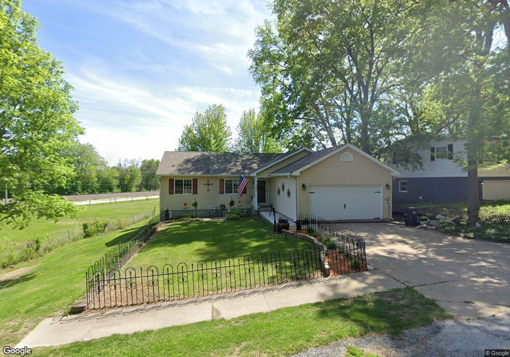
182 Sherman St Muscatine, IA 52761
Estimated Value: $185,000 - $229,000
3
Beds
3
Baths
1,144
Sq Ft
$184/Sq Ft
Est. Value
About This Home
This home is located at 182 Sherman St, Muscatine, IA 52761 and is currently estimated at $210,089, approximately $183 per square foot. 182 Sherman St is a home located in Muscatine County with nearby schools including Muskie Early Learning Center, Madison Elementary School, and Central Middle School.
Ownership History
Date
Name
Owned For
Owner Type
Purchase Details
Closed on
Apr 13, 2005
Sold by
Boyer Richard D and Boyer Monika L
Bought by
Tutt Frann M
Current Estimated Value
Home Financials for this Owner
Home Financials are based on the most recent Mortgage that was taken out on this home.
Original Mortgage
$120,000
Interest Rate
6.05%
Mortgage Type
New Conventional
Create a Home Valuation Report for This Property
The Home Valuation Report is an in-depth analysis detailing your home's value as well as a comparison with similar homes in the area
Home Values in the Area
Average Home Value in this Area
Purchase History
| Date | Buyer | Sale Price | Title Company |
|---|---|---|---|
| Tutt Frann M | $139,000 | None Available |
Source: Public Records
Mortgage History
| Date | Status | Borrower | Loan Amount |
|---|---|---|---|
| Closed | Tutt Frann M | $120,000 |
Source: Public Records
Tax History Compared to Growth
Tax History
| Year | Tax Paid | Tax Assessment Tax Assessment Total Assessment is a certain percentage of the fair market value that is determined by local assessors to be the total taxable value of land and additions on the property. | Land | Improvement |
|---|---|---|---|---|
| 2025 | $3,320 | $202,400 | $21,300 | $181,100 |
| 2024 | $3,320 | $193,400 | $21,300 | $172,100 |
| 2023 | $3,194 | $193,916 | $21,306 | $172,610 |
| 2022 | $2,978 | $157,820 | $20,100 | $137,720 |
| 2021 | $2,978 | $154,890 | $20,100 | $134,790 |
| 2020 | $2,840 | $143,960 | $20,100 | $123,860 |
| 2019 | $2,922 | $140,770 | $0 | $0 |
| 2018 | $2,878 | $140,770 | $0 | $0 |
| 2017 | $2,878 | $134,080 | $0 | $0 |
| 2016 | $2,834 | $134,080 | $0 | $0 |
| 2015 | $2,834 | $130,110 | $0 | $0 |
| 2014 | $2,764 | $130,110 | $0 | $0 |
Source: Public Records
Map
Nearby Homes
- 1554 Washington St
- 140 Sheridan St
- 318 Monroe St
- 1708 Cobblestone Dr
- 0 Lot #8 Rivers Edge Unit 25-238
- 0 Lot #9 Rivers Edge Unit 25-237
- 0 Lot #11 Rivers Edge Unit 25-235
- 0 Lot #13 Rivers Edge Unit 25-233
- 0 Lot #10 Rivers Edge Unit 25-236
- 1414 Lincoln Blvd
- 1416 Lincoln Blvd
- 0 Lot #12 Rivers Edge Unit 25-234
- 504 Adams St
- 0 Fillmore St Parcel
- 416 Jackson St
- 1509 Lincoln Blvd
- 514 Jackson St
- 610 Jackson St
- 1707 Lincoln Blvd
- 100 Eagle Watch Rd
- 180 Sherman St
- 178 Sherman St
- 177A Sherman St
- 177B Sherman St
- 181 Sherman St
- 183 Sherman St
- 176 Sherman St
- 179 Sherman St
- 187 Sherman St
- 189 Sherman St
- 191 Sherman St
- 177 Sherman St
- 174 Sherman St
- 193 Sherman St
- 1584 Washington St
- 173 Sherman St
- 1588 Washington St
- 1582 Washington St
- 171 Sherman St
- 170 Sherman St