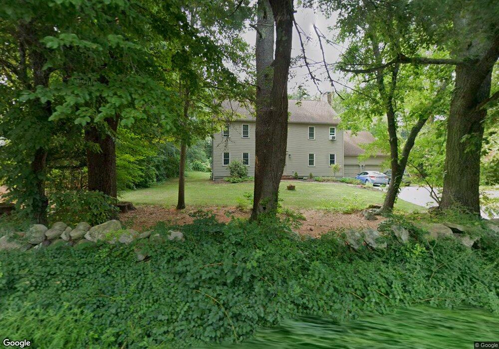
182 Water St Pembroke, MA 02359
Estimated Value: $936,000 - $1,103,000
--
Bed
3
Baths
3,104
Sq Ft
$323/Sq Ft
Est. Value
About This Home
This home is located at 182 Water St, Pembroke, MA 02359 and is currently estimated at $1,002,797, approximately $323 per square foot. 182 Water St is a home located in Plymouth County with nearby schools including Pembroke High School, Cadence Academy Preschool - Hanover, and Cardinal Cushing Centers.
Ownership History
Date
Name
Owned For
Owner Type
Purchase Details
Closed on
Feb 26, 1987
Sold by
C&J Group Inc
Bought by
Prince Walter B
Current Estimated Value
Home Financials for this Owner
Home Financials are based on the most recent Mortgage that was taken out on this home.
Original Mortgage
$228,000
Interest Rate
9.19%
Mortgage Type
Purchase Money Mortgage
Create a Home Valuation Report for This Property
The Home Valuation Report is an in-depth analysis detailing your home's value as well as a comparison with similar homes in the area
Home Values in the Area
Average Home Value in this Area
Purchase History
| Date | Buyer | Sale Price | Title Company |
|---|---|---|---|
| Prince Walter B | $285,000 | -- |
Source: Public Records
Mortgage History
| Date | Status | Borrower | Loan Amount |
|---|---|---|---|
| Open | Prince Walter B | $200,000 | |
| Closed | Prince Walter B | $25,000 | |
| Closed | Prince Walter B | $228,000 |
Source: Public Records
Tax History Compared to Growth
Tax History
| Year | Tax Paid | Tax Assessment Tax Assessment Total Assessment is a certain percentage of the fair market value that is determined by local assessors to be the total taxable value of land and additions on the property. | Land | Improvement |
|---|---|---|---|---|
| 2025 | $10,441 | $868,600 | $305,600 | $563,000 |
| 2024 | $10,348 | $860,200 | $300,400 | $559,800 |
| 2023 | $9,532 | $749,400 | $285,600 | $463,800 |
| 2022 | $9,158 | $647,200 | $235,500 | $411,700 |
| 2021 | $10,850 | $744,200 | $220,300 | $523,900 |
| 2020 | $10,560 | $728,800 | $215,500 | $513,300 |
| 2019 | $10,208 | $699,200 | $210,300 | $488,900 |
| 2018 | $9,972 | $669,700 | $210,300 | $459,400 |
| 2017 | $9,898 | $655,500 | $200,300 | $455,200 |
| 2016 | $9,693 | $635,200 | $185,500 | $449,700 |
| 2015 | $9,246 | $627,300 | $175,500 | $451,800 |
Source: Public Records
Map
Nearby Homes
- 218 Schoosett St
- 46 Lorna Ave
- 172 Washington St
- 261 Washington St
- 15 Kings Terrace
- 133 Brigantine Cir
- 55 Shipyard Ln
- 33 Barker Square Dr Unit 33
- 28 Old Shipyard Ln
- 21 Union St
- 31 Hillcrest Dr
- 66 Hemlock Dr
- 21 Chowdermarch St
- 5 Royal Dane Dr Unit 46
- 10 Royal Dane Dr Unit 88
- 20 Meadow Brook Rd
- 15 Bagnell Dr Unit 15
- 16 Broad Oak Way
- 451 School St Unit 5-2
- 26 Church St
- 174 Water St
- 186 Water St
- 181 Water St
- 168 Water St
- 191 Water St
- 205 Schoosett St
- 175 Water St
- 213 Schoosett St
- 213 Schoosett St Unit Single
- 198 Water St
- 209 Schoosett St
- 199 Schoosett St
- 199 Schoosett St Unit xx
- 165 Water St
- 195 Schoosett St
- 197 Water St
- 6 Burr Ave
- 202 Water St
- 5 Burr Ave
- 1 Hickory Ln