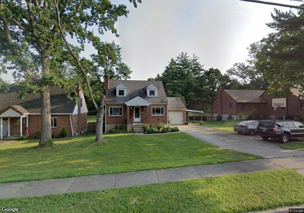
1820 Adams Rd Cincinnati, OH 45231
Estimated Value: $162,000 - $218,000
3
Beds
1
Bath
1,119
Sq Ft
$175/Sq Ft
Est. Value
About This Home
This home is located at 1820 Adams Rd, Cincinnati, OH 45231 and is currently estimated at $195,835, approximately $175 per square foot. 1820 Adams Rd is a home located in Hamilton County with nearby schools including Mt Healthy High School and Central Montessori Academy.
Ownership History
Date
Name
Owned For
Owner Type
Purchase Details
Closed on
Jul 12, 2010
Sold by
Us Bank National Association
Bought by
Sigafoos Bradley J and Sigafoos Alecia M
Current Estimated Value
Home Financials for this Owner
Home Financials are based on the most recent Mortgage that was taken out on this home.
Original Mortgage
$67,983
Outstanding Balance
$45,243
Interest Rate
4.75%
Mortgage Type
FHA
Estimated Equity
$150,592
Purchase Details
Closed on
May 28, 2010
Sold by
Hollingsworth Misty and Hollingsworth Joshua A
Bought by
U S Bank National Association
Home Financials for this Owner
Home Financials are based on the most recent Mortgage that was taken out on this home.
Original Mortgage
$67,983
Outstanding Balance
$45,243
Interest Rate
4.75%
Mortgage Type
FHA
Estimated Equity
$150,592
Purchase Details
Closed on
Feb 22, 2007
Sold by
Hollingsworth Joshua A
Bought by
Hollingsworth Joshua A and Hollingsworth Misty
Home Financials for this Owner
Home Financials are based on the most recent Mortgage that was taken out on this home.
Original Mortgage
$100,000
Interest Rate
6.27%
Mortgage Type
New Conventional
Purchase Details
Closed on
Jun 6, 2005
Sold by
Koize John P and Koize Mary E
Bought by
Hollingsworth Joshua A
Home Financials for this Owner
Home Financials are based on the most recent Mortgage that was taken out on this home.
Original Mortgage
$114,500
Interest Rate
5.91%
Mortgage Type
Fannie Mae Freddie Mac
Purchase Details
Closed on
Oct 18, 1996
Sold by
Palmer Brian W
Bought by
Koize John P and Praechter Mary E
Purchase Details
Closed on
Jul 22, 1996
Sold by
Vaughn Terri L
Bought by
Palmer Brian W
Purchase Details
Closed on
Jun 2, 1994
Sold by
Lee Jeffrey A and Lee Denyse M
Bought by
Palmer Brian W and Vaughn Terri L
Home Financials for this Owner
Home Financials are based on the most recent Mortgage that was taken out on this home.
Original Mortgage
$79,611
Interest Rate
8.5%
Mortgage Type
VA
Create a Home Valuation Report for This Property
The Home Valuation Report is an in-depth analysis detailing your home's value as well as a comparison with similar homes in the area
Home Values in the Area
Average Home Value in this Area
Purchase History
| Date | Buyer | Sale Price | Title Company |
|---|---|---|---|
| Sigafoos Bradley J | $68,900 | Prism Title & Closing Servic | |
| U S Bank National Association | $59,000 | Attorney | |
| Hollingsworth Joshua A | -- | Priority Land Title Agency O | |
| Hollingsworth Joshua A | $114,500 | None Available | |
| Koize John P | $84,000 | -- | |
| Palmer Brian W | -- | -- | |
| Palmer Brian W | -- | -- |
Source: Public Records
Mortgage History
| Date | Status | Borrower | Loan Amount |
|---|---|---|---|
| Open | Sigafoos Bradley J | $67,983 | |
| Previous Owner | Hollingsworth Joshua A | $100,000 | |
| Previous Owner | Hollingsworth Joshua A | $114,500 | |
| Previous Owner | Palmer Brian W | $79,611 |
Source: Public Records
Tax History Compared to Growth
Tax History
| Year | Tax Paid | Tax Assessment Tax Assessment Total Assessment is a certain percentage of the fair market value that is determined by local assessors to be the total taxable value of land and additions on the property. | Land | Improvement |
|---|---|---|---|---|
| 2024 | $2,703 | $51,839 | $15,481 | $36,358 |
| 2023 | $2,726 | $51,839 | $15,481 | $36,358 |
| 2022 | $2,349 | $31,980 | $15,218 | $16,762 |
| 2021 | $2,292 | $31,980 | $15,218 | $16,762 |
| 2020 | $2,353 | $31,980 | $15,218 | $16,762 |
| 2019 | $1,975 | $28,301 | $13,468 | $14,833 |
| 2018 | $1,987 | $28,301 | $13,468 | $14,833 |
| 2017 | $1,875 | $28,301 | $13,468 | $14,833 |
| 2016 | $1,426 | $21,221 | $12,478 | $8,743 |
| 2015 | $1,435 | $21,221 | $12,478 | $8,743 |
| 2014 | $1,427 | $21,221 | $12,478 | $8,743 |
| 2013 | $1,605 | $24,116 | $14,179 | $9,937 |
Source: Public Records
Map
Nearby Homes
- 7832 Lincoln Ave
- 7718 Hamilton Ave
- 1737 Compton Rd
- 1559 Adams Rd
- 7428 Werner Ave
- 2175 Carlsbory Dr
- 1509 Adams Rd
- 1545 Mcmakin Ave
- 1965 Stevens Ave
- 1559 Meredith Dr
- 7438 Hickman St
- 1514 Compton Rd
- 2238 Pacora Dr
- 7404 Perry St
- 2204 Woodacre Dr
- 9371 Montoro Dr
- 7400 Hickman St
- 7508 Elizabeth St
- 1450 Summe Dr
- 7420 Elizabeth St